Brought to you by William Richmond, Inc. Roofing, Siding, & Windows
Winter is quickly approaching, and with it comes the annual question many across the Mid-Atlantic ask: How snowy will it be this year? After a colder and more active winter last season, the first time in five to six years many areas finally reached their average snowfall, the setup for the months ahead offers several encouraging signals for snow lovers. This outlook breaks down what the Mid-Atlantic can expect in terms of snowfall, temperature trends, and storm potential as we head into the heart of winter.
The Science Behind the Forecast
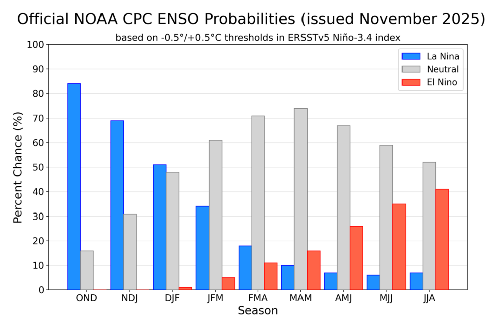
This winter begins under a weak La Niña, the cool phase of ENSO that features colder-than-normal Pacific waters. Weak La Niña’s don’t always guarantee big snowfall, but they often bring frequent cold shots into the Mid-Atlantic — something we saw last winter when many areas finally returned to their typical snowfall for the first time in years. Additional early-season signals, including a projected favorable NAO and AO phases, favor colder air settling into the eastern U.S. More snow cover across Siberia this fall, along with a negative PDO, also supports a stronger northern jet stream capable of sending periodic Arctic air into the region. Meanwhile, the MJO, a tropical pattern that influences global storminess, is expected to rotate through phases 7, 8, and 1, which often promote colder and more unsettled conditions in the eastern U.S.
Because long-range forecasting improves when we understand how past years behaved, this outlook also draws from winters with similar atmospheric setups. Years such as 1950–51, 1967–68, 2005–06, and 2013–14 featured weak or fading La Niña’s, recurring cold intrusions, and snowfall that landed near or above average across much of the Mid-Atlantic. These analogs, combined with this year’s early pattern signals, point toward a winter that leans colder than average with steady early-season snow opportunities, and additional late-season potential if La Niña weakens as expected.
Snowfall Expectations
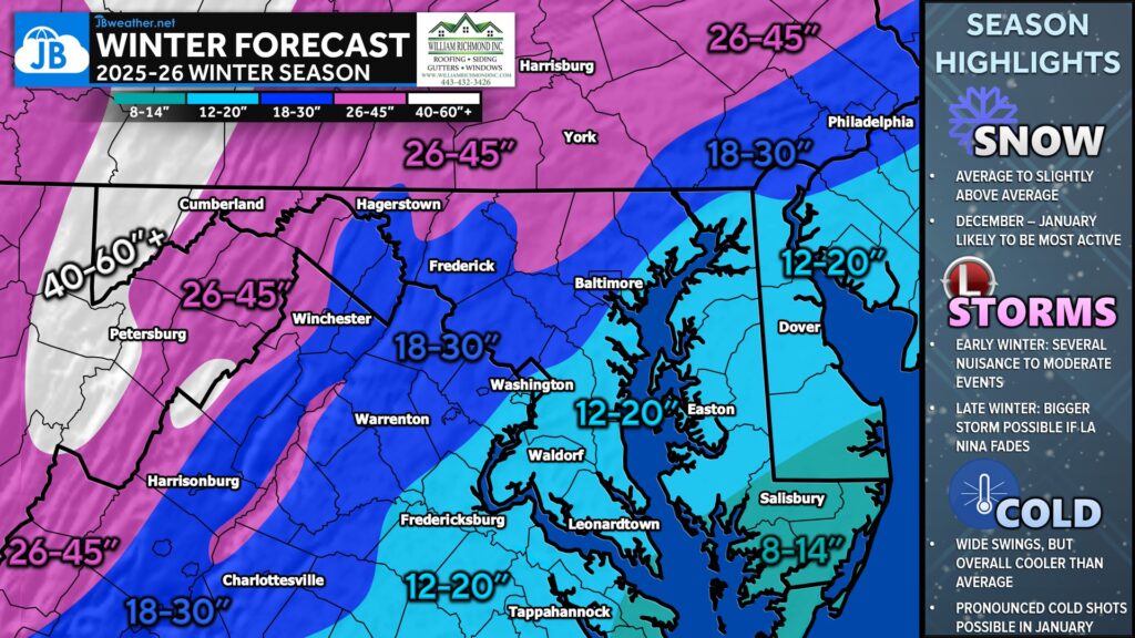
Overall, this winter is expected to bring average to slightly above-average snowfall across much of the region. The early to mid-winter period (December through January) looks to be the most active, with several opportunities for nuisance to moderate snowfall events. Smaller clipper systems and modest coastal disturbances may bring recurring 1–4″ or 3–6″ type snowfalls, especially in areas that hold onto cold air more effectively. Far western and mountain locations are positioned for the strongest performance, with reliable cold and occasional upslope enhancement. Meanwhile, coastal and tidal-influenced areas along and southeast of I-95 should still see improved chances at meaningful snowfall this compared to the last few winters. Snowfall in southeastern zones will be dependent on the potential of seeing mid-to-late season southern sliders or a costal storm if La Niña is allowed to weaken.
Temperature Trends
Temperatures this winter are projected to run overall cooler than average, thanks to a persistent northern-stream influence and repeated injections of Arctic air. While typical Mid-Atlantic variability will still occur, the pattern suggests fewer prolonged warm spells. January looks especially chilly, setting up a period where cold air and storm chances overlap more effectively — something that hasn’t consistently happened for several years until last winter’s turnaround.
Storm Track and Pattern Evolution
The storm track this season favors an active early pattern, with fast-moving clipper systems, cutter systems, and smaller coastal waves bringing repeated wintry chances. As winter progresses, the big wildcard becomes how quickly the La Niña weakens. A transition toward a more neutral pattern could enhance the chance for one or two larger coastal storms later in the season, particularly in February. This potential late-season upside adds an element of volatility to the forecast, but it also reinforces the likelihood of near- or above-average totals for many locations.
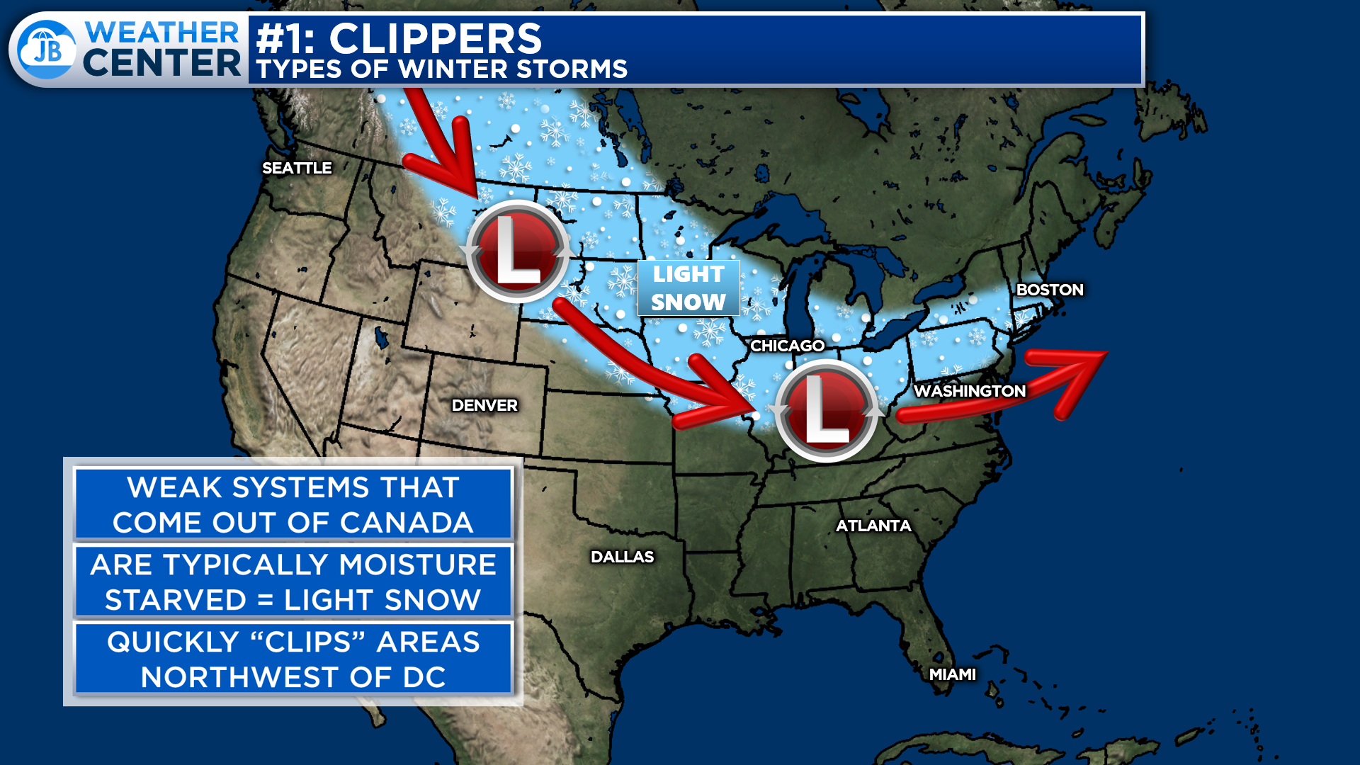
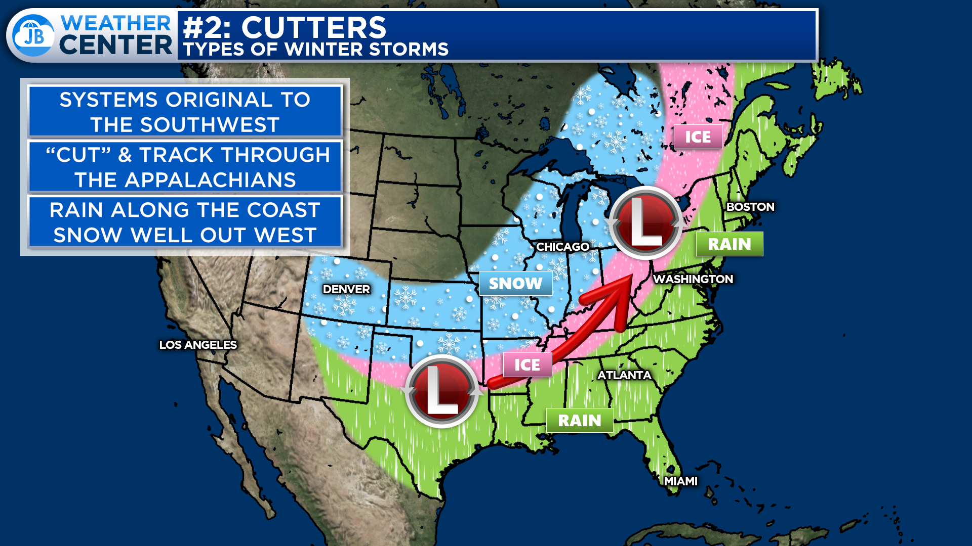
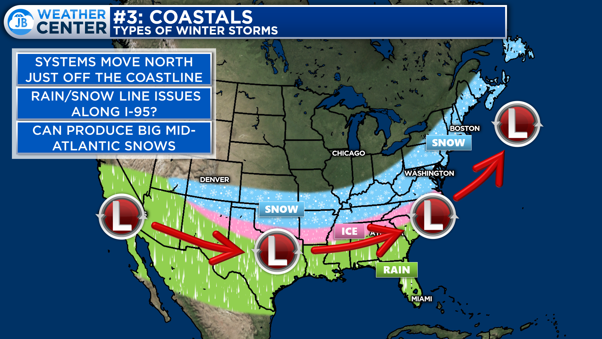
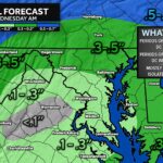
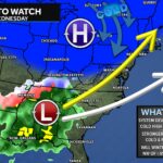
The images above showcase the three types of storm tracks I expect this winter. You can click on any of them to see them in fullscreen size and to read more about them.
Final Thoughts
Taken together, the ingredients are in place for a healthy, engaging winter across Maryland — one characterized by consistent opportunities, a colder atmosphere, and the potential for a bigger storm later in the season if the larger pattern shifts. While no seasonal forecast is perfect, the data strongly suggests that snow lovers should once again have plenty to watch this year. JB Weather will continue to monitor updates as we move closer to winter and provide adjustments as needed.

William Richmond Inc. is your trusted roofing and siding contractor in Southern Maryland. Our services include roof installation and repair, siding replacement, gutter installation and repair, and window replacement. Contact us today for quality workmanship and exceptional customer service.
John Bordash
View More PostsJB Weather forecaster John Bordash is working around the clock to provide Southern Maryland, and neighboring communities, with accurate and reliable weather information.