Forecast
Latest 7 Day Forecast
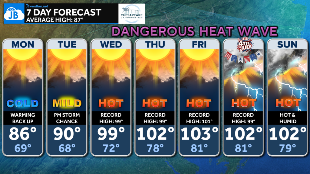
After one more comfortable day on Monday, temperatures will rapidly climb through the week as a powerful summer ridge settles over the East. Confidence continues to increase that our hottest stretch of weather in years is on the way.
Here’s what we’re watching:
🔥 Highs climb into the upper 90s to lower 100s Wednesday through Sunday
🥵 Heat index values of 102°-108°, with isolated spots approaching 110°
🌙 Very little overnight relief as lows remain in the 70s to lower 80s
📈 Several daily record highs are likely, and temperatures may even challenge our all-time record high of 105° if the hotter forecast guidance verifies.
While these forecast temperatures are already extreme, some of the latest weather models are even hotter, meaning additional upward adjustments remain possible over the next couple of days.
🎆 For the Fourth of July: Expect dangerous heat during the day with temperatures around 100° or higher before increasing chances for afternoon and evening thunderstorms. If you have outdoor plans, be prepared for both the heat and the possibility of storms.
Brought to you by Bill Oosterink, Realtor. Buying. Selling. Investing. Ready when you’re ready! Check out www.somdDreamHome.com today!