Brought to you by G&H Jewelers, Inc.
This week has offered a much-needed reprieve from the cold and snow as temperatures have gotten in the 60s the last two days. Unfortunately, this is February in the Mid-Atlantic, and the warmth will not last. In fact, I am tracking the chance of snow for this weekend. However, I’m not sure that this will turn out to be the snowstorm that some may be hoping for.
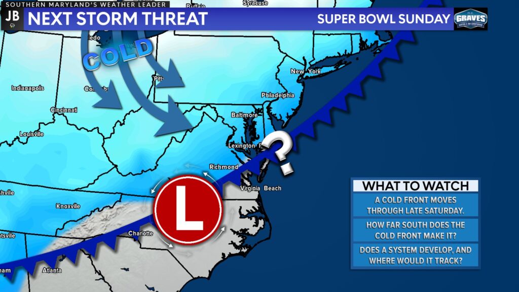
After highs in the 60s on Friday, and potentially on Saturday, we will see a cold front push through the region late Saturday. This front will usher in a new injection of cold air for early next week. As the front moves through, we may see a weak system develop along the front by early Sunday.
The timing of the frontal passage through our region and of when that potential system develops will be key for our snow chances on Sunday. The trend has been for a weaker system with a quicker frontal passage, which would limit our chance of snow accumulation.
Our Chesapeake’s Bounty Futurecast has not been overly enthusiastic with this potential setup, which I do agree with. Our model here shows that we may see rain showers develop overnight Saturday as the front passes through. Then we see the colder air rush in as the system begins to develop along the front.
As the system develops we then see the moisture increase on Sunday. With the cold air present, this would allow any precip to fall as snow. The issue I am seeing is that this system will be weak as it passes by, limiting the moisture supply. Additionally, the warm ground will limit accumulation. The system will move by quickly as well, keeping the window for potential accumulation short, likely only a few hours late Sunday.
Now, the timeline here could be pushed forward by a few hours if the cold front passes through quickly.
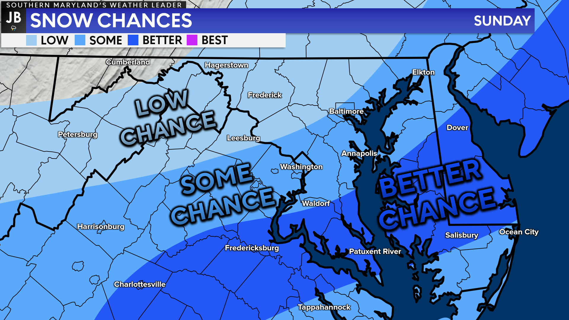
To me, the better chances for snow on Sunday will be south and east of Washington. This is not to say that this region will see high snow totals, but this is the region where there should be enough moisture present for some snow.
I do not expect a big snowstorm from this setup. Impacts actually look to be rather minimal across our region. It is too early to throw out exact totals for our region. However, this event does not look to bring more than a couple of inches, at most. We will refine these details over the coming days, though.
Stay with JB Weather for the latest information on impacts here in Southern Maryland. You can always access my forecasts and updates here on the website, on Facebook, on Twitter, and on YouTube. JB Weather is Southern Maryland’s Weather Leader, and I am working around the clock to keep you ahead of any storm!
-JB
Shop G&H Jewelers Today for Loose Diamonds, Fine Diamond & Colored Gemstone Jewelry, On-site Custom Jewelry Design (CAD) & Manufacturing, Jewelry Repair and GIA Graduate Gemologist Appraisal Services. Third Generation Family Owned & Operated Since 1965.
John Bordash
View More PostsJB Weather forecaster John Bordash is working around the clock to provide Southern Maryland, and neighboring communities, with accurate and reliable weather information.

1 thought on “Weekend Snowstorm? Not So Fast…”
Comments are closed.
[…] [ February 10, 2022 ] Weekend Snowstorm? Not So Fast… Winter Weather […]