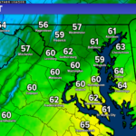
The National Weather Service in Sterling, VA has issued a FLOOD WATCH for along the I-95 corridor, including:
- Anne Arundel (MD)
- Prince Georges (MD)
- Charles (MD)
- Washington, D.C.
This watch is in effect until 6AM Thursday. Just because your county is not under the watch does not mean that flooding and heavy rain are not possible for you– they are. The primary threats tonight are:
- Heavy rain as mositure works northward
- Potenital for embedded thunderstorms that could put down a lot of rain quickly.
SUMMARY: Rainfall rates of 1-2 inches an hour overnight may result in localized flooding of roadways.
PRECAUTIONARY/PREPAREDNESS ACTIONS: You should monitor later forecasts and be alert for possible Flood Warnings. Those living in areas prone to flooding should be prepared to take action should flooding develop.
You can access my full, in-depth forecast, with a look at specific timing, in the update I provided this evening which is linked below.
It will be important to stay with JB Weather for the latest information on Fred and the impacts here in Southern Maryland tonight. You can always access my forecasts and updates here on the website, on Facebook, on Twitter, and on YouTube. JB Weather is Southern Maryland’s Weather Leader, and I am working around the clock to keep you ahead of the storm!
-JB

