Brought to you by Batteries Plus
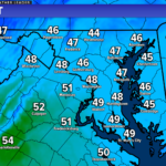
The early arrival of Spring that many of us have been enjoying came crashing down this weekend. We have spent the last couple of days stuck with highs in the 40s, lows in the 20s, and some of us saw some snow yesterday. Thankfully, we will see warmer air surge northward on Wednesday. However, this warmer air will look to set the stage for a potential stormy Thursday.
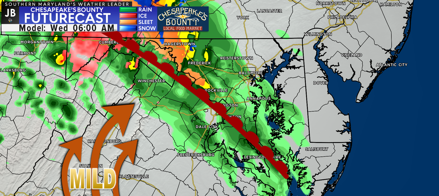
We will a warm front gradually work its way northward overnight tonight and into tomorrow morning. This will likely help to set off some showers across the region tomorrow morning, during the AM rush. While the umbrella may be needed tomorrow morning, I don’t anticipate this being heavy rain or lasting into the afternoon.
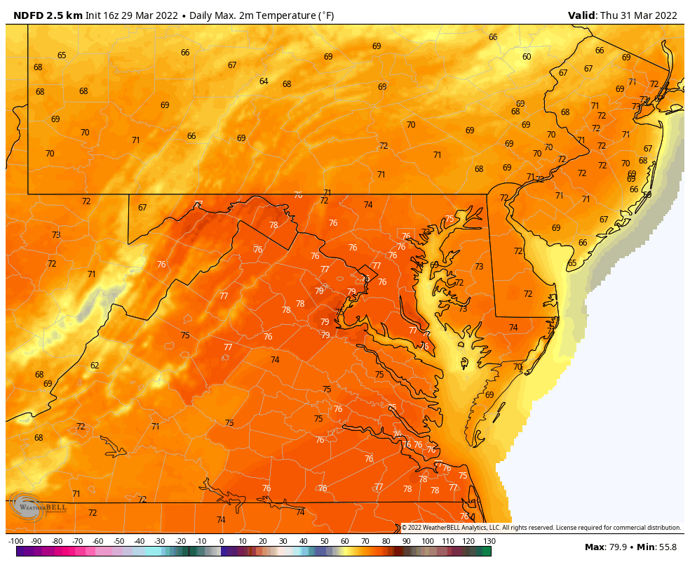
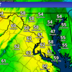
Behind this warm front, warmer air will move into the region. This will allow many of us to see temperatures get near average tomorrow, in the upper 50s and lower 60s, and then into the 70s on Thursday! This change will represent a nearly 30° swing in our temperatures from today. We will also see winds remain elevated through Thursday as gusty southerly winds deliver the warm air.
This warmer air will help to prime the atmosphere for potential storminess later on Thursday evening.
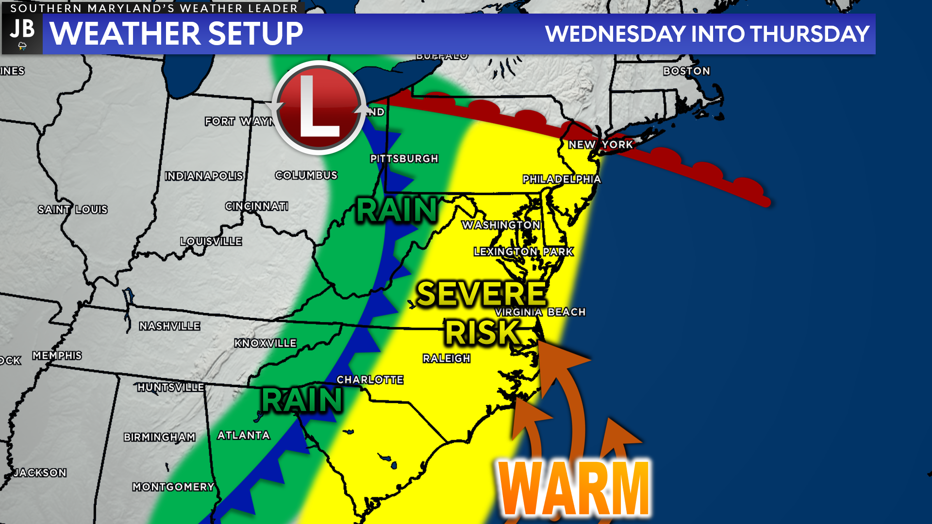
By Thursday afternoon the initial warm front will be well to our north. However, there will be a cold front back to our west that will be waiting to swing through the region. This front will move through late Thursday and will look to interact with the already established warm air. This interaction will look to set off the potential for thunderstorms Thursday evening as the front moves eastward.
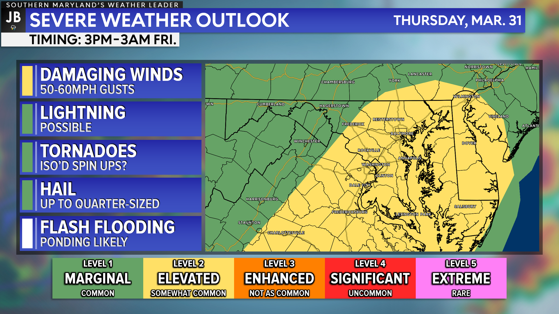
Right now, the Storm Prediction Center has placed areas east of the Blue Ridge mountains under a Level 2 “Elevated Risk” of potentially seeing severe storms. The key threats here would be for a potential line of storms to develop that could produce damaging winds and up to quarter-sized hail. There would be a non-zero tornado threat as well, but this would not be the biggest threat at play.
We will likely have some showers and cloud cover that work through early on Thursday morning. If those showers and clouds stick around long enough, then they would act to limit the severe weather chances. The opposite is true if they were to exit the area quickly Thursday morning. The more sunshine and the warmer we can get Thursday, the higher the severe threat.
As things stand right now, I do not anticipate this to be a severe weather outbreak for our region. With that said though, we will need to monitor this forecast and be aware of any changes or trends that develop. We will learn more over the coming days, which will allow us to fine-tune this forecast.
Stay aware of additional updates as this forecast is likely to change and develop! Drown out any sound you may hear of this being a “once in a lifetime severe weather event.” We have faced worse severe weather setups than this one. Our core severe weather season is June-August and these early season events have a tendency to not be as bad as feared. With that said though, do remain aware, and respect the potential for storms on Thursday.
Behind the cold front on Thursday, we will see temperatures return to the 50s for the weekend, with quieter conditions taking hold.
Stay with JB Weather for the latest information on Southern Maryland weather. I will continue to provide updates on this potential severe weather threat over the coming days! You can always access my forecasts and updates here on the website, on Facebook, on Twitter, on Instagram, and on YouTube.
-JB°

Brought to you by Batteries Plus at our new location on West Dares Beach Road in Prince Frederick. Your locally owned one-stop-shop for everyday & hard-to-find batteries, lighting, phone repair, auto key fobs and much more. Stop by today, or give us a call at (443) 968-2056. Or visit our second location on St. Andrews Church Road in California.
John Bordash
View More PostsJB Weather forecaster John Bordash is working around the clock to provide Southern Maryland, and neighboring communities, with accurate and reliable weather information.
1 thought on “Warm Air Arrives Midweek with Storms Possible Thursday”
Comments are closed.
[…] [ March 29, 2022 ] Warm Air Arrives Midweek with Storms Possible Thursday Severe Weather […]