Brought to you by Batteries Plus
Our soggy week continues on as yet another system works through the region today. This system will not just bring rain but also a sharp temperature gradient that will divide the region between early-March coolness and mid-April warmth!
Starting off first with Futurecast, you can see the multiple rounds of rain that we will be tracking throughout the day. We are likely to see the rain work through the region in two waves.
The first wave moves through this morning with widespread showers and a couple of areas with embedded bouts of heavier rain. We should see this round of rain work through the region between 6am and 11am/12pm. We should then see a brief break during the early afternoon hours.
The second wave of rain moves through the region between mid-afternoon, around 2-4pm, and late this evening, between 8-10pm. This second round is likely to bring periods of heavy rain across much of the region with the potential for an embedded thunderstorm or two. While showers will likely remain overnight, they will not be as widespread.
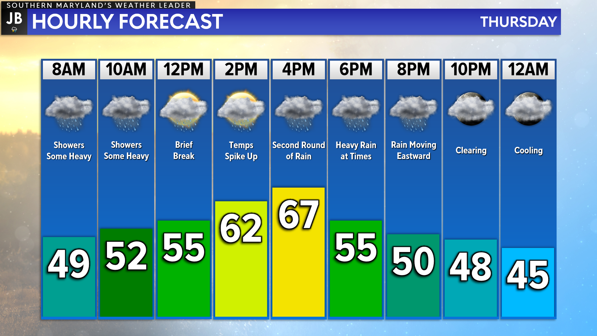
We are off to a rather cool start this morning thanks to the rain showers that are moving in! As we see the first round move out, and we see a break in the activity, temperatures will likely spike up! Our southeastern-most communities are likely to see temperatures spike into the 60s, and even the lower 70s. Our northwestern communities, closer to I-95, will likely stay in the 50s today. Quite the gradient in temperatures today, which makes doing an hourly forecast quite hard!
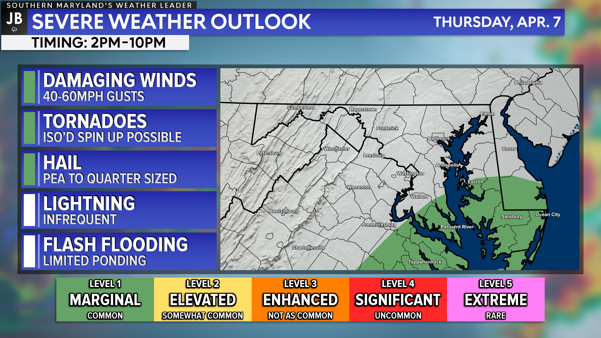
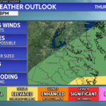
As mentioned above, there will be the risk for 1 or 2 embedded thunderstorms this afternoon and evening. The Storm Prediction Center has outlined our southernmost communities under a Level 1 “Marginial Risk” of seeing severe storms with this evening round of rain. Notice that these are the same areas that would see temperatures max out in the 60s/70s this afternoon. The two go hand-in-hand. The warmest areas will see the highest chance of seeing a thunderstorm.
With all of that said, the severe weather chances are not particularly high today. The greatest atmospheric dynamics that could support severe storms should stay well to our south across Southeastern Virginia. However, the severe weather threat is non-zero in Southern and on the Northern Neck today. If we do manage to see 1 or 2 severe storms the greatest risk that they would pose would be locally heavy rain and gusty winds.

The Nationals have pushed back the first pitch for Opening Day due to the weather! The first pitch against the Mets is now scheduled for 7:05pm. While the later start time is better to avoid the worst of the weather, scattered showers will still remain possible throughout the game. Additionally, winds may also gust upwards of 20-30mph at times!
Stay with JB Weather for the latest information on Southern Maryland weather. You can always access my forecasts and updates here on the website, on Facebook, on Twitter, on Instagram, and on YouTube.
-JB

Brought to you by Batteries Plus at our new location on West Dares Beach Road in Prince Frederick. Your locally owned one-stop-shop for everyday & hard-to-find batteries, lighting, phone repair, auto key fobs and much more. Stop by today, or give us a call at (443) 968-2056. Or visit our second location on St. Andrews Church Road in California.
John Bordash
View More PostsJB Weather forecaster John Bordash is working around the clock to provide Southern Maryland, and neighboring communities, with accurate and reliable weather information.