Brought to you by Calvert Title Company
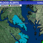
The National Weather Service has issued a COASTAL FLOOD WARNING for the shoreline in St. Mary’s County that will be in effect from 4AM-1PM Monday, especially around times of high tide.
The Middle Atlantic River Forecast Center is forecasting a tide height of over four feet Sunday night. This could lead to up to one and half feet of inundation above ground level in low-lying areas due to tidal flooding.
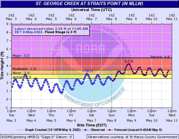
IMPACTS: At 3.0 feet, yards are flooded on Saint George Island, and water will begin covering the road leading to the island, especially if there is wave action.
ADDITIONAL DETAILS: Tides two to two and a half feet above normal. The next two high tides at Point Lookout are at 8:09 PM and 8:16 AM. The next two high tides at Piney Point are at 9:02 PM and 9:03 AM. The next two high tides at Coltons Point are at 9:38 PM and 9:39 AM.
PRECAUTIONARY/PREPAREDNESS ACTIONS: Take the necessary actions to protect flood-prone property. If travel is required, do not drive around barricades or through water of unknown depth.
Brought to you by Calvert Title Company. Calvert Title Company is guiding you HOME one closing at a time! Check out https://calverttitle.com/ today!
John Bordash
View More PostsJB Weather forecaster John Bordash is working around the clock to provide Southern Maryland, and neighboring communities, with accurate and reliable weather information.