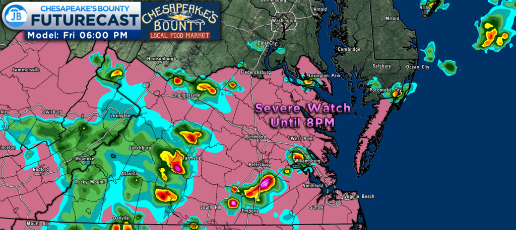
The Storm Prediction Center in Norman, OK has issued a SEVERE THUNDERSTORM WATCH for the Mid-Atlantic, including:
- King George (VA)
- Westmoreland (VA)
- St. Mary’s (MD)
This watch is in effect until 8PM Friday. Primary threats this evening are:
- Damaging wind gusts up to 70mph are possible
- Hail up to 1″ is possible
SUMMARY: Remnants of a long-lived storm complex should intensify as it spreads east of the Appalachians across the Piedmont toward the Coastal Plain.
That complex will likely lead to storms moving across Virginia this evening, and St. Mary’s County will be on the edge. Futurecast keeps almost all of the storm activity to our south across VA. While the worst weather will be to our south, I cannot totally rule out a storm locally. Stay weather aware!

PRECAUTIONARY/PREPAREDNESS ACTIONS: Remember, a Severe Thunderstorm WATCH just means that conditions are favorable for severe thunderstorms in and close to the watch area. People in these areas should be on the lookout for threatening weather conditions and listen for later statements and possible warnings. Severe thunderstorms can and occasionally do produce tornadoes.

It will be important to stay with JB Weather for the latest information on this severe weather threat and the impacts here in Southern Maryland. You can always access my forecasts and updates here on the website, on Facebook, on Twitter, on Instagram, and on YouTube. JB Weather is Southern Maryland’s Weather Leader, and I am working around the clock to keep you ahead of the storm!
-JB

