Brought to you by Chesapeake Orthodontics
After reaching the lower 90s yesterday, we have one more hot and humid day on tap before cooler air works in for Sunday and Monday. This cooler air will push through thanks to a cold front, that will look to set off scattered thunderstorms this afternoon and evening. Everyone will have a chance to see these thunderstorms push through, causing some impacts on Saturday evening plans.
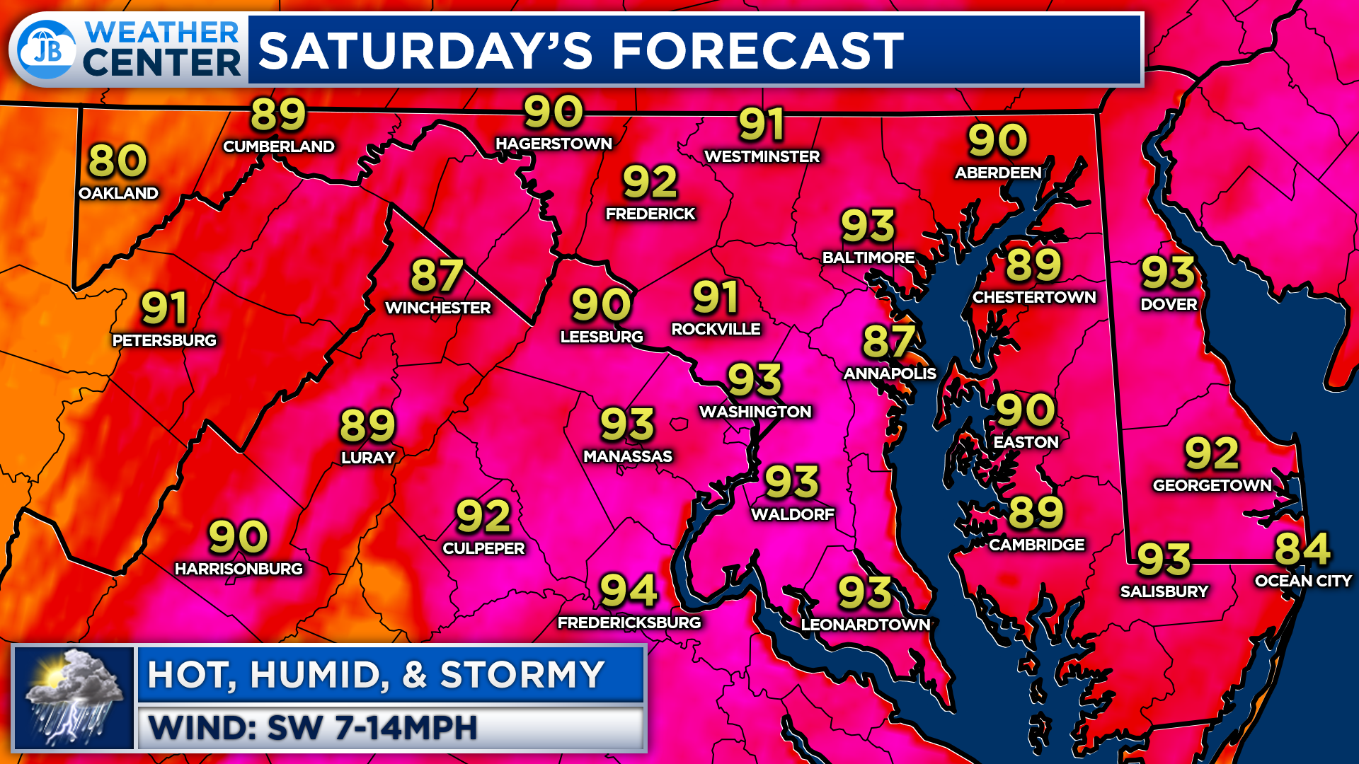
First, we will see temperatures rise into the lower to middle 90s once again this afternoon. This will be thanks to the southwesterly flow we will have, out ahead of the front. Much like yesterday, our dewpoints will be high, in the upper 60s to lower 70s, making it feel quite humid out there. This hot and humid combination will set the stage for storm energy to form in the atmosphere, to support storm development.
This morning’s run of Futurecast shows that we should start to see thunderstorms begin to fire up between 2-5pm. The later it takes for thunderstorms to fire up, the more intense they could become, since there would be more atmospheric instability for thunderstorms to tap into.
Nevertheless, we are likely to see a few rounds of showers and thunderstorms move through the region anytime after 2pm. The first round of storms, which is likely to move through before sunset, will likely contain the severe threat. Behind that initial round of storms, additional showers and locally heavy downpours are possible, and they could continue throughout the evening and night.
We should start to see some clearing by sunrise tomorrow, with most of the rain coming to an end by mid-morning.
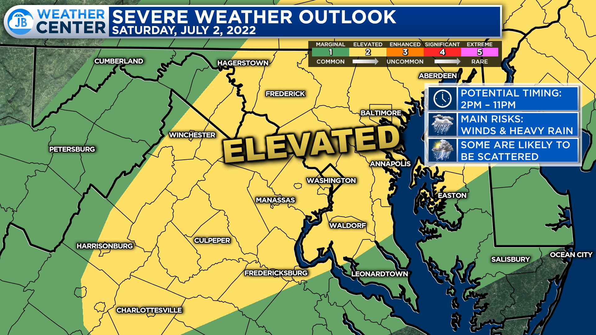
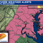
The Storm Prediction Center has much of our region under a Level 2 “Elevated Risk” of severe weather for this afternoon and evening. This means that we have notable odds of seeing a couple of storms that fire up today turn severe as they work eastward. To me, anyone between the Appalachians and the Bay could see severe storms. Thankfully, this does not look to be a severe weather outbreak.
Remember that severe weather forecasting is far from a guarantee of anything. The goal of these forecasts is to alert you to the potential of storms, not a promise of storms.
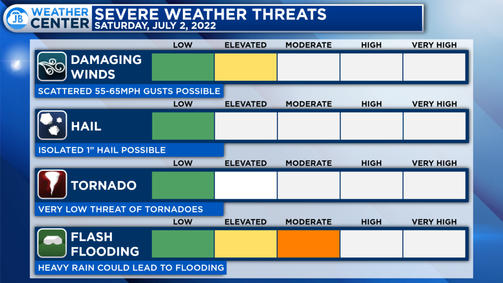
The primary risks today will come from damaging winds and flash flooding. Winds in thunderstorms could gust upwards of 60-65 mph. The atmospheric profile does not seem all that conducive for tornadic development, which is welcomed news. Some storms could contain 1″ hail, though.
With the threat of multiple rounds of showers and storms, I would be concerned about a higher than normal flooding threat. Rounds of showers and storms will propagate eastward over the course of the afternoon and evening, and they could quickly put down up to an inch of rain, leading to some issues.
Now, not everyone will see heavy rain today. As is the case with typical summertime thunderstorms, rainfall amounts and impacts could vary quite a bit over short distances. And, weather conditions will be prone to change very quickly and suddenly.
If you have outdoor plans or events scheduled for today, especially after 2pm, I would begin thinking about what a Plan B could look like, and have a plan to move indoors quickly, if needed. Stay weather aware this afternoon, and stay alert if any watches or warnings get issued. The deeper we get into the afternoon and evening, the higher the chance that you could see showers and storms move overhead.
Stay with JB Weather for the latest information on Southern Maryland weather. You can always access my forecasts and updates here on the website, on Facebook, on Twitter, on Instagram, and on YouTube.
-JB
Dr. Thomas Hao and Dr. Dylan Schneider offer comprehensive orthodontic services for all ages. Schedule your free consultation today. Visit www.SOMDBraces.com today for more information!
John Bordash
View More PostsJB Weather forecaster John Bordash is working around the clock to provide Southern Maryland, and neighboring communities, with accurate and reliable weather information.