Brought to you by Berkshire Hathaway HomeServices PenFed Realty
A stationary frontal boundary, attempting to deliver cooler and drier air, has stalled out over our region as an area of low-pressure slowly works along it. This has lead to the development of rain across the Mid-Atlantic over the last 12-18 hours. This rain will look to continue off and on throughout the day, especially for areas along and east of I-95.
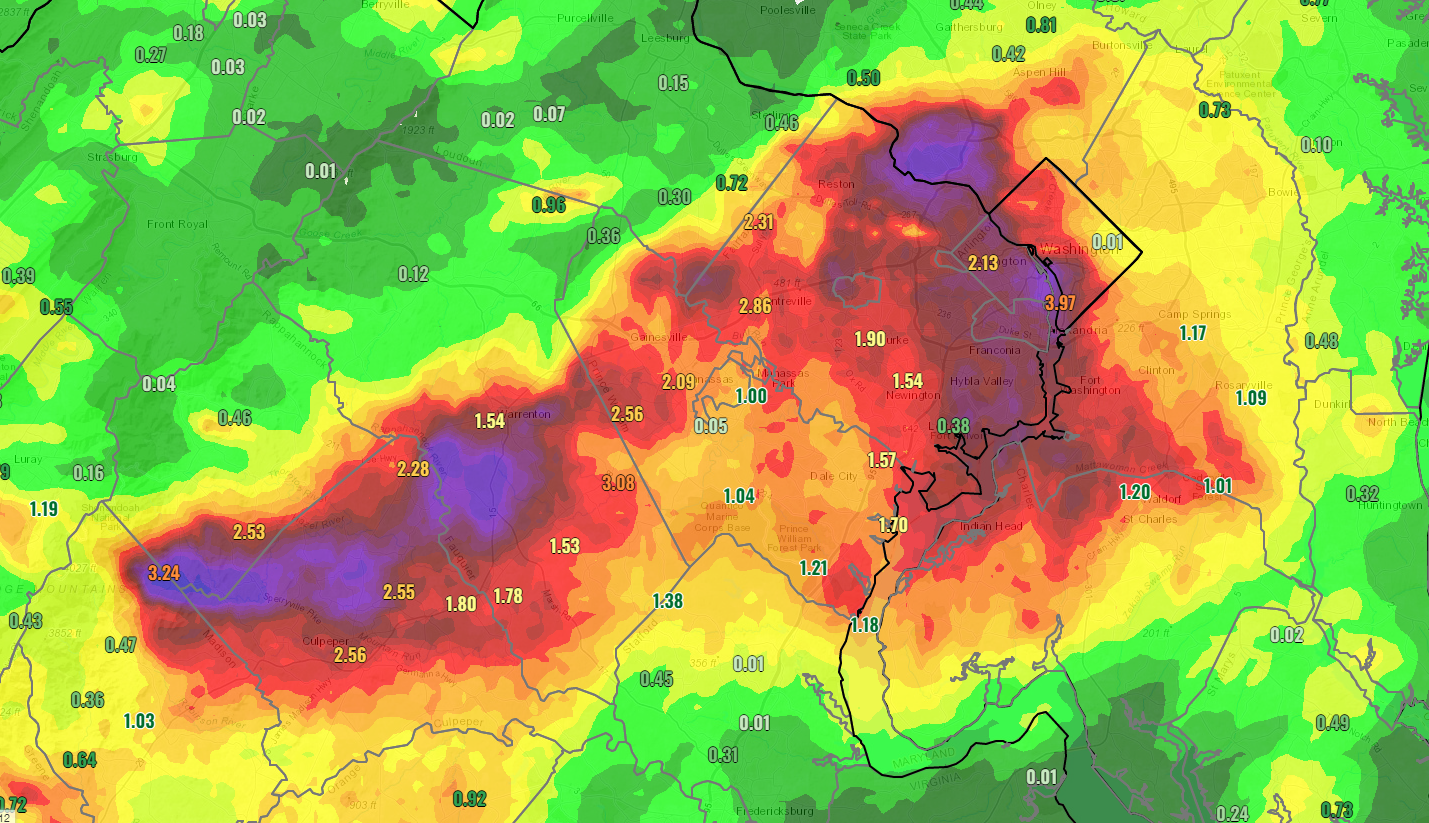
Overnight, we saw several pockets of heavy rain develop across portions of Virginia and the DC Metro area. The National Weather Service reports show that between 2-4″+ of rain fell overnight in the area shaded in dark red and purple on the map above. A larger swath of 1-2″+ fell across the region, including through parts of PG and Charles Counties, where a Flood Warning is in effect until 9:30AM.
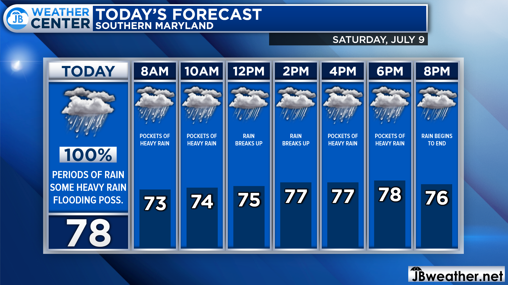
The rain has begun to shift eastward this morning, focusing on areas south and east of I-95. This rain will continue throughout the day. The highest impact times look to be from 5am through 10am before a brief break with only light rain develops during the midday hours. Then, we are likely to see another development of moderate to heavy rain between 2pm and 7pm. The rain should finally begin to end around sunset.
Our Chesapeake’s Bounty Futurecast shows that it will not rain heavily everywhere all day today. Instead, we are likely to see localized pockets of rain move through the region. Where these pockets are set up will determine who sees the heaviest rain. This means that some places across the region are likely to see a lot of rain today while others may see very little.
Futurecast is also doing a great job of depicting the two distinct time frames where we could see heavy rain. The midday break will not feature sunny skies and totally dry conditions, just a period where heavy rain will be much less likely as the atmosphere recharges.
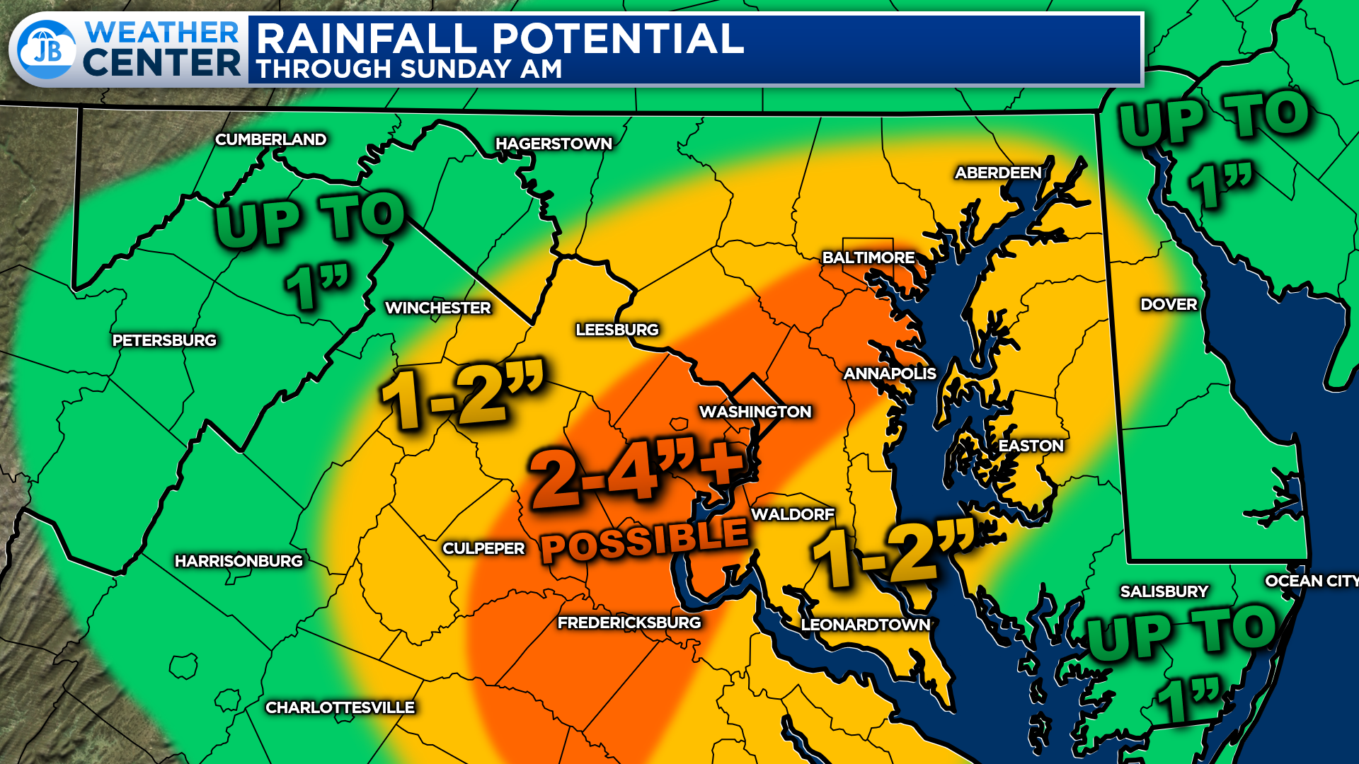
Buy and large, it looks like 1-4″ of rain will be possible across the region today. The heaviest rains may look to set up along and just southeast of I-95 today, leading some localized higher totals. “Locally higher” means that there are likely to be a few towns that see more than 4″, but not enough to warrant me drawing a new forecast range because it is likely to be limited who sees those highest totals.
Keep in mind that it is nearly impossible to draw an exact rainfall map that pinpoints who the big winner and losers will be. Some will see less than half an inch of rain today, even in the orange zone, and some will see more than 4″. So, this is just a general look at what may happen.
As you may have gathered, forecasting summertime rainfall amounts is very different and much more complex than forecasting winter snowfall totals. Snow totals tend to be more uniform, and are easier to draw on a map with a higher degree of accuracy. Summertime rainfall can vary so much over such a short distance, that it is nearly impossible to capture every small bit of nuanced. This is what the map says “Rainfall Potential” not “Rainfall forecast.”
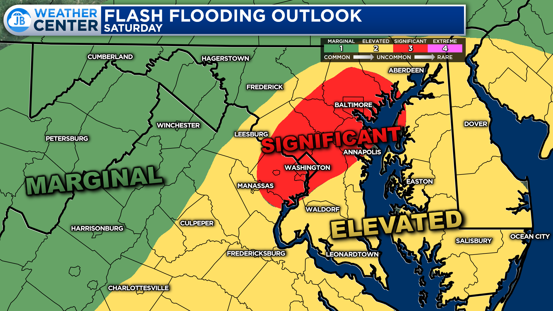
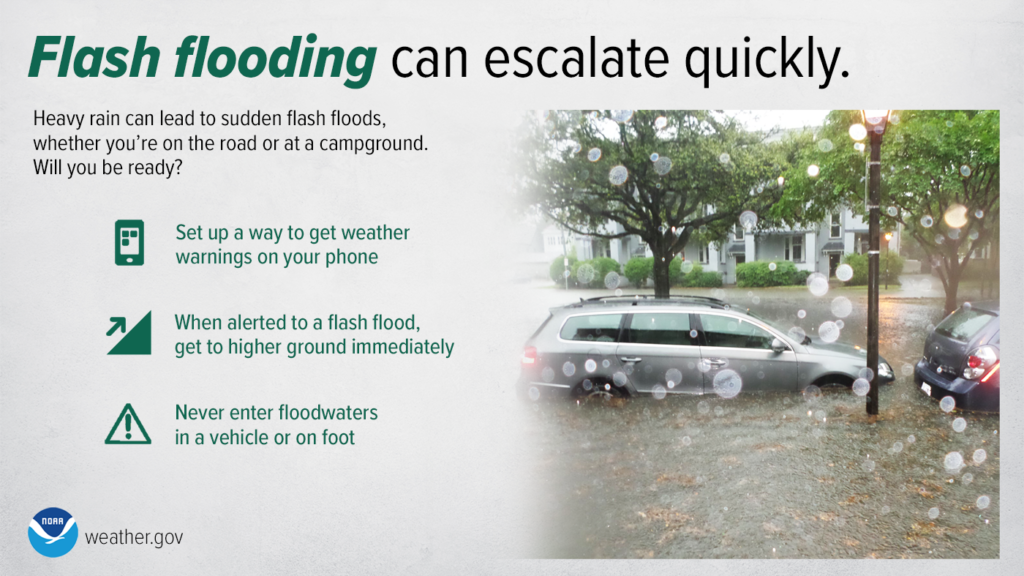
The Weather Prediction Center has outlined the I-95 corridor as having the highest threat of flash flooding today. That is where a Level 3 “Signficant Riskk” has been placed, which is very uncommon–only getting issued a couple of times a year. This indicated the greater likelihood of seeing numerous flooding events develop.
The rest of our local area is under a Level 2 “Elevated Risk” of flash flooding. This slightly lower categorization of our flood risk reflects the increased difficulty it will be to have flooding occur since we have been so dry over the last 6 weeks. With that said, though, this is still a serious categorization. Localized flash flooding is very much possible in this yellow zone if you remain under a pocket of heavy rain long enough.
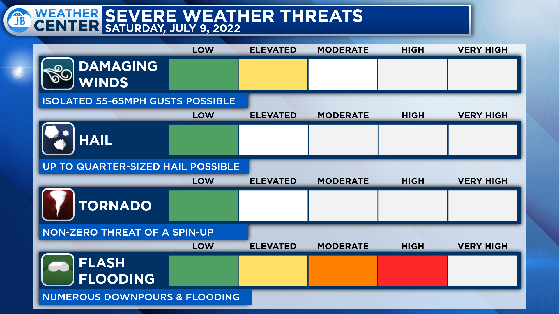
All in all, the next 12-24 will have the potential to bring moderate to high impacts. Pockets of heavy rain will likely develop and move through parts of the region. The main weather risk today will come from Flash Flooding. Some areas picking up as much as 1-2″+ of rain. We may also see some embedded thunderstorms develop, but the severe risk is low. We may see 1 or 2 storms contain 55-65mph wind gusts, but that looks to be the upper extent of the storm threat.
It will be important to stay weather aware today, especially if you are traveling. Not everyone will see heavy rain and flooding. However, those that do could see high impacts develop quite quickly. Outdoor activities are going to be rather difficult to pull off today given the complex forecast, and the high ceiling of the rain potential.
You can access live coverage of today’s heavy rain threat at the new live blog I will be doing today. The goal is to help you find all updates in one place, as opposed to trying to piece together updates from across platforms.
Stay with JB Weather for the latest information on Southern Maryland weather. I will be with you all throughout the day to cover this impactful system. You can always access my forecasts and updates here on the website, on Facebook, on Twitter, on Instagram, and on YouTube.
-JB

Real Estate now! Not sure where to start? View our Southern Maryland inventory of homes, land, farms and commercial properties on penfedrealty.com. Engage with our planning tools to determine your next real estate lifestyle decision, choose your realtor as a trusted advisor. Experience the difference with service and support from real estate’s forever brand!
John Bordash
View More PostsJB Weather forecaster John Bordash is working around the clock to provide Southern Maryland, and neighboring communities, with accurate and reliable weather information.