Brought to you by Chesapeake Orthodontics
We have a high-impact weather day on tap across the region! Temperatures and humidity are likely to be exceptionally high, and we have the risk of PM storms, as well. This is likely the beginning of a 4 day stretch of high weather impacts from our heat wave.
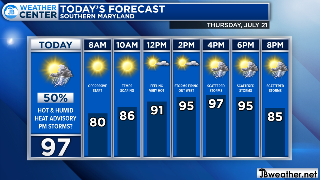
We are already off to a warm and humid start this morning. This will set the stage for temperatures to soar, likely reaching the 90s by lunchtime! We will look to max out in the upper 90s as some hit-and-miss storms begin to develop and push through this evening.
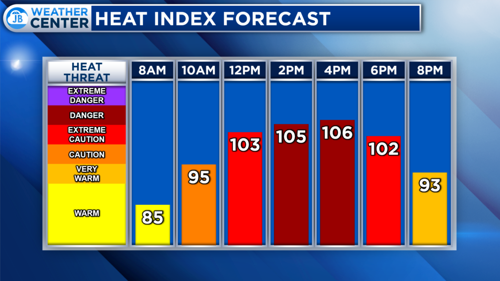
Dewpoints today will be in the 70s, which is considered quite oppressive. This high humidity will combine with the hot temperatures to send heat indices, or feels like temps, through the roof! The hottest and most dangerous stretch is likely to be from late-morning through mid-afternoon.
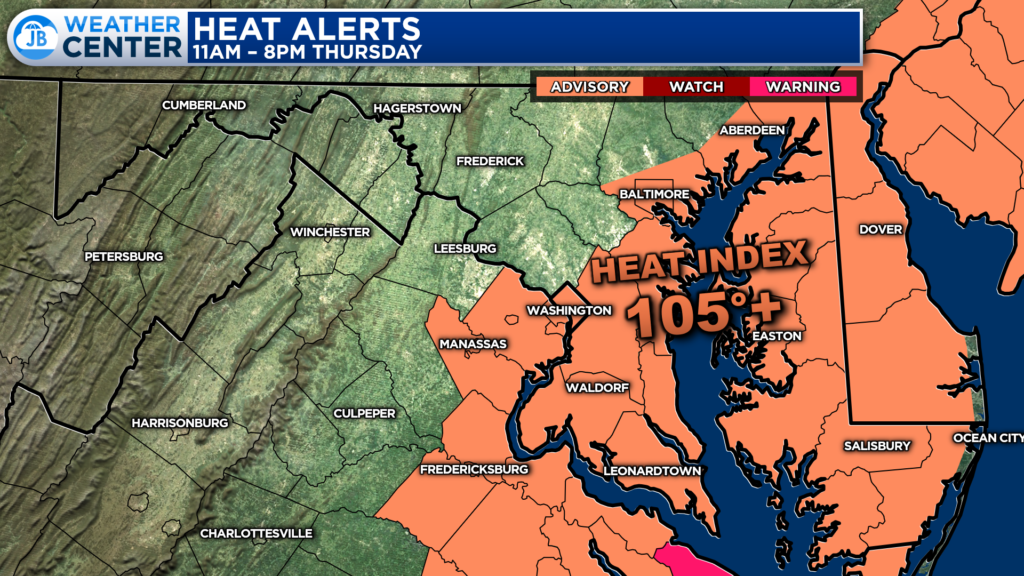
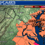
These high heat indices would be why areas along and east of I-95, including all of Southern MD, have been placed under Heat Advisories (denoted by the orange shading). While it will be hot everywhere, this is the zone where the humidity will be the highest, leading to those dangerous heat indices.
The heat and humidity today will also allow for copious amounts of atmospheric storm energy to develop across the region. As a weak wave of atmospheric energy passes through this afternoon, we are likely to see hit-and-miss storms develop. If these storms form, there will be plenty of energy for them to tap into, which could allow them to become strong to severe.
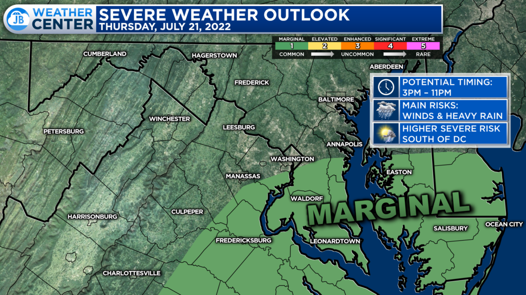
The greatest risk of seeing storms will be from 3pm until 11pm, and will likely be focused southeast of DC. These spots have been placed under a Level 1 “Marginal Risk” of severe weather, which denotes the risk of 1 or 2 severe storms being possible.
Futurecast tends to think that storm coverage may be a bit more widespread than the Storm Prediction Center suggests. This is because Futurecast limits the amount of cloud cover this afternoon. If this does happen, then we could see this risk level upgraded later today. Nevertheless, I would take this storm risk, even at Level 1, seriously.
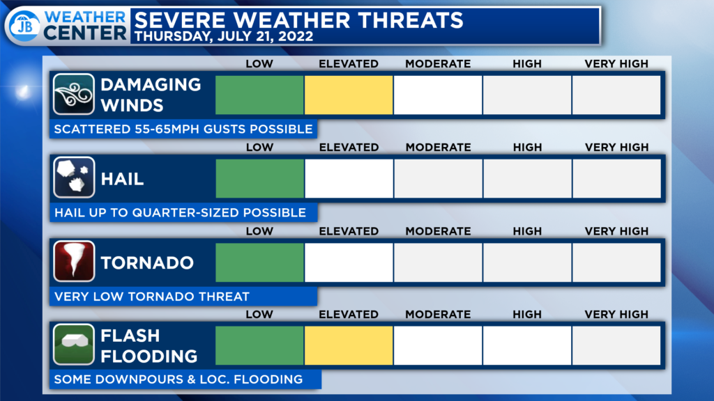
The primary threats from any storms this afternoon and evening will be damaging winds, potentially up to 55-65mph, and localized flash flooding. We could see 1 or 2 storms become strong, and they could bring some locally high impacts in both of the aforementioned categories. Thankfully, the tornado threat is quite low today.
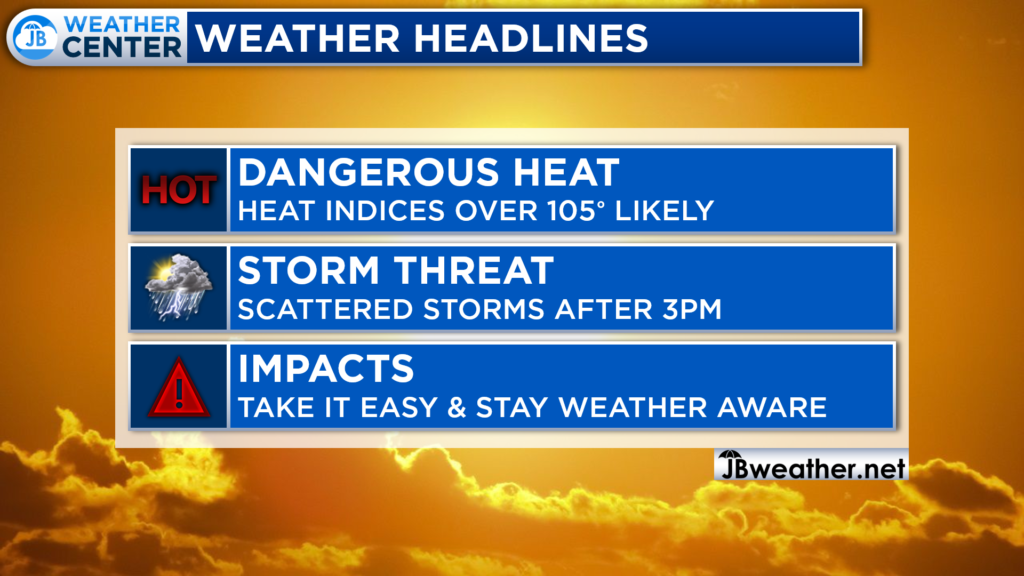
If you have outdoor plans at any point today, you will experience high heat impacts. You will want to take it easy out there today in regards to the heat. Take frequent breaks, stay hydrated, and stay cool. You will also want to stay weather aware for that PM storm threat.
While I would not necessarily cancel any outdoor plans, I would seriously consider moving any plans indoors to escape the heat, humidity, and storm threat. Sports practices are likely to face some difficulties getting complete practice sessions in with no impact.
Stay with JB Weather for the latest information on Southern Maryland weather. You can always access my forecasts and updates here on the website, on Facebook, on Twitter, on Instagram, and on YouTube.
-JB

Dr. Thomas Hao and Dr. Dylan Schneider offer comprehensive orthodontic services for all ages. Schedule your free consultation today. Visit www.SOMDBraces.com today for more information!
