Brought to you by OakPoint Insurance
A warm Sunday ended up resulting in very little storm activity yesterday afternoon as a cold front pushed through the region. Regardless of storm development, we still saw that cold front march through, and it will deliver a refreshing shot of Fall air over the next couple of days.

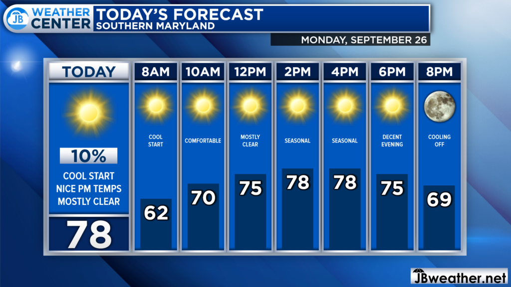
We are off to a cool start this morning with temperatures in the 50s! We will see temperatures gradually warm into the 60s throughout the morning and into the 70s this afternoon. We should keep mostly sunny skies around, but far northern communities, near DC, may see a brief sprinkle around lunchtime. Winds will also be elevated, gusting up to 20mph at times.

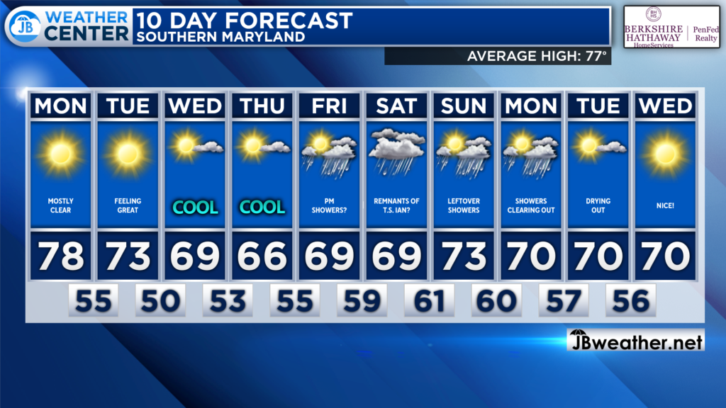
The next several days are looking fantastic as we continue to transition into Fall. Temperatures over the next 10 days should all stay below 80°! We will have to introduce the chance of rain as the remnants of Ian may try to work up the Appalachians this weekend. I will have more details on this later on this afternoon, and throughout the week! Stay tuned as we learn more and this forecast evolves.
Stay with JB Weather for the latest information on Southern Maryland weather. You can always access my forecasts and updates here on the website, on Facebook, on Twitter, on Instagram, and on YouTube.
-JB

The premier insurance agency in Southern Maryland with three locations. We provide insurance for Home, Auto, Business, Farm, and Life. In partnership with many top insurers, we provide solutions to fit our client’s needs. Get in touch with us at 301-863-8100 to experience the difference, mention JB Weather to claim your free gift!

