Brought to you by Chesapeake Orthodontics
While we have seen some thunderstorms over the last couple of months across the Mid-Atlantic, the lack of widespread rain and severe weather this Spring and early Summer has been noticeable. However, Monday will look to offer up one of the Mid-Atlantic’s “best” chances of severe weather in several months.
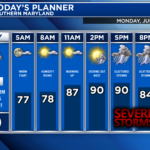
A warm and humid day will set on Monday with temperatures nearing 90°. The heat and humidity will serve as ingredients for potential severe weather as a cold front pushes through the region Monday afternoon. While the specifics are still a bit fuzzy, the overall threat of strong to severe thunderstorms will be present.
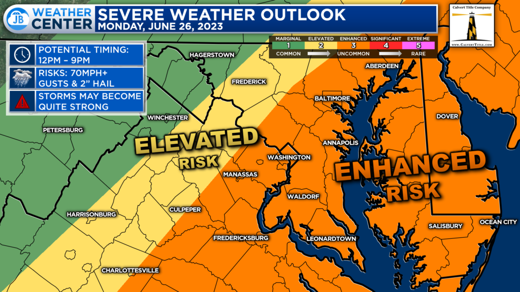
The Storm Prediction Center has placed much of our region under an uncommon Level 3 “Enhanced Risk”. This heightened risk level has been focused along and east of I-95 for Monday afternoon.
The placement of these threat areas seems rather accurate. These are the suspected areas the most likely to see the greatest combination of severe weather ingredients in the atmosphere as we move into the afternoon hours of Monday.
Our Futurecast generally has a good handle on the setup for tomorrow. After a quiet morning, thunderstorms will look to develop along I-81 during the mid-afternoon hours. These storms will move eastward and run into a favorable environment for strengthening.
While the exact placement and timing of these storms are nearly impossible to pin down, the general theme of scattered to widespread strong to severe storms anytime after 3pm seems to be the theme for tomorrow.
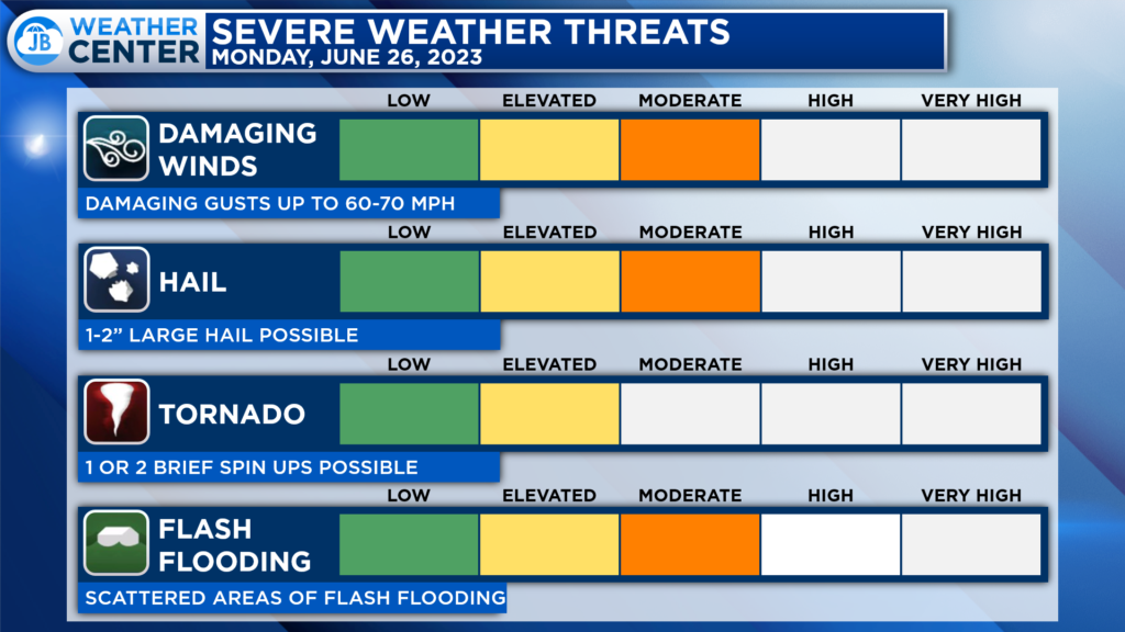
Many severe weather modes are in play for tomorrow. Any storms that do move into this favorable environment will have the chance to produce 60-70mph wind gusts, large hail, and flash flooding. I also cannot rule out one or two rotating storms tomorrow. Granted, the tornado threat is the primary concern for tomorrow–it is more of a secondary threat.
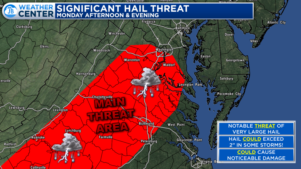
The Storm Prediction Center has outlined the red-shaded area as having a noticeably higher threat of seeing abnormally large for tomorrow. The concern of 2″+ sized hail could bring an added level of threat and damage concern. Not every storm tomorrow will produce large hail. but the threat certainly looks to be there thanks to the cold air and strong updrafts in the upper levels of the atmosphere.
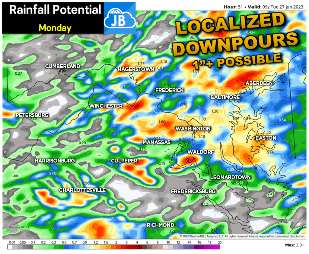
Any storms that develop tomorrow will have the potential to put down a lot of water, in a short amount of time, regardless of the severe threat. Our modeling shows the potential for some localized areas to see over an inch of rain. This is something to be aware of as strong storms move in during the afternoon hours. The placement of the heavy rain will be determined on where specific storms develop and track.
Remember that severe weather forecasting is far from a guarantee of anything. The goal of these forecasts is to alert you to the potential of storms, not a promise of storms.
Stay with JB Weather for the latest information on Southern Maryland weather. You can always access my forecasts and updates here on the website, on Facebook, on Twitter, on Instagram, and on YouTube.
-JB

Dr. Thomas Hao and Dr. Dylan Schneider offer comprehensive orthodontic services for all ages. Schedule your free consultation today. Visit www.SOMDBraces.com today for more information!

