A weak, moisture-starved system is set to slide through the region later today, bringing a few rounds of light rain from this afternoon into the overnight hours. This won’t be a major event by any stretch, but it will help chip away at the developing drought that continues to spread through parts of the Mid-Atlantic. Temperatures will remain safely in the 40s, so this is an all-rain setup with no wintry mischief this time around. Overall impacts remain low, and for most of us, this will simply be a damp evening.
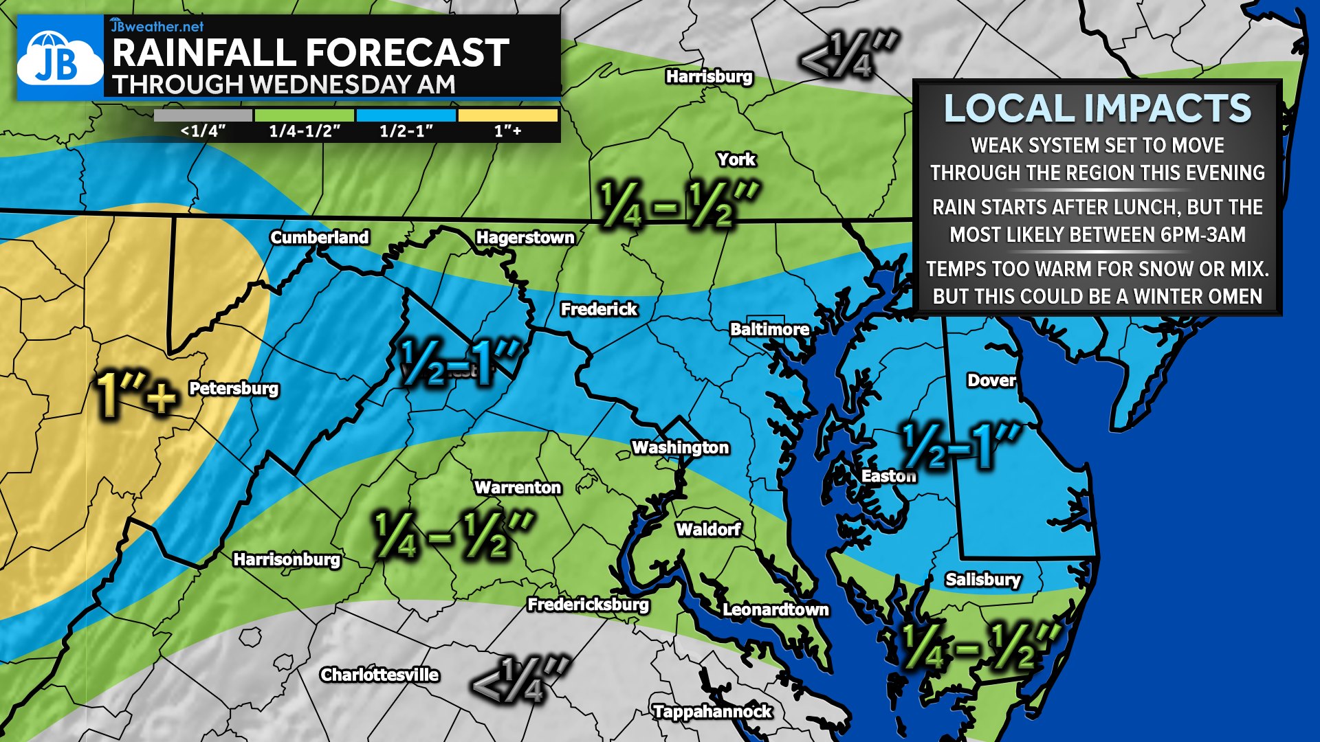
Rain is most likely between 2 PM and 3 AM, with the steadiest coverage expected during the evening commute and the first half of tonight. Totals will vary depending on location: areas shaded in green are in line for ¼–½ inch, while locations in the blue zone could see closer to ½–1 inch. The higher terrain out toward the Potomac Highlands may even flirt with a bit more than an inch. Meanwhile, a familiar dry slot may once again trim amounts south of Charlottesville and Fredericksburg to less than a quarter-inch.
While this is plain rain, the setup is worth noting. If temperatures were just 10–15 degrees colder — and using a classic 10:1 snow ratio — these rainfall amounts would translate to 2–5 inches in the green-shaded regions and 5–10 inches in the blue band. In many ways, this system looks like a template for how early-winter storms often behave around here: a narrow corridor of higher precipitation, sharp gradients on either side, and the ever-present risk of someone missing out entirely.
Tonight’s system wraps up before sunrise Wednesday, setting us up for a drier but seasonably chilly day. While nothing about this event is disruptive, it may be a small preview of the kind of storm tracks we’ll be watching closely once true winter cold arrives. Stay tuned — the pattern is slowly starting to wake up.
John Bordash
View More PostsJB Weather forecaster John Bordash is working around the clock to provide Southern Maryland, and neighboring communities, with accurate and reliable weather information.