This morning, we’ve gotten new winter weather alerts to talk about for Friday as confidence increases in a light snow event for parts of central Virginia. Here’s the latest update on what to expect.
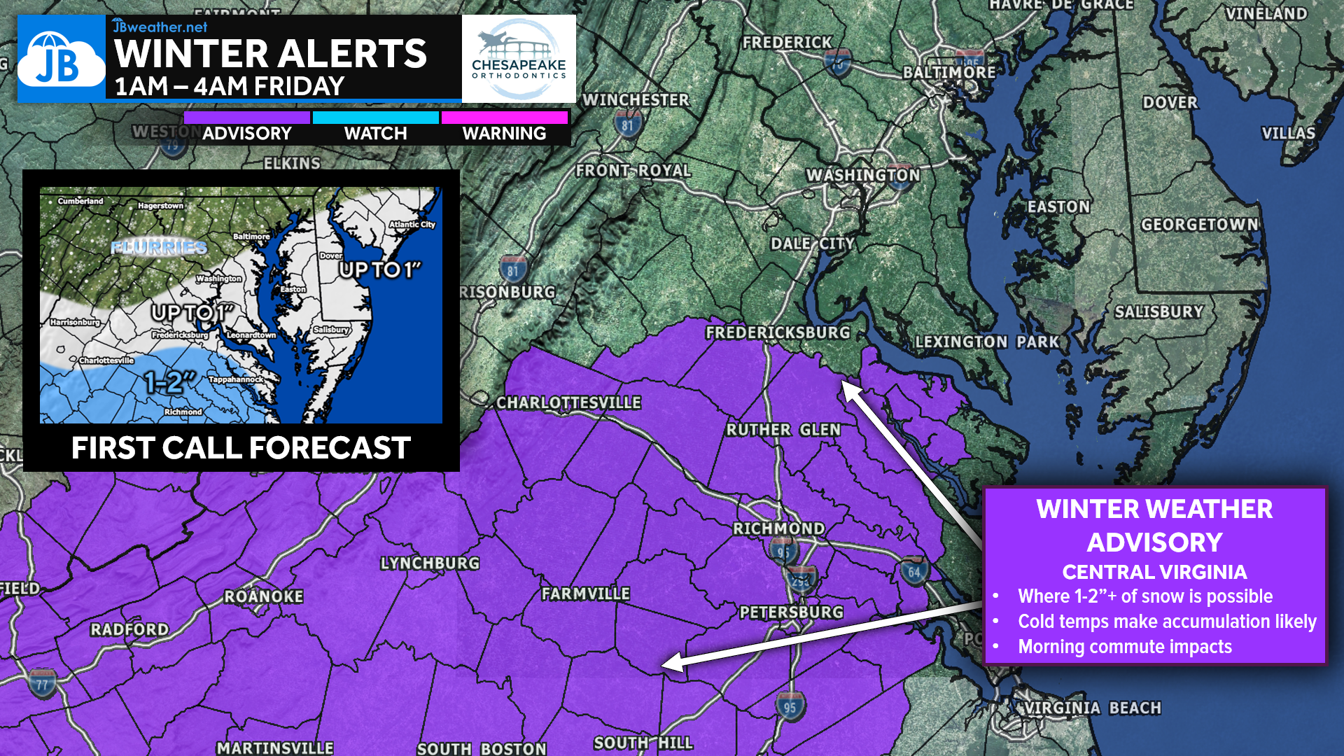
Winter Weather Advisories (shown in purple) have now been issued across central Virginia from 1 AM to 4 PM Friday. These advisories were posted for the areas with the highest likelihood of seeing 1–2 inches of snow Friday morning, which may lead to some slick spots and commute impacts. Locally, this includes Westmoreland, Spotsylvania, and Orange Counties, and extends south through Tappahannock and Richmond down to the VA/NC state line.
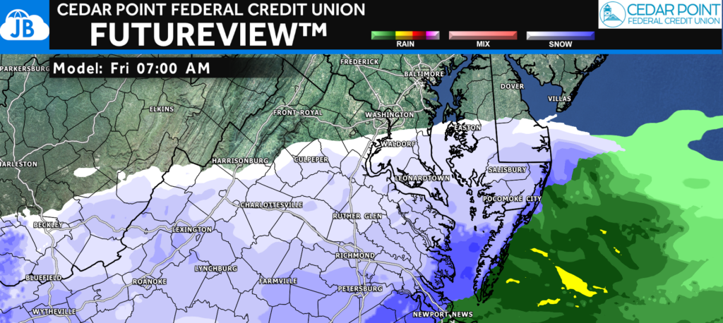
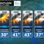
It’s certainly possible that these advisories get expanded farther north if we see a northward shift in the storm track. This continues to highlight how areas south of Route 50 remain right on the edge of this system. Shown is our Futureview model for Friday morning showing this sharp gradient. I’ll be issuing my full Final Call Forecast later this afternoon and evening once I’m home from school and can pour over the latest data. But, below is yesterday’s First Call Forecast below if you want a deeper breakdown of the setup, model differences, and snowfall potential.
Stay with JB Weather for the latest information on impacts here in Southern Maryland and across the Mid-Atlantic. You can always access my forecasts and updates here on the website, on Facebook, on Twitter, on Instagram, and on YouTube. JB Weather is the Mid-Atlantic’s Weather Leader, and I am working around the clock to keep you ahead of any storm!
John Bordash
View More PostsJB Weather forecaster John Bordash is working around the clock to provide Southern Maryland, and neighboring communities, with accurate and reliable weather information.