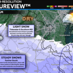
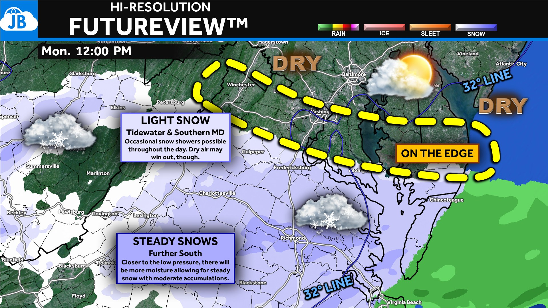
Good morning! Today’s system continues to track just to our south, keeping Southern Maryland right on the edge of the steadier snow. While this won’t be a major winter event for our region, we will still see occasional snow showers—especially late morning through early evening—with minor accumulations possible in southern St. Mary’s County.
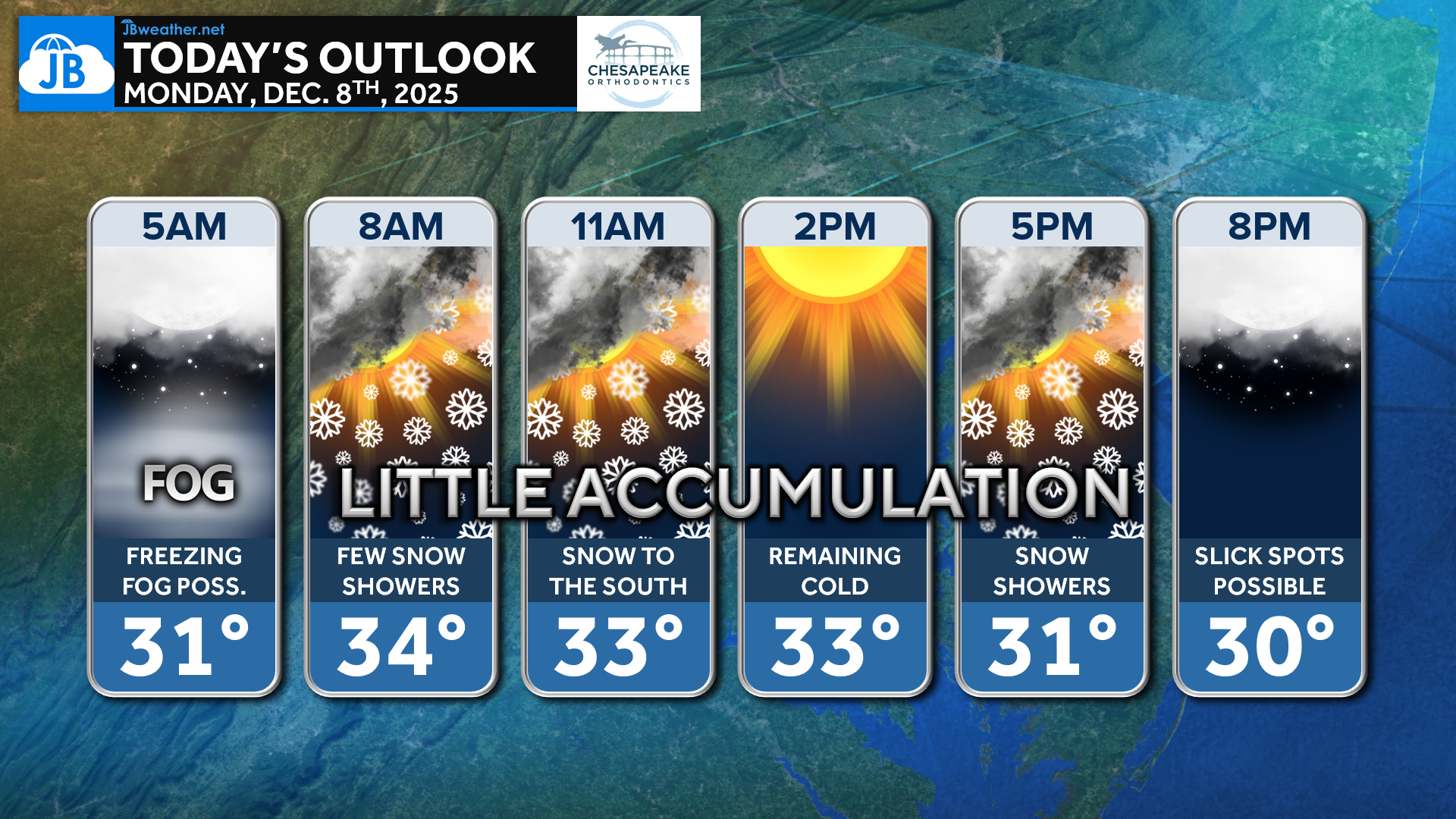
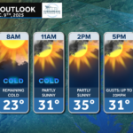
This morning begins with freezing fog in spots, so use caution if you’re out early. As we move into the 8 AM–11 AM window, a few snow showers may start drifting north into the region. Most areas will stay cold all day, with temperatures holding in the lower to mid 30s. By midday and into the evening, additional snow showers are possible, but only little accumulation is expected locally. Slick spots may form after sunset as temperatures drop back toward freezing.
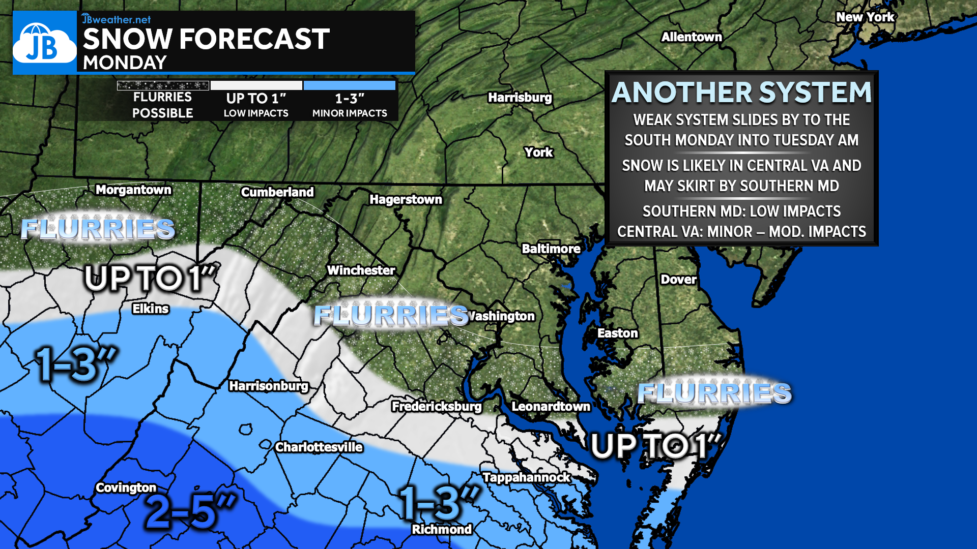
The steadiest, most organized snow remains focused well to our south—across central Virginia and the Richmond metro, where 1–3″ is likely and 2–5″ is possible in some areas. For Southern Maryland, the northern edge of the snow shield is very sharp. A coating to up to 1″ remains possible in southern St. Mary’s County, especially from California to Scotland. Elsewhere across Charles and Calvert Counties, flurries or a brief dusting is all that’s expected.
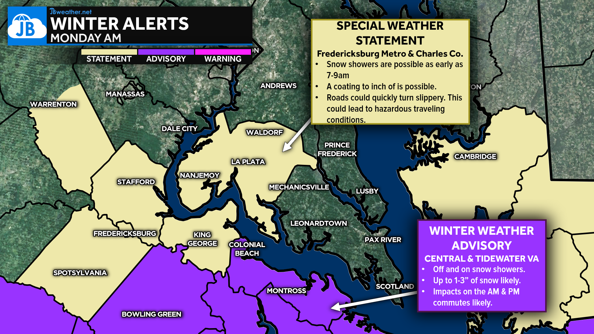
A Special Weather Statement is in effect for Charles County and the Fredericksburg metro, where early-morning snow showers could quickly coat roads and create slick spots between 7–9 AM. A quick coating to 1″ is possible in these zones. Farther south, central and Tidewater Virginia remain under a Winter Weather Advisory, with the Richmond metro under a Winter Storm Warning, where several inches of snow and moderate impacts are likely.
Locally, impacts remain elevated but low. With minimal accumulation expected across Southern Maryland, most roads will stay just damp, but brief slick spots are possible on secondary or untreated surfaces—especially during any heavier snow shower. Meanwhile, areas southwest of us—from Fredericksburg through central Virginia—will see medium impacts, including snow-covered roads and potential travel delays or school schedule changes.
Hi-resolution model guidance continues to show Southern Maryland right on the edge of the deeper moisture. Occasional snow showers will push in throughout the day, but dry air across northern and central Maryland limits how far north the steadier snow can extend. This supports the idea of intermittent flakes with light accumulation limited to far southern St. Mary’s. As the system pulls east later today, leftover snow showers will taper off into the evening.
Stay with JB Weather for the latest information on impacts here in Southern Maryland and across the Mid-Atlantic. You can always access my forecasts and updates here on the website, on Facebook, on Twitter, on Instagram, and on YouTube. JB Weather is the Mid-Atlantic’s Weather Leader, and I am working around the clock to keep you ahead of any storm!
John Bordash
View More PostsJB Weather forecaster John Bordash is working around the clock to provide Southern Maryland, and neighboring communities, with accurate and reliable weather information.