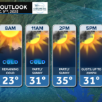
A cold front is on the way, and it will have a big influence on our weather over the next 24–36 hours. Today brings increasing winds, a mix of sun and clouds, and afternoon gusts approaching 40–45 mph for many. By Wednesday, colder air spills in behind the front, leading to falling temperatures and even some wintry weather in the mountains.
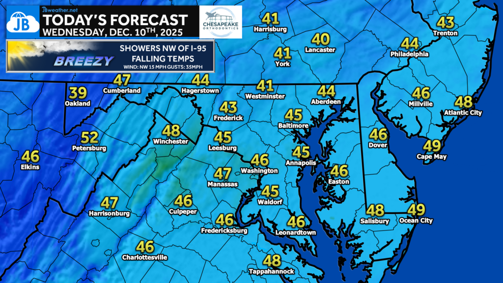
Temperatures today will climb into the 40s to near 50°, but the arrival of the front on Wednesday means temperatures will actually fall during the day, especially north and west of I-95. Many spots will start Wednesday in the mid-40s but slide into the upper 30s by afternoon as colder air pours in.
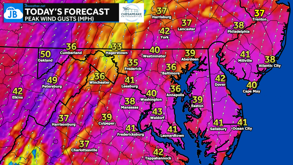
Today’s winds will be the most noticeable part of this setup, with widespread gusts between 35–45 mph and locally higher gusts over the mountains where 50+ mph will be possible. Winds remain elevated into Wednesday behind the front, keeping wind chills running lower than the actual air temperature.
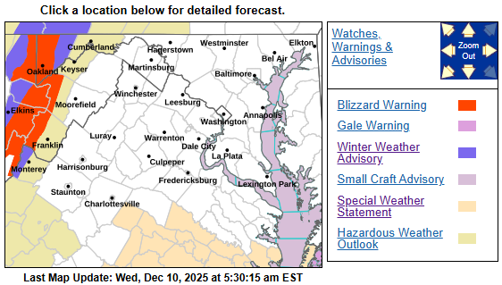
As the front passes through, scattered showers are expected northwest of I-95, mainly late morning through early afternoon on Wednesday. Farther west, colder air and strong upslope flow will generate periods of snow in the mountains, where blizzard warnings are in effect due to whiteout conditions and very strong winds. No issues are expected locally, but travel into the high terrain will be hazardous.
Stay with JB Weather for the latest information on impacts here in Southern Maryland and across the Mid-Atlantic. You can always access my forecasts and updates here on the website, on Facebook, on Twitter, on Instagram, and on YouTube. JB Weather is the Mid-Atlantic’s Weather Leader, and I am working around the clock to keep you ahead of any storm!
John Bordash
View More PostsJB Weather forecaster John Bordash is working around the clock to provide Southern Maryland, and neighboring communities, with accurate and reliable weather information.