Brought to you by: Dugan, McKissick and Longmore, LLC
Tomorrow will likely be our last day in this heat wave as a cold front will look to move through this weekend. Tomorrow will likely be the hottest day out of the last 7. A Heat Advisory has already been issued for our region ahead of the surge of warmth tomorrow.
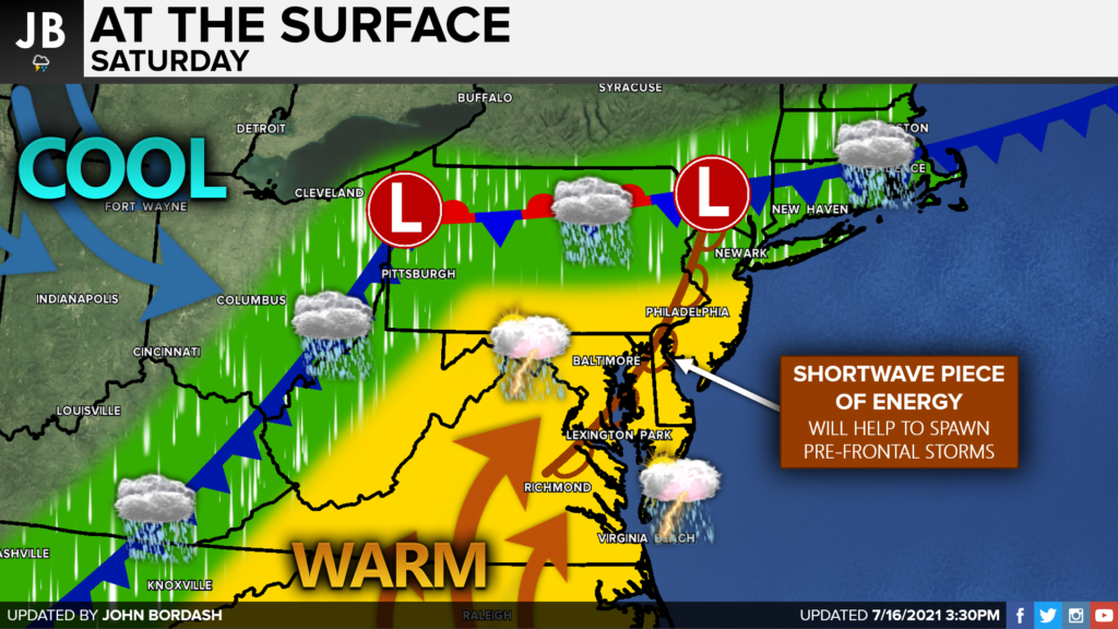
The injection of additional heat and humidity into our region will help set the stage for potential storms by Saturday afternoon. A shortwave piece of energy will run out ahead of the main front and will attempt to kick off storms across our region. The setup seems conducive for storm development, and the heat/humidity should allow for a few storms to potentially become severe.
We would likely begin to see some storms fire up to our west between 12 PM – 3 PM. Then, between 3 PM – Midnight, we could see a few different rounds of storms impact Southern Maryland. Our Chesapeake’s Bounty Futurecast shows this potential threat quite well.
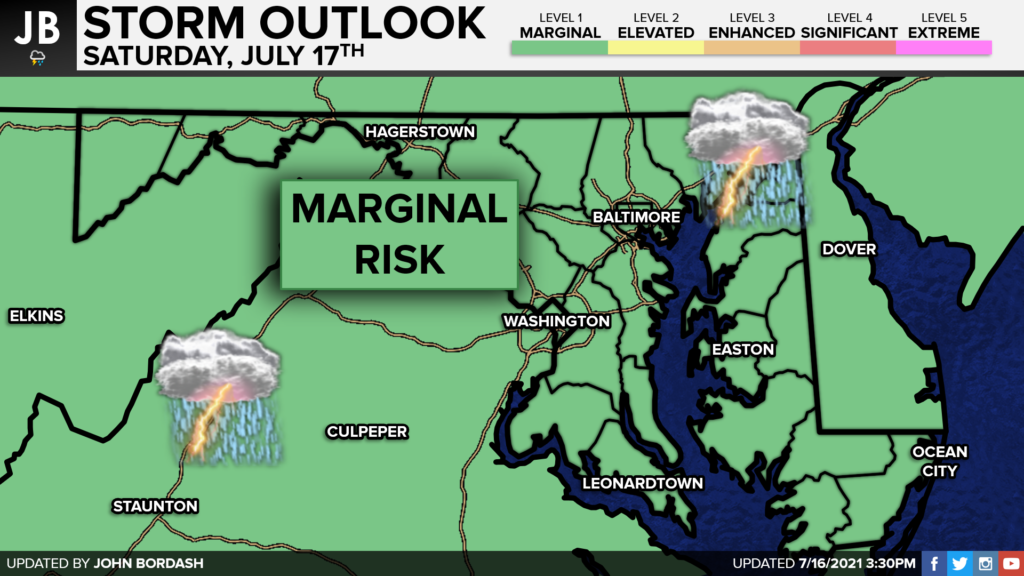
These potential storms are definitely not a guaranteed promise for tomorrow. We will need to see if the shortwave energy provides enough atmospheric lift in our region to kick of these storms. Nevertheless, the Storm Prediction Center has already issued a Level 1 Marginal Risk of Severe Weather across our region. The main threat tomorrow will likely be damaging wind gusts up to 60-70mph and flooding rains. If certainty grows with the storm potential, I could easily see our region being upgraded to a Level 2 Elevated Risk.
Stay with JB Weather for the latest information on Southern Maryland weather. You can always access my forecasts and updates here on the website, on Facebook, on Twitter, and on YouTube.
-JB

Dugan, McKissick & Longmore, LLC has served our Southern Maryland community for over 25 years. Our trusted attorneys are here to handle your unique case from beginning to end. To schedule an appointment, call us today at 301-862-3764 or visit our website at www.paxlawyers.com.
