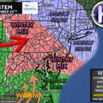
A quick-hitting winter system will move through the Mid-Atlantic late tonight into Tuesday morning, bringing a brief window of wintry weather north of Baltimore before warmer air flips most areas back to rain. While this is not a major winter storm, the timing during the morning commute means even light snow or ice could cause slick travel and school impacts.
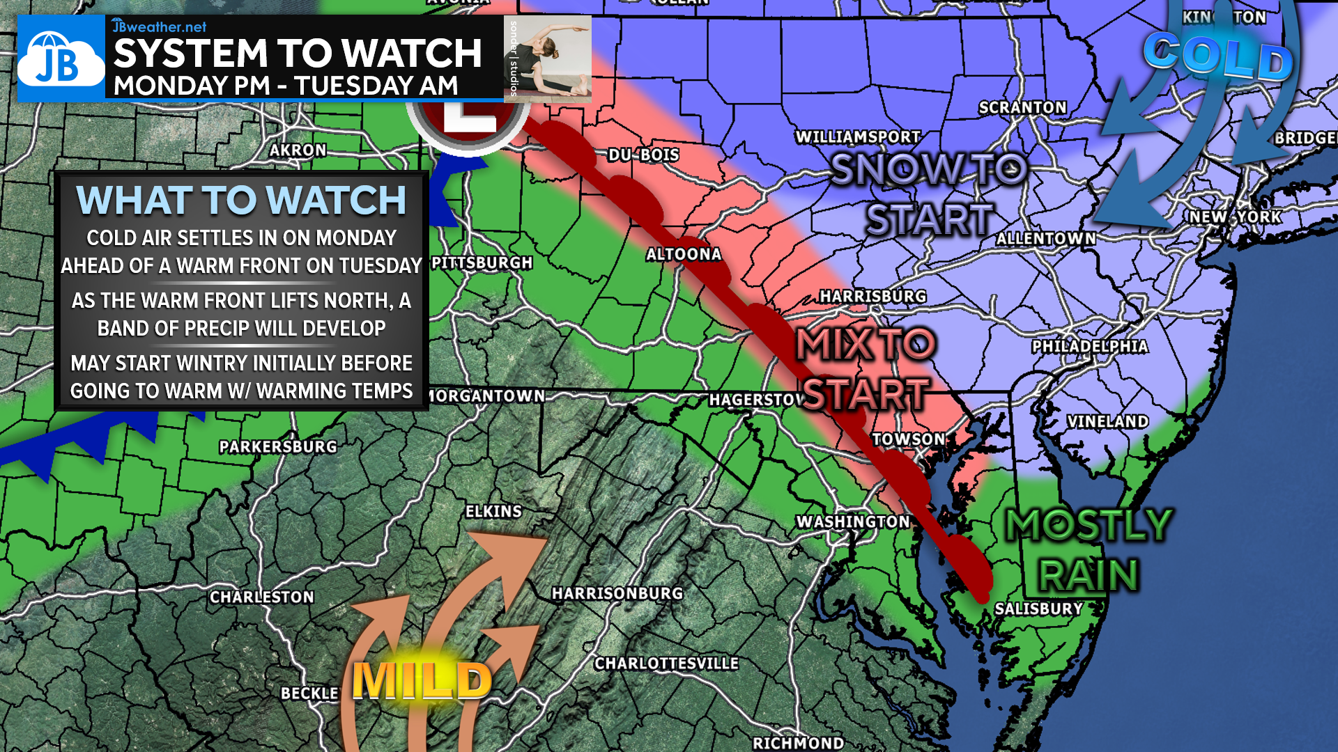
High pressure settling in today will allow a fresh injection of cold air to lock in across much of the Mid-Atlantic tonight. As we head into the overnight hours, attention turns to a fast-moving clipper system racing east across the Ohio Valley. This system will drag a warm front northward toward the Mid-Atlantic early Tuesday morning, setting the stage for a brief round of precipitation during the pre-dawn to early morning hours.
As the warm front lifts north, a narrow band of light precipitation is expected to develop and move west to east across the region between roughly 3 AM and 9 AM Tuesday. With cold air still in place at the surface north of Baltimore, there may be just enough cold air initially for precipitation to start as a light wintry mix of snow and sleet in parts of northern Maryland and southern Pennsylvania. Farther south and east, including areas closer to and south of Baltimore, precipitation should fall mainly as rain from the start.
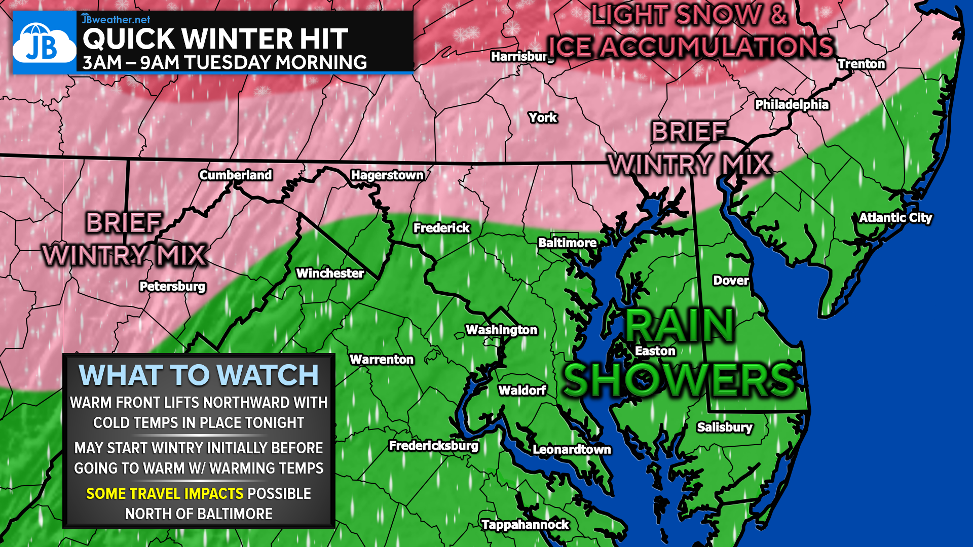
The best chance for any wintry weather will be north of Baltimore, including areas toward York, Harrisburg, and northern Frederick County. Even there, warmer air is expected to surge northward fairly quickly, causing any snow or mixed precipitation to transition to plain rain as temperatures rise Tuesday morning. Precipitation overall should remain light and somewhat spotty, with many locations seeing more nuisance-level amounts than anything significant.
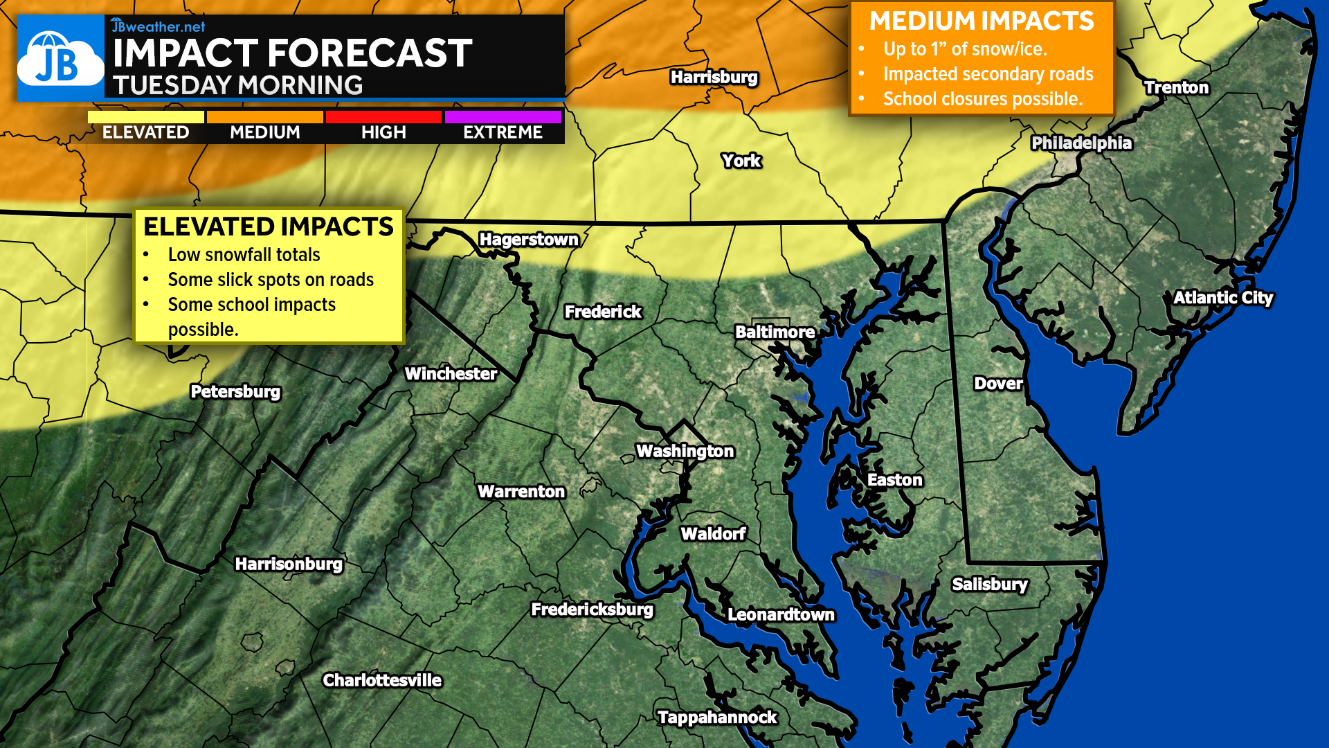
While accumulation looks limited — generally under an inch of snow or ice — the timing is less than ideal. Any wintry mix occurring during the early morning hours could create slick spots on untreated and secondary roads north of Baltimore, potentially impacting the Tuesday morning commute. Some school delays are possible, especially for districts still in session or operating on half days ahead of winter break, with isolated closures not out of the question if conditions line up just right. Overall, this looks like a low-end but timing-driven event, and we’ll continue to monitor for any changes overnight.
Stay with JB Weather for the latest information on impacts here in Southern Maryland and across the Mid-Atlantic. You can always access my forecasts and updates here on the website, on Facebook, on Twitter, on Instagram, and on YouTube. JB Weather is the Mid-Atlantic’s Weather Leader, and I am working around the clock to keep you ahead of any storm!
John Bordash
View More PostsJB Weather forecaster John Bordash is working around the clock to provide Southern Maryland, and neighboring communities, with accurate and reliable weather information.