A warm front will lift through the region tonight, followed closely by a cold front on Saturday. As these fronts move through, light precipitation may break out at times, with the best chance for activity northwest of I-95, where stronger atmospheric forcing will be in place. This setup favors spotty rain and snow showers, rather than a steady or widespread event.
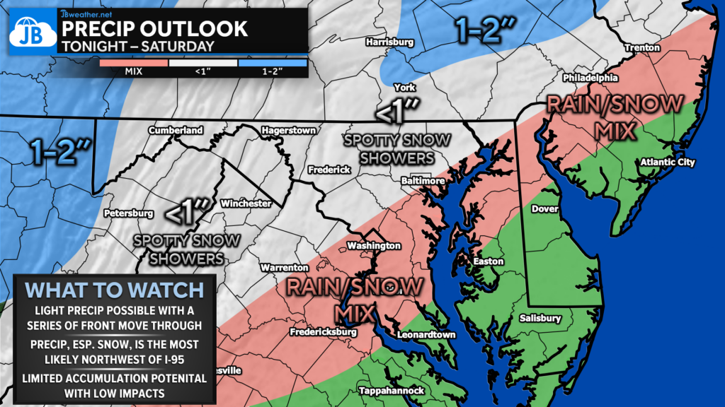
Overall, impacts look limited. Any snow that does fall will generally be light and scattered, with little to no accumulation expected for most locations. The best chance for minor accumulations will be across the higher elevations and parts of eastern Pennsylvania, while areas closer to and southeast of I-95 are more likely to see a rain/snow mix or plain rain. With warm ground temperatures and marginal conditions, this looks like a low-impact system, but one worth keeping an eye on as fronts move through.
John Bordash
View More PostsJB Weather forecaster John Bordash is working around the clock to provide Southern Maryland, and neighboring communities, with accurate and reliable weather information.