Brought to you by Chesapeake Orthodontics.
We are monitoring a potential winter storm threat for this coming weekend, with increasing confidence that a storm system will develop somewhere along the East Coast. While it is still 5–6 days away, this is a pattern worth watching closely as small changes could lead to very different outcomes locally.
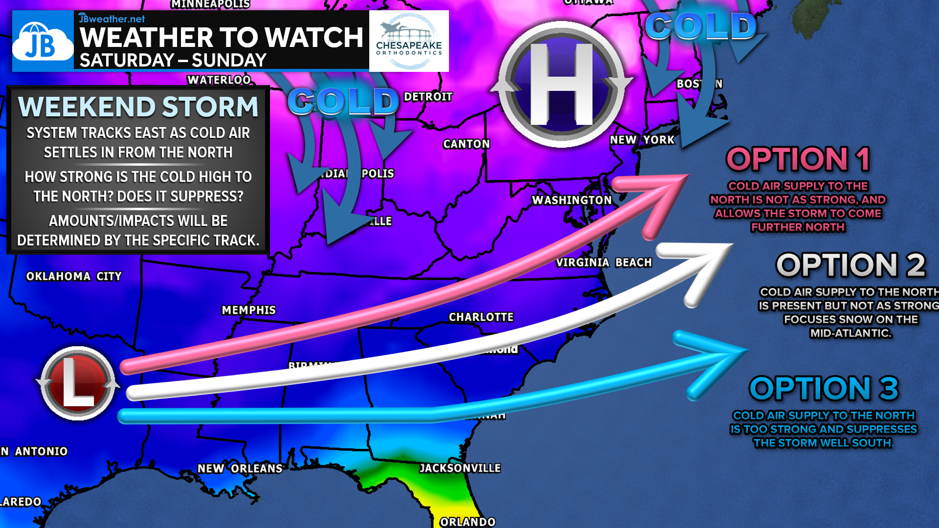
The overall setup features cold air pressing south from high pressure to the north, interacting with a developing storm system moving east across the southern U.S. and up the coast. How strong that northern high pressure becomes will determine whether the storm is suppressed south, tracks along the coast, or is allowed to push farther north. This interaction, highlighted in the overview graphic, is the key reason for the current uncertainty and will ultimately decide precipitation type, impacts, and how far north meaningful winter weather reaches. Each of our models showcase a different option, as shown below:
Option 1: Northern Track

The Canadian model shows a weaker cold air supply to the north, allowing the storm to track farther up the coast. This would bring a higher-impact winter weather threat, with snow north of the storm and a broad mixed-precipitation zone closer to the Mid-Atlantic.
Option 2: Middle Track
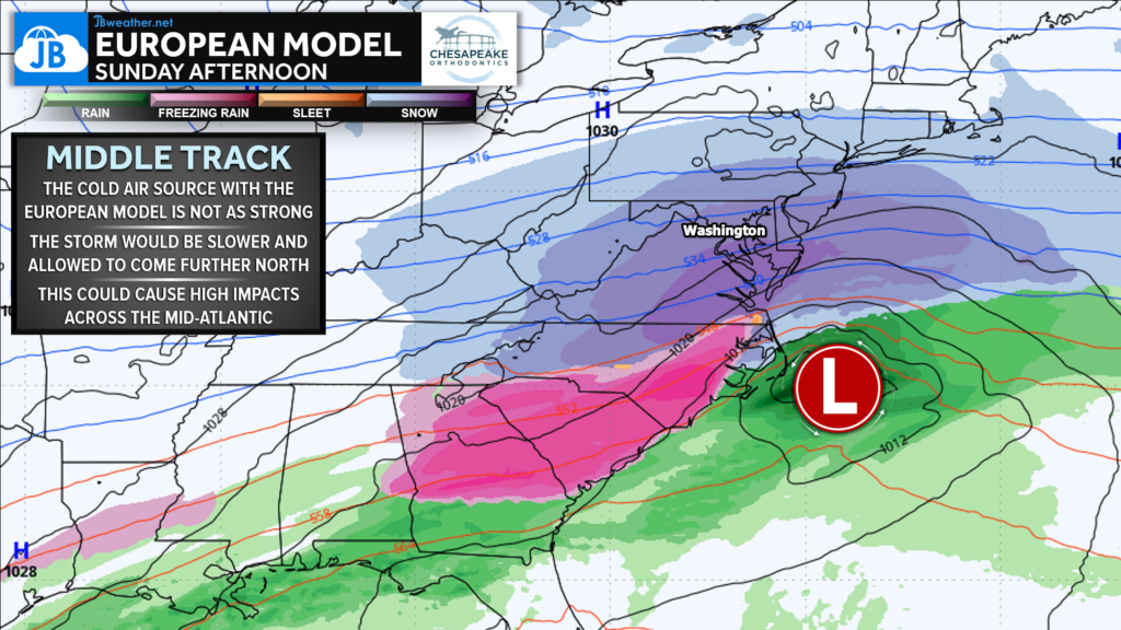
The European model presents a middle-ground solution, with cold air present but not overpowering. This allows the storm to move north more slowly and could place the Mid-Atlantic in a favorable zone for wintry precipitation, with sharp gradients between snow, mix, and rain across the Southeast
Option 3: Southern Track
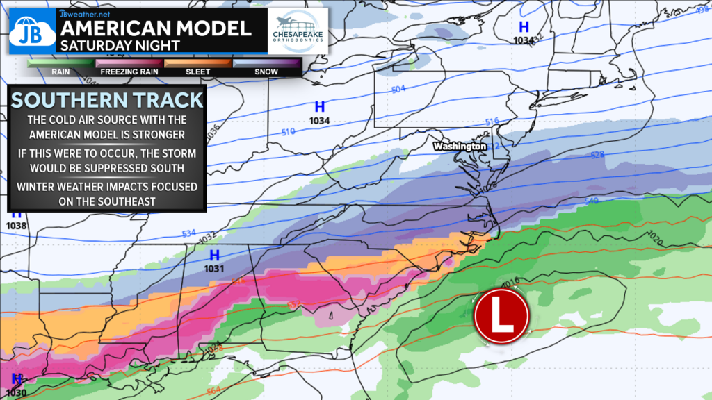
The American model features the strongest high pressure to the north, which would act to suppress the storm farther south. If this solution verifies, the most significant winter weather would remain focused across the Southeast, with limited impacts locally.
Bottom Line
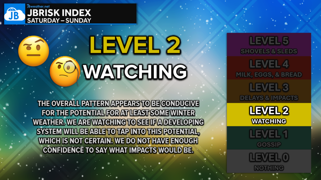
This system remains highly track-dependent, and it is far too early to pin down timing, track, or amounts. While there is strong agreement that a storm will exist, the exact placement is still very much in question. One concern is that high pressure to the north may be too strong, but similar setups have trended north late in the forecast cycle, so all options remain on the table. We’ll continue to monitor trends closely as confidence improves.
Stay with JB Weather for the latest information on impacts here in Southern Maryland and across the Mid-Atlantic. You can always access my forecasts and updates here on the website, on Facebook, on Twitter, on Instagram, and on YouTube. JB Weather is the Mid-Atlantic’s Weather Leader, and I am working around the clock to keep you ahead of any storm!
Dr. Thomas Hao and Dr. Dylan Schneider offer comprehensive orthodontic services for all ages. Schedule your free consultation today. Visit www.SOMDBraces.com today for more information!
John Bordash
View More PostsJB Weather forecaster John Bordash is working around the clock to provide Southern Maryland, and neighboring communities, with accurate and reliable weather information.
2 thoughts on “Weather to Watch: Winter Storm Potential This Weekend”
Comments are closed.
Thank you
Thanks JB!