Brought to you by Sonder Studios
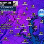
Yesterday’s winter storm delivered widespread snow and ice impacts across the region, and while the system has moved out, its effects are far from over. Cold air is pouring back in behind the storm, and gusty northwest winds are setting the stage for a bitter and hazardous start to the week. Today will be quiet weather-wise, but dangerous conditions remain.
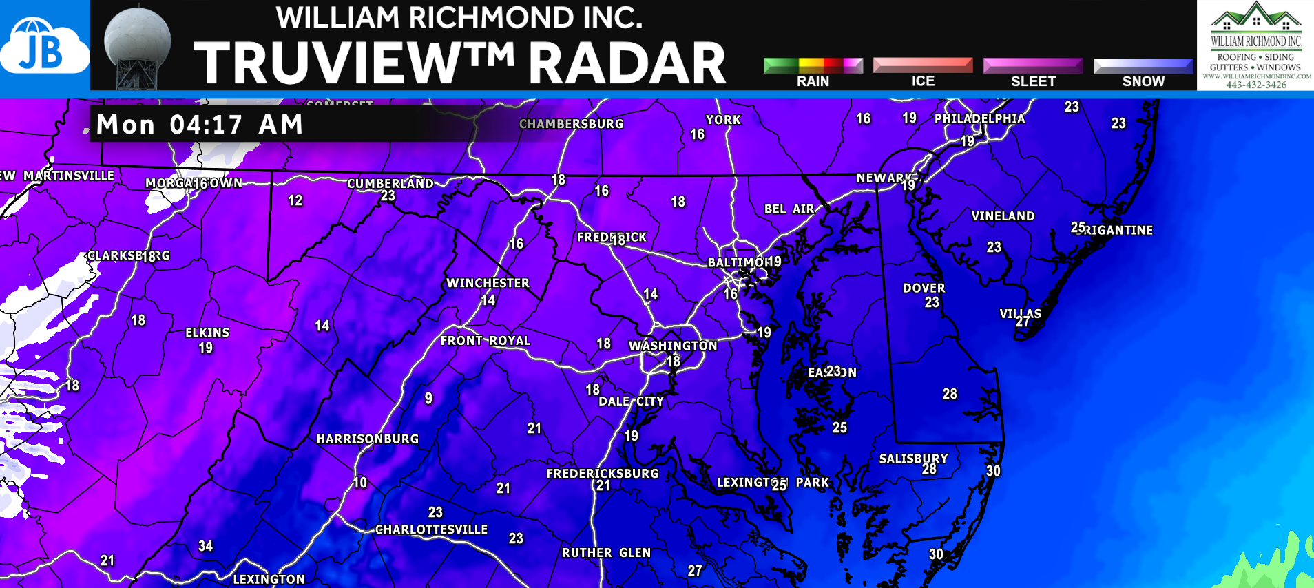
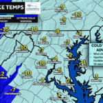
Early this morning, temperatures are sitting in the teens for many areas, with the coldest readings found where snow and ice totals were highest yesterday. While radar is largely quiet now, leftover moisture combined with falling temperatures has led to widespread black ice, especially on untreated roads, sidewalks, and parking lots. With schools closed across much of the region, anyone who must travel this morning should take it slow and use extreme caution.
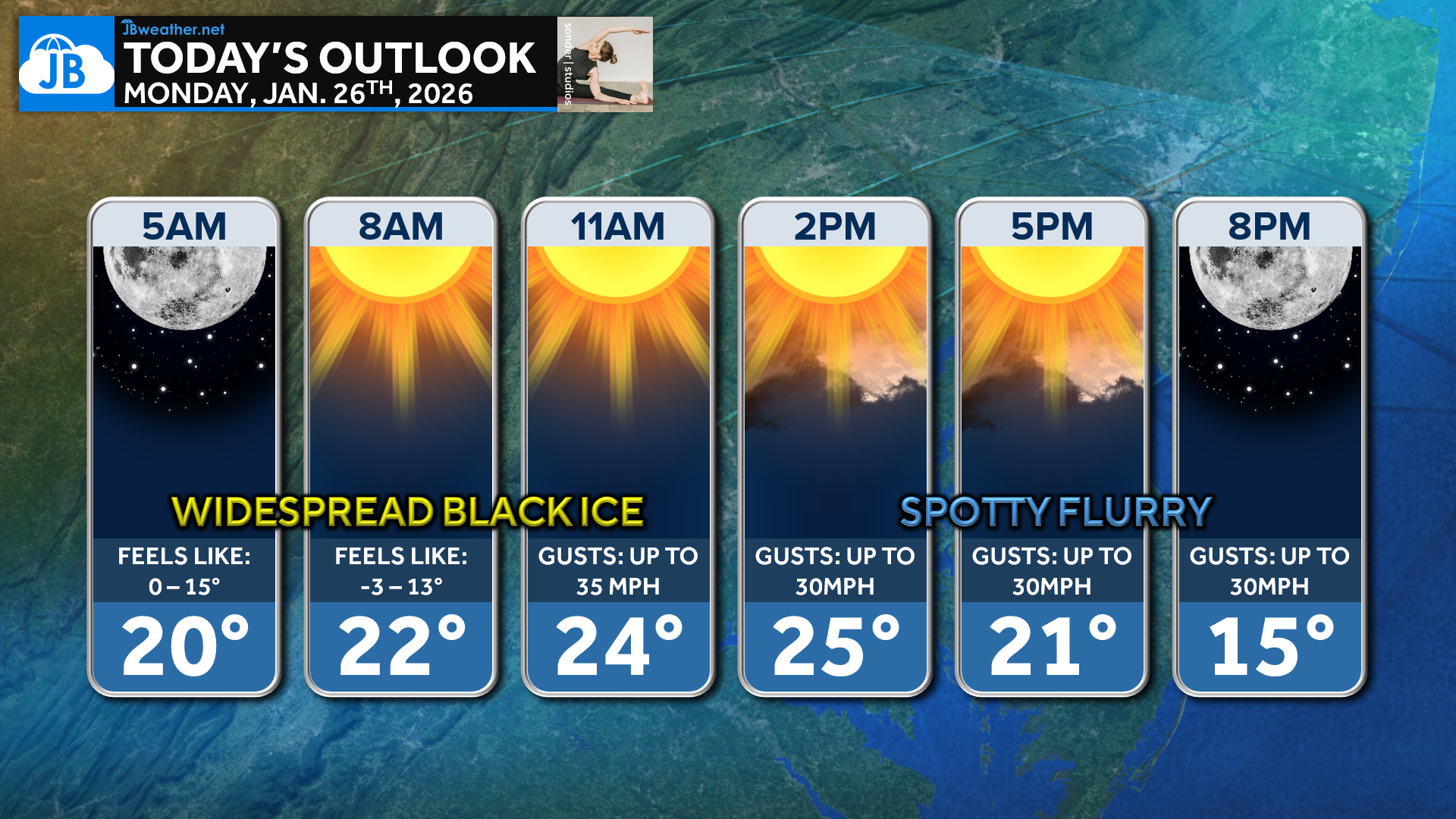
Skies will turn mostly sunny as we move through the day, but don’t let the sunshine fool you—it will do little to warm things up. High temperatures will struggle to reach the low to mid-20s, and brisk northwest winds will make it feel much colder. Wind chills will remain in the teens or even single digits at times, keeping conditions firmly locked in winter mode.
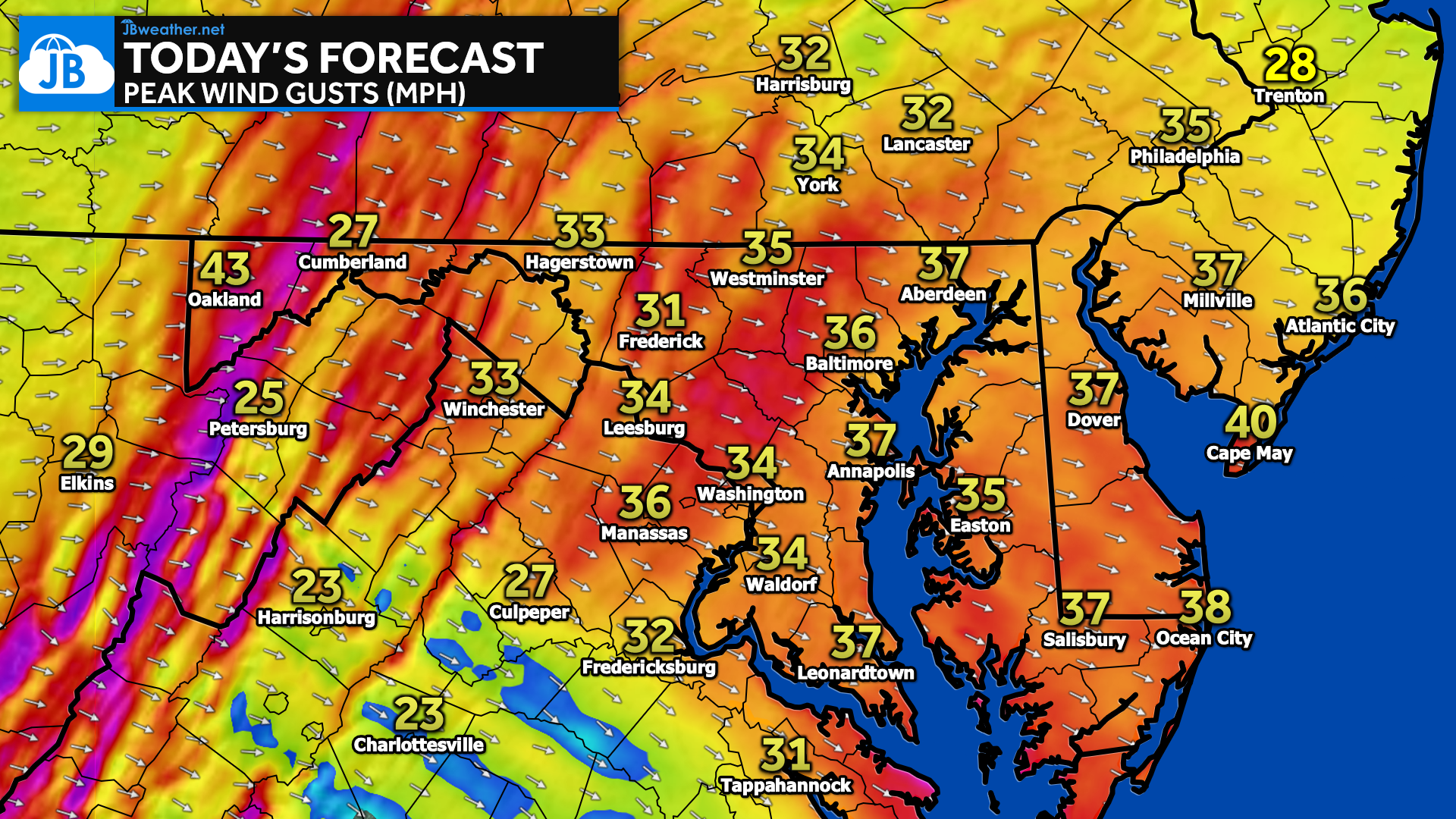
Northwest winds will be a big story today, with gusts frequently reaching 30–35 mph and locally higher in exposed areas. These winds will not only amplify the cold but could also lead to scattered power outages, especially where ice remains on trees and power lines from yesterday’s storm. Loose outdoor items should be secured, and crews may be dealing with lingering storm-related issues throughout the day.
Bottom Line
The combination of ice, cold, and wind makes today more about impacts than precipitation. Black ice will remain a concern not just this morning, but again over the next several mornings as refreezing continues. A spotty flurry cannot be ruled out tonight, but no accumulation is expected. Temperatures plunge back toward 0° or below overnight, sending us straight back into the arctic freezer.
Stay with JB Weather for the latest information on impacts here in Southern Maryland and across the Mid-Atlantic. You can always access my forecasts and updates here on the website, on Facebook, on Twitter, on Instagram, and on YouTube. JB Weather is the Mid-Atlantic’s Weather Leader, and I am working around the clock to keep you ahead of any storm!

SONDER STUDIOS® is home to Yoga, Pilates, Barre, and Strength classes in Calvert County. Wellness is our business, and belonging is at the heart of our culture. We are grateful for your trust for 6+ years. Sign up for an intro week at www.sonderstudios.us
John Bordash
View More PostsJB Weather forecaster John Bordash is working around the clock to provide Southern Maryland, and neighboring communities, with accurate and reliable weather information.