We remain on track to see a storm develop this weekend and rapidly strengthen off the East Coast. The overall setup has not changed, and confidence remains high that a coastal storm will form. What we are still sorting out is how close to the coast it tracks, which will determine where the heaviest snow falls and who sees more limited impacts.
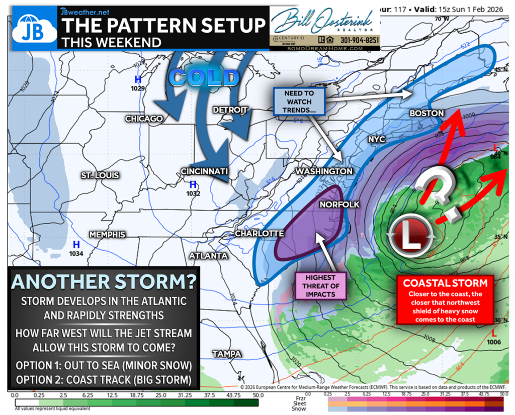
Right now, most guidance favors the scenario that keeps the storm a bit farther offshore, focusing heavy snow across the Carolinas and southern Virginia, while impacts decrease quickly north of there as the storm gets pushed out to sea. That said, we are still watching areas along and east of I-95, where some snow impacts remain possible. These types of storms are well known for last-minute northwest shifts, and even a small adjustment would expand snow farther north.
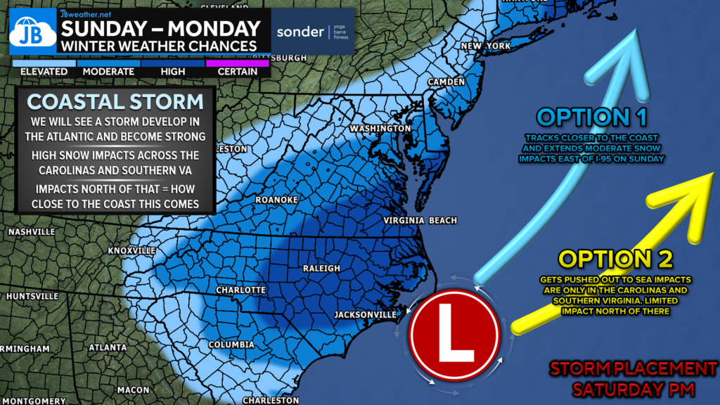
Locally, this setup could bring steady snow late Saturday into early Sunday, with a couple of inches possible, especially in St. Mary’s County. Snow amounts would increase moving south and east, with lower Delmarva seeing more, and parts of the Carolinas potentially picking up half a foot or more. This is not shaping up to be a widespread East Coast blizzard, but it is a system that could still surprise some areas — which is why we’ll continue to watch it closely and fine-tune the forecast.
Stay with JB Weather for the latest information on impacts here in Southern Maryland and across the Mid-Atlantic. You can always access my forecasts and updates here on the website, on Facebook, on Twitter, on Instagram, and on YouTube. JB Weather is the Mid-Atlantic’s Weather Leader, and I am working around the clock to keep you ahead of any storm!

SONDER STUDIOS® is home to Yoga, Pilates, Barre, and Strength classes in Calvert County. Wellness is our business, and belonging is at the heart of our culture. We are grateful for your trust for 6+ years. Sign up for an intro week at www.sonderstudios.us
John Bordash
View More PostsJB Weather forecaster John Bordash is working around the clock to provide Southern Maryland, and neighboring communities, with accurate and reliable weather information.

