Brought to you by Bill Oosterink, Realtor
Arctic air remains firmly in place today, keeping conditions bitterly cold and uncomfortable across the region.
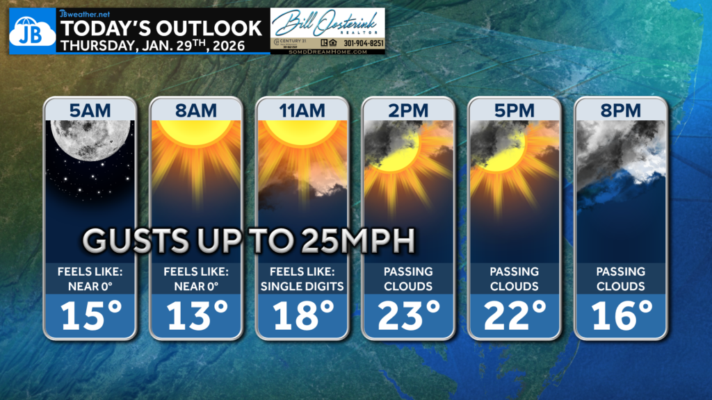
Temperatures start the morning in the teens with wind chills near zero, and gusty winds up to 25 mph will keep it feeling brutally cold all day. After some early sunshine, passing clouds move through this afternoon, but highs will struggle to climb out of the low 20s. Wind chills remain in the single digits to teens for much of the day, so bundle up if you’re heading out.
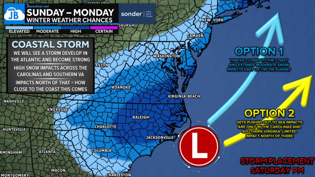
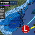
We are continuing to monitor a potential coastal storm expected to develop over the weekend. The overall pattern remains favorable for storm development, with cold air firmly in place and atmospheric blocking slowing systems along the East Coast. At this time, the biggest question is how close the storm tracks to the coast, which will determine who sees meaningful impacts. While this is not a locked-in scenario, the setup is one that historically deserves close attention. Confidence will increase as we move closer, and updates will continue as trends become clearer.
Stay with JB Weather for the latest information on impacts here in Southern Maryland and across the Mid-Atlantic. You can always access my forecasts and updates here on the website, on Facebook, on Twitter, on Instagram, and on YouTube. JB Weather is the Mid-Atlantic’s Weather Leader, and I am working around the clock to keep you ahead of any storm!
Buying. Selling. Investing. Ready when you’re ready! Check out www.somdDreamHome.com today!
John Bordash
View More PostsJB Weather forecaster John Bordash is working around the clock to provide Southern Maryland, and neighboring communities, with accurate and reliable weather information.