Brought to you by Cedar Point Federal Credit Union
Our region is still feeling the effects of last weekend’s winter storm and the lingering cold. However, I’m monitoring our next snow threat!
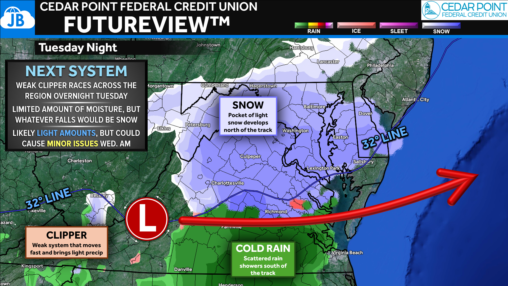
I’m keeping an eye on a weak clipper system that looks to race across the region late Tuesday night into early Wednesday morning. This will not be a strong or moisture-rich system. However, current guidance suggests it may dig far enough south to bring a period of light snow to much of the area. With limited moisture available, any precipitation that falls would be snow, and ice is not a concern with this setup.
The main forecast question at this stage is the track. A subtle shift north or south will determine where the highest snow chances set up and how far the 32° line pushes south. Even so, this is shaping up as a low-impact event, with snowfall generally capped at an inch or two, at most.
While totals will be light, even a coating to an inch could be enough to create minor travel issues, especially for the Wednesday morning commute. This is something worth monitoring over the next couple of days as confidence in placement improves.
Stay with JB Weather for the latest information on impacts here in Southern Maryland and across the Mid-Atlantic. You can always access my forecasts and updates here on the website, on Facebook, on Twitter, on Instagram, and on YouTube. JB Weather is the Mid-Atlantic’s Weather Leader, and I am working around the clock to keep you ahead of any storm!
Cedar Point has been providing trusted banking, lending and personal finance solutions to the Southern Maryland Community since 1945. Visit the credit union at any of its 6 locations in St. Mary’s, Charles and Calvert counties or online at www.cpfcu.com.
John Bordash
View More PostsJB Weather forecaster John Bordash is working around the clock to provide Southern Maryland, and neighboring communities, with accurate and reliable weather information.


1 thought on “Early Look: Light Snow Possible Late Tuesday Night”
Comments are closed.
Thanks JB for keeping us updated here in Southern Maryland.