After a wet and gloomy Memorial Day weekend, we’re finally beginning to turn the page a bit Wednesday… but not before one more round of active weather moves through the region. As a final piece of upper-level energy swings overhead, scattered thunderstorms are expected to develop during the afternoon and evening in a warm and humid air mass. While the rain has certainly helped chip away at our severe to extreme drought conditions, a few storms tomorrow could become strong to locally severe.
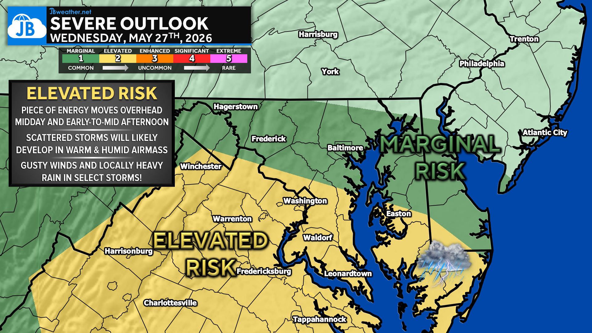
The greatest severe weather threat on Wednesday looks to set up across southern portions of the region, including DC, southern Maryland, and parts of central Virginia, where an Elevated Risk (Level 2 out of 5) is in place. Areas farther north, including much of central Maryland and southern Pennsylvania, remain under a Marginal Risk. Scattered storms are expected to develop as a cold front pushes southward, and some storms could produce damaging wind gusts of 55-60mph along with torrential downpours. While widespread severe weather is not expected, a few stronger storms could quickly become impactful during the afternoon and evening hours.
Timing-wise, storms may begin developing as early as late morning west of the mountains before becoming more scattered and widespread during the mid-to-late afternoon. Futureview guidance shows the greatest coverage likely between about 1 PM and 7 PM as clusters of storms track southeastward through the region. Not everyone will see a storm, but any storm that develops could produce brief heavy rain, gusty winds, and frequent lightning before moving through fairly quickly.
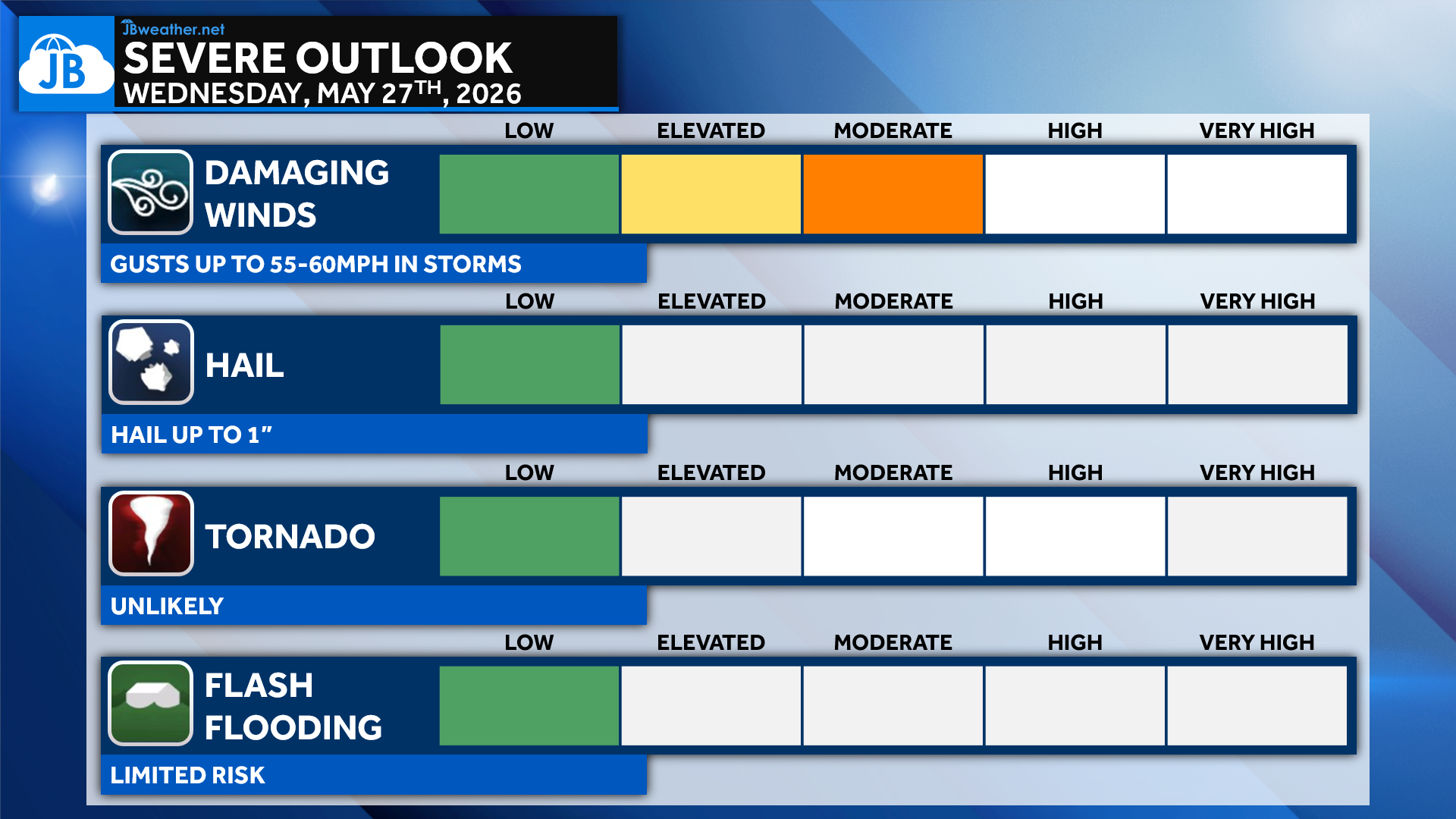
Overall, damaging winds remain the primary concern tomorrow, especially in the stronger storm cells that can organize during the afternoon. Large hail and isolated flooding are secondary threats, while the tornado risk currently appears very low. Given the recent stretch of wet weather and saturated ground in some areas, even isolated stronger wind gusts could still bring down a few trees or power lines.
Stay with JB Weather for the latest information on impacts here in Southern Maryland and across the Mid-Atlantic. You can always access my forecasts and updates here on the website, on Facebook, on Twitter, on Instagram, and on YouTube. JB Weather is the Mid-Atlantic’s Weather Leader, and I am working around the clock to keep you ahead of any storm!

John Bordash
View More PostsJB Weather forecaster John Bordash is working around the clock to provide Southern Maryland, and neighboring communities, with accurate and reliable weather information.