Brought to you by Professional Communication Training
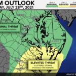
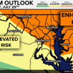
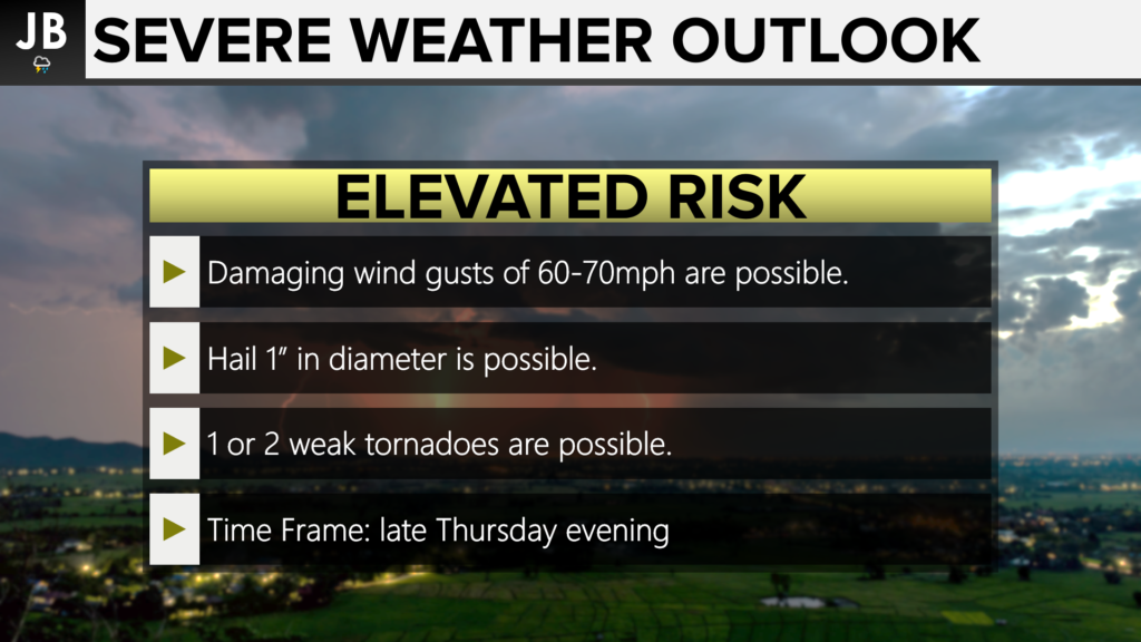
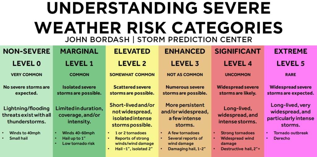
After a hot and humid week, cooler air will look to push into our region late this week, and stick around through the weekend and into early next week. However, we may see that cooler air come at a cost! Thunderstorms are possible tomorrow evening as a cold front moves through the region. Much of the region has been placed under an Elevated Risk of seeing severe thunderstorms tomorrow evening. The primary risk for our region will likely be damaging winds with our secondary risks being large hail and one or two weak tornadoes.
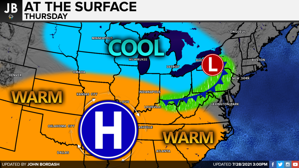
A ridge of high pressure has been in control of the weather across a large portion of the country. It’s this ridge that has brought heat and humidity to our region. Tomorrow, we will be on the edge of this ridge as a frontal system works its way southeast from the Great Lakes. This is the same system that is responsible for the severe weather threat across the Great Lakes. The derecho that may impact that region will likely die off before it reaches our area.
As the cold front drops southward, it will bring not just cooler air behind it, but that threat of severe storms as well. We should be able to warm up nicely tomorrow across the region with ample humidity around. That combination of heat and humidity will help to prime the atmosphere for some storm development late Thursday afternoon and evening. The incoming cold front from our northwest will act as the trigger for these potential storms.
Severe weather is not a guarantee tomorrow. Prefrontal showers are possible tomorrow morning, which could limit how warm and humid we get (which in turn would lower our thunderstorm fuel). It is also possible that the majority of any thunderstorm development is focused to our north. However, if we can clear out our morning showers, warm up nicely, and can get that cold front to move through at a decent pace the threat for scattered thunderstorms would be high. If all three of these things occur, we could see some impactful severe weather between 2-11PM tomorrow.
With all of that said, Our Chesapeake’s Bounty Futurecast has not been nearly as bullish on tomorrow’s storm threat, which is shown below.
Tomorrow has the potential to be an active day in the weather department. An incoming cold front will look to deliver some relief to our region, but not without a threat of storms tomorrow afternoon and evening. Morning showers, a lack of heat, and a weakening of the cold front could limit our risk, or keep the risk to our north across PA and NJ. It is not a guarantee that we will see storms tomorrow. However, with decent daytime heating and a strong cold front, we could see some scattered severe storms. The potential is certainly there for an impactful weather day, and we will need to wait and see how all of this could play out.
Keep in mind that severe weather forecasting is far from a guarantee of anything. The goal of these forecasts is to alert you to the potential of storms, not a promise of storms. Stay with JB Weather for the latest information on impacts here in Southern Maryland. You can always access my forecasts and updates here on the website, on Facebook, on Twitter, and on YouTube. JB Weather is Southern Maryland’s Weather Leader, and I am working around the clock to keep you ahead of any storm!
-JB

The mission at Professional Communication Training (PCT) is to help people work together to work better. Business communication is a complicated, multi-layered system. PCT works with companies to create customized, soft-skill training sessions to be held, in-person or virtually. Each interactive session provides a blend of discussion and practical application of tools. People work best when they feel connected to each other and the project. I can help establish and maintain that connectedness. We also offer professional writing and editing services and classes. Contact Nikki Phillips at [email protected]
John Bordash
View More PostsJB Weather forecaster John Bordash is working around the clock to provide Southern Maryland, and neighboring communities, with accurate and reliable weather information.