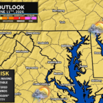
The Storm Prediction Center has issued a Severe Thunderstorm Watch for much of the Mid-Atlantic, including the Washington D.C. and Baltimore metro areas, northern and western Maryland, portions of central Pennsylvania, northern Virginia, and eastern West Virginia. The watch remains in effect until 10:00 PM Thursday evening.
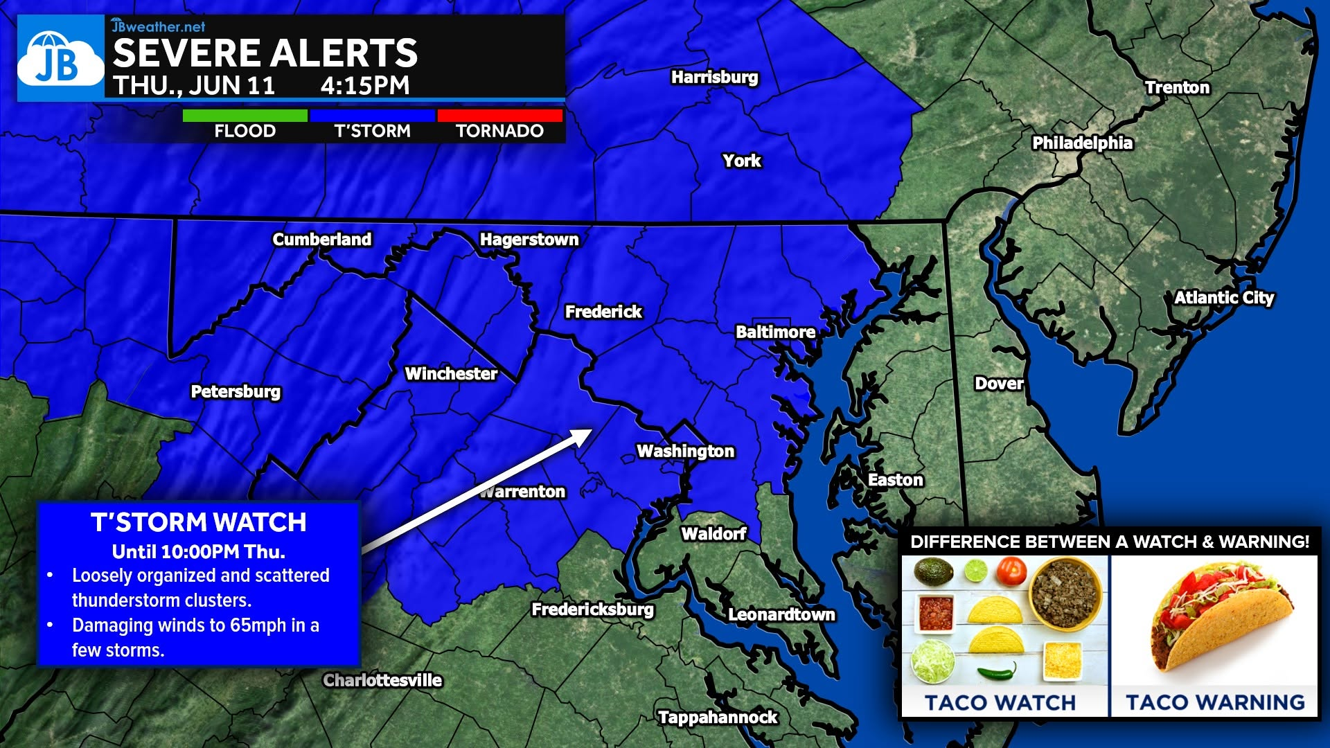
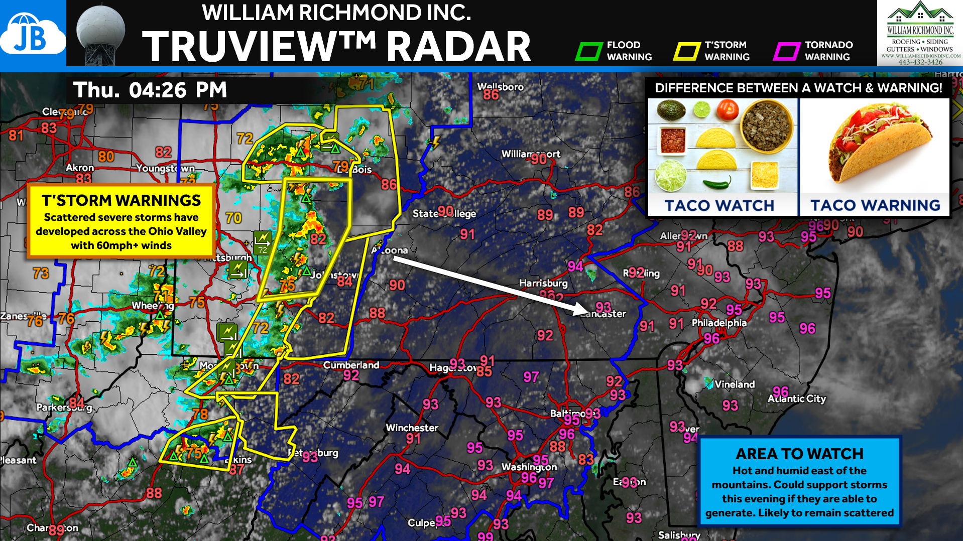
This watch was issued as several loosely organized clusters of thunderstorms continue to develop and move eastward across the region. While storms may remain somewhat scattered, the atmosphere remains unstable enough to support strong to severe thunderstorms capable of producing damaging wind gusts up to 60-65 mph. Not every community will experience severe weather, but any storm that intensifies could quickly produce strong winds capable of downing tree limbs, causing isolated power outages, and creating hazardous travel conditions.
Why Was the Watch Issued?
Unlike major severe weather outbreaks that are driven by a strong cold front, today’s setup is being fueled by extreme heat, humidity, and several subtle disturbances moving through the atmosphere. These smaller-scale boundaries can act as triggers for thunderstorm development, allowing storms to rapidly strengthen during the late afternoon and evening hours.
The Storm Prediction Center notes that thunderstorm clusters should continue spreading eastward through the evening, maintaining a risk for scattered damaging winds across the watch area.
Main Threats
🌬️ Damaging Wind Gusts: The primary concern this evening. Wind gusts of 60-65 mph are possible in the strongest storms. Isolated tree damage and scattered power outages could occur.
⚡ Frequent Lightning: Any thunderstorm will produce dangerous cloud-to-ground lightning.
🌧️ Localized Heavy Rain: Brief downpours may reduce visibility and create ponding on roadways.
🌪️ Low Tornado Risk: While not the primary threat, severe thunderstorms can occasionally produce a brief tornado. Residents should remain alert for any warnings issued later this evening.
Watch vs. Warning
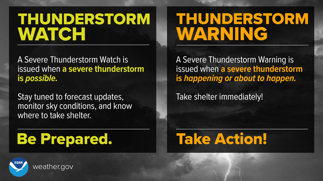
A Severe Thunderstorm Watch means conditions are favorable for severe thunderstorms to develop. A Severe Thunderstorm Warning means a severe storm is occurring or imminent and immediate action should be taken. Think of it this way:
🌮 Taco Watch = Ingredients are on the counter and tacos are possible.
🌮 Taco Warning = The taco has arrived.
Timing
⏰ Now through 10 PM
The greatest threat will likely occur during the late afternoon and evening as thunderstorms move from west to east across the region. Some areas may remain completely dry, while others could experience a quick burst of severe weather.
Bottom Line
The severe weather threat this evening remains focused on scattered damaging wind gusts up to 65 mph. While storms are not expected to be widespread, any thunderstorm that develops or moves through your area could become severe with little warning. Make sure you have a way to receive weather alerts this evening and be prepared to move indoors if a warning is issued.
Stay with JB Weather for the latest information on impacts here in Southern Maryland and across the Mid-Atlantic. You can always access my forecasts and updates here on the website, on Facebook, on Twitter, on Instagram, and on YouTube. JB Weather is the Mid-Atlantic’s Weather Leader, and I am working around the clock to keep you ahead of any storm!
John Bordash
View More PostsJB Weather forecaster John Bordash is working around the clock to provide Southern Maryland, and neighboring communities, with accurate and reliable weather information.