We have an active weather day on tap! The Storm Prediction Center has placed much of our area under a Level 2 “Elevated Risk” of seeing strong to severe thunderstorms this afternoon and evening. This threat highlights the higher than normal risk of damaging winds, flash flooding, and even a few brief tornadoes.
Keep in mind that severe weather forecasting is far from a guarantee of anything. The goal of these forecasts is to alert you to the potential of storms, not a promise of storms.
This threat comes as a cold front looks to move through our region today. This incoming cold front will look to bring a few rounds of heavy rain and severe storms to the region throughout the afternoon and evening. Moderate to high impacts will be possible across the Mid-Atlantic today, as a result.
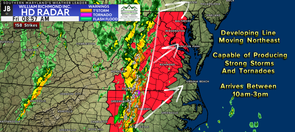
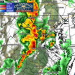
Currently, there is a developing line of storms back out in southwestern Virginia. This developing line of storms will become the first of potentially two or three rounds of severe weather today. This line has already prompted multiple tornado warnings and severe thunderstorm warnings across Virginia.
Our latest run of Futurecast is doing a great job of depicting today’s severe weather risk. Futurecast shows the initial round of storms pushing through between 10am-3pm. This initial line will likely have the highest severe weather potential. This is because they will have the most amount of storm energy and atmospheric shear to tap into. This means that heavy rain, damaging winds, and even a brief spin-up tornado or two will be possible.
With that said, this model is starting to hone in on the second round of storms this evening, between 6pm-12am, being as severe as the first one. This would mean an extended severe weather & spinup tornado risk. This potential would be dependent on us seeing some afternoon sunshine after the first round. At this point, it’s all a wait-and-see game. You will need to stay weather aware all day!
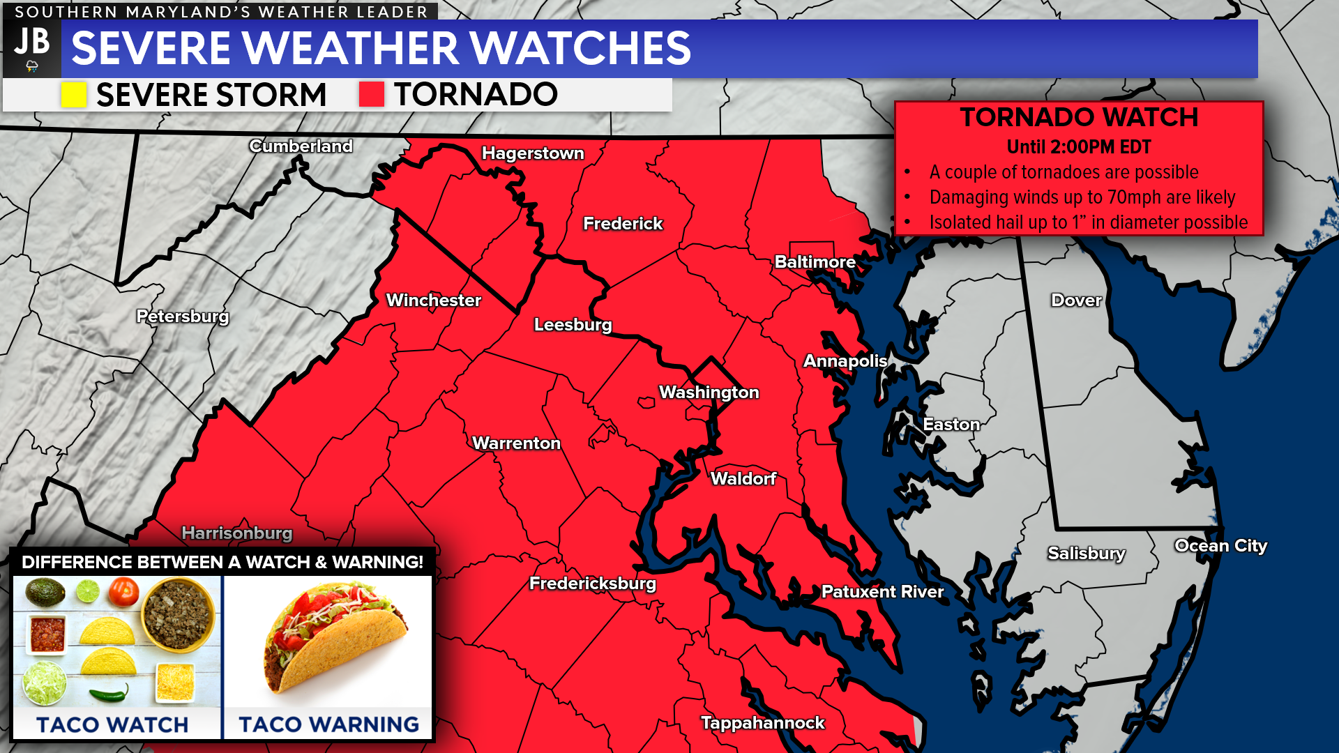
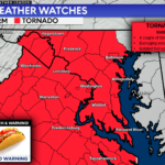
The Storm Prediction Center has already placed much of our region under a TORNADO WATCH until 2PM. Again, this tornado threat is the greatest as the first round of storms works through. While not everyone will see a tornado this afternoon, there could be a couple of brief spin-ups across the region that we will need to watch out for.
You can get more details on this Tornado Watch, here: https://jbweather.net/breaking-tornado-watch-issued-until-2pm/

Remember, a Tornado WATCH just means conditions are favorable for tornadoes and severe thunderstorms to develop, nothing is occurring right now. People in the watch area should be on the lookout for threatening weather conditions and listen for later statements and possible warnings if severe weather or tornadoes are imminent.
SUMMARY: Today has the potential to be a high-impact weather day. Multiple lines of storms will look to move through our region. These lines will have the ability to have embedded storms that could try to rotate. These storms could also bring heavy rain and damaging winds. The heightened severe weather threat is really focused on our region, so we will need to pay especially careful attention throughout the day.
Have a game plan of what you will do if your area gets placed under a Severe Thunderstorm or Tornado Warning. Consider these questions:
- What alternate routes home can you take?
- What schedule alterations can you make?
- Where will you go if a dangerous storm is overhead?
- What items will you bring with you if you are in a weather emergencysituation?
- Where is the closest substantial shelter near your home, school, or work?
- What ways will you be able to get weather updates? (We know the answer is JB Weather!)
- If you have to seek higher ground, where will you go?
I do not say all of this to worry you! But it is important to start thinking about the answers to these questions so you can act in a high-stress and high-impact weather situation.
If you cannot access social media throughout the day, you can always get live JB Weather radar, futurecast, and live weathercasts at the links below! It will be important to have these links handy if alerts get issued and you need the latest information!
JB Weather Radar/Futurecast: https://jbweather.net/radar/
JB Weather LIVE updates: https://jbweather.net/live/
Stay with JB Weather for the latest information on impacts here in Southern Maryland. You can always access my forecasts and updates here on the website, on Facebook, on Twitter, on Instagram, and on YouTube. JB Weather is Southern Maryland’s Weather Leader, and I am working around the clock to keep you ahead of the storm!
-JB
John Bordash
View More PostsJB Weather forecaster John Bordash is working around the clock to provide Southern Maryland, and neighboring communities, with accurate and reliable weather information.