Brought to you by SouthernMaryland SportsCards
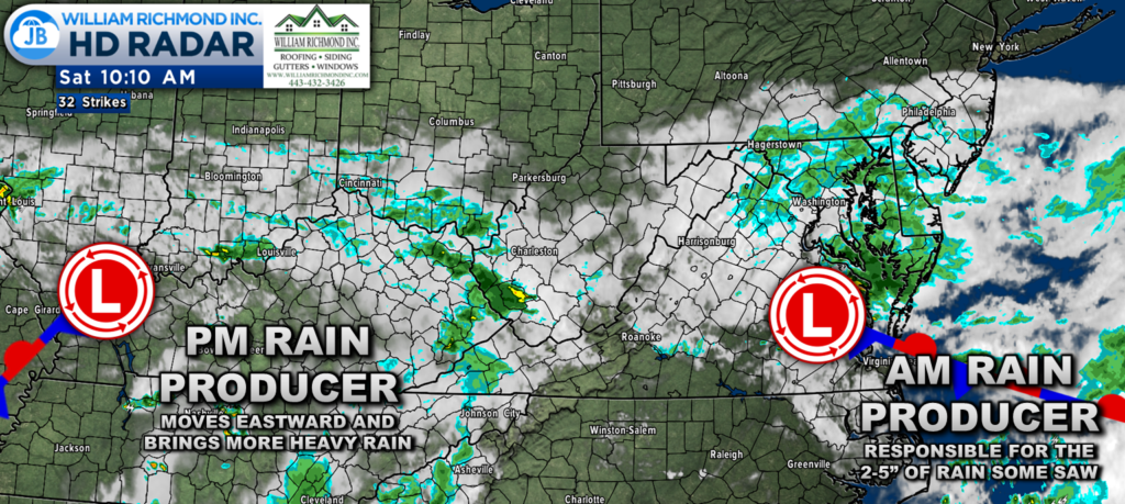
Areas of heavy rain developed overnight and pushed through parts of Southern Maryland this morning. This heavy rain led to widespread flooding issues across St. Mary’s, Charles, Anne Arundel, and Westmoreland Counties. The rain from this morning is beginning to push out as the first area of low pressure pushes out to the east. However, another low pressure to our west will bring more rain this afternoon.
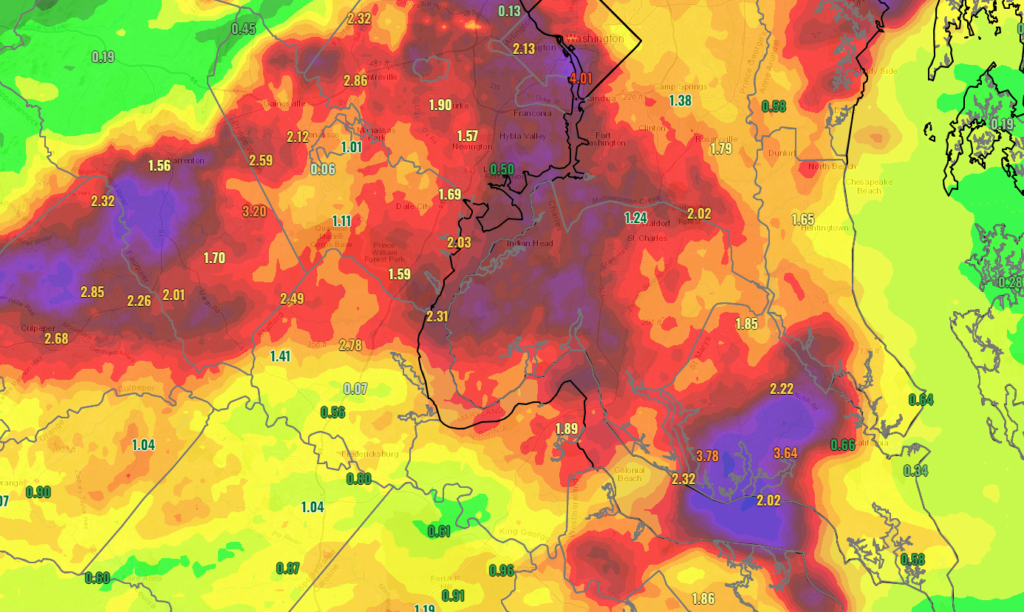
Many areas saw at least an inch of rain over the last 12-18 hours. However, several bullseyes saw even more than that. Central parts of St. Mary’s County, around Leonardtown, Loveville, Chaptico, and Avenue, picked up between 3-5″ this morning. This heavy rain led to high impacts and numerous road closures.
Northwestern Charles, western PG, and DC also saw heavy rain last night. These zones recorded 2-4″ of rian, promptiong several flash flood warnings. Central Anne Arundel County, from Harwood to Annapolis, saw heavy rain, leading to 2-4″ of rain falling in that region and prompting several water rescues.
Our Futurecast shows that we will see intermittent rain showers continue off and on until tomorrow morning, and we should begin to dry out. With that said, we could see another round of heavy rain move through parts of the region this afternoon and evening, between 2pm and 11pm, as that secondary area of low pressure works through.
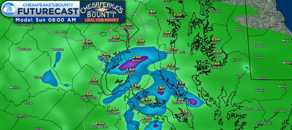
Futurecast suggests that some regions could see an additional 1-2″+ of rain over the next 12-24 hours. The exact placement of these locally higher rain amounts is hard to forecast, so take their placement on the model with a grain of salt. The message to take away from this is that more heavy rain will likely be focused east of I-95 this afternoon.
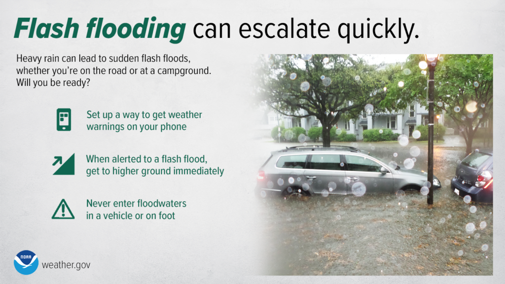
After this morning’s deluge of rain, additional amounts of rain, especially this high, could cause some serious flooding issues. It will be essential to stay weather aware this afternoon and evening as flooding issues will likely continue to impact our region. Have a way to get weather warnings and updates and not drive through flooded roadways.
You can stay up to date on the latest information that I am publishing by staying tuned to the new live blog I have turned on for this event.
Stay with JB Weather for the latest information on Southern Maryland weather. I will be with you all throughout the day to cover this impactful system. You can always access my forecasts and updates here on the website, on Facebook, on Twitter, on Instagram, and on YouTube.
-JB

Southern Maryland born and raised, Matt buys sports card collections for cash. Connect with him on Facebook, email at [email protected], or meet him at the Southern MD Sports Card Show, before and during the Southern MD Blue Crabs game, on August 20th! Check out
https://www.facebook.com/southernmarylandsportscards
