Brought to you by Dugan, McKissick, Longmore LLC
After a wet couple of days, much of our region has been allowed to dry out some today. However, this reprieve from the rain will likely not last long. With a frontal boundary hanging around our region, we are likely to see areas of rain develop late Sunday night and into the day on Monday. Localized heavy rain is likely as well.
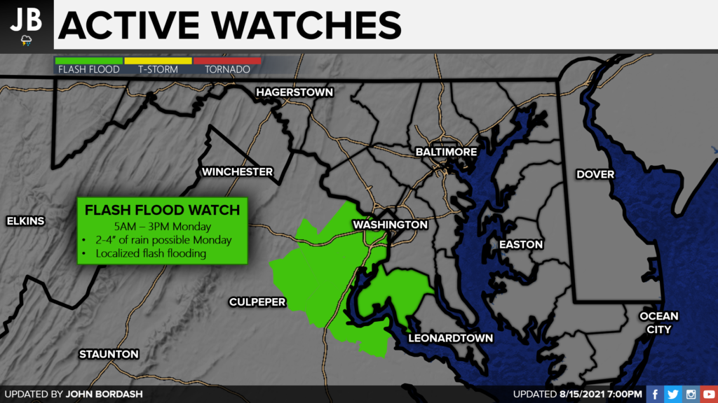
With this in mind, the National Weather Service has already issued a Flash Flood Watch for Charles (MD) and King George (VA) Counties, along with a few counties in northern Virginia. This will be the area that the heaviest rain may fall on Monday, but all areas will have the threat of rain. Any additional rain on top of what we recieved Saturday night could cause flooding issues. I would not be surprised to see this Flash Flood Watch get expanded to include more counties, but only time will tell.
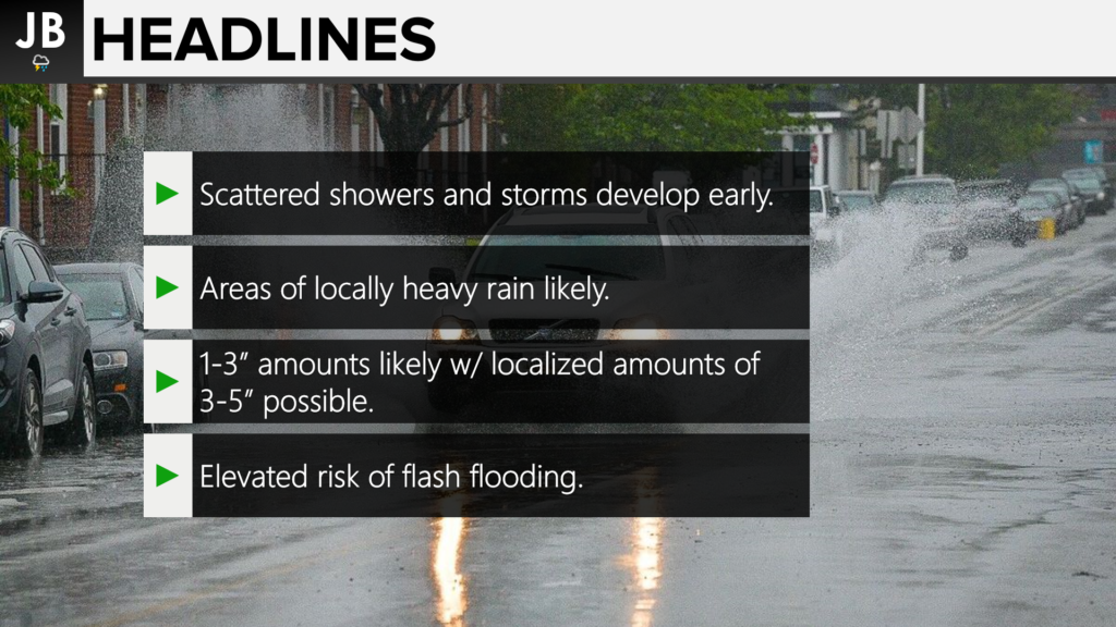
As a frontal boundary drifts back north, we will see rain showers begin to break out overnight. It looks possible that areas of heavy rain may greet you as you head out of the door tomorrow morning. Rain coverage will likely increase throughout the morning with the addition of daytime heating. We are likely to see a few areas of heavy rain that develop, which may not move fast. These could drop a lot of rain. We should begin to see the rain lessen up as head towards the evening and overnight hours. Our Chesapeake’s Bounty Futurecast plays this out really well, below.
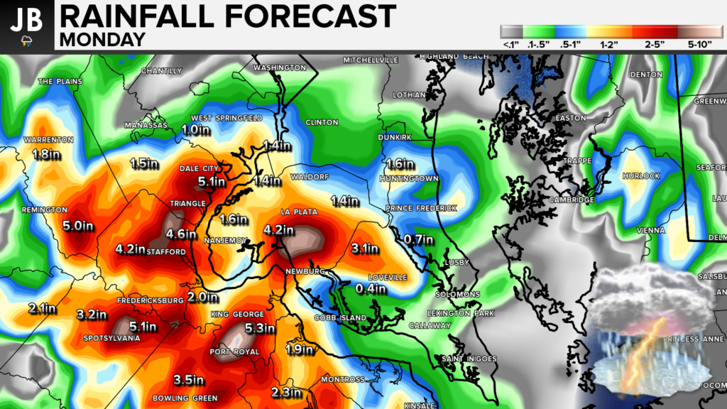
How much rain could we be talking about? Well, down below is the rainfall forecast output from our Futurecast model. This model focuses the heaviest rain along the Potomac River with potential totals getting between 2-4″. Outside of that, lesser amounts, but still rather high, of 1-2″ could be possible. This could all fall rather fast, which could lead to flooding issues. These issues could affect both the morning and evening commutes.
All-in-all a wet day seems likely as we kick off the work week. While the heaviest rains may focus along the Potomac River tomorrow, we could see widespread flooding issues. We will likely see rain kick off late tonight and go throughout the day. Monday morning into mid-afternoon may offer some of the heaviest rains.
It will be important to stay weather aware tomorrow. Stay with JB Weather for the latest information on Southern Maryland weather. You can always access my forecasts and updates here on the website, on Facebook, on Twitter, and on YouTube.
-JB

Dugan, McKissick & Longmore, LLC has served our Southern Maryland community for over 25 years. Our trusted attorneys are here to handle your unique case from beginning to end. To schedule an appointment, call us today at 301-862-3764 or visit our website at www.paxlawyers.com.
John Bordash
View More PostsJB Weather forecaster John Bordash is working around the clock to provide Southern Maryland, and neighboring communities, with accurate and reliable weather information.