Hurricane Melissa has explosively intensified into a Category 5 hurricane this morning, now producing sustained winds of 160 mph with an extremely low pressure of 917 mb.
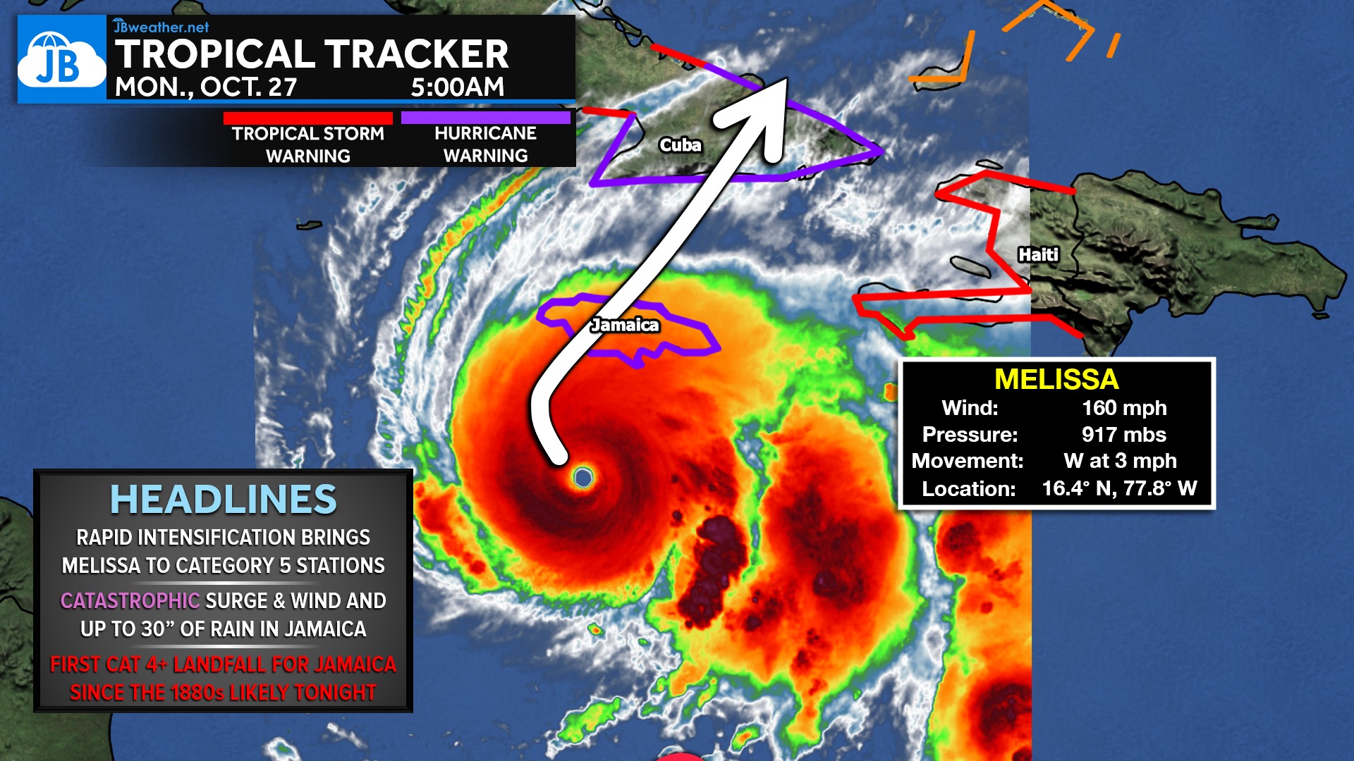
Melissa continues to strengthen as she crawls west-northwest, and the storm is now on track to make landfall in Jamaica tonight into early Tuesday. This will be a catastrophic event for the island, with life-threatening storm surge, destructive winds, and up to 30 inches of rainfall capable of causing widespread flooding and landslides.
After impacting Jamaica, Melissa will move toward Cuba and then the Bahamas through early this week. Both regions face the potential for significant to severe impacts as the storm maintains major-hurricane intensity during its trek northward. While Melissa will eventually accelerate into the open Atlantic, her strength and size mean that dangerous coastal conditions may extend well beyond the center.
At this time, there is no direct threat to the mainland United States, as Melissa is still expected to turn sharply north and then northeast into the Atlantic later this week. However, her impacts on Jamaica could be historic—possibly the first Category 4+ landfall on the island since the 1880s—and the situation remains extremely serious. This will be a storm to monitor closely in the days ahead.
John Bordash
View More PostsJB Weather forecaster John Bordash is working around the clock to provide Southern Maryland, and neighboring communities, with accurate and reliable weather information.