Brought to you by G&H Jewelers, Inc.
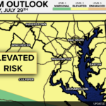
A potentially active weather day looks to be on tap for parts of the Mid-Atlantic. The Storm Prediction Center has issued a Level 3 ENHANCED RISK of severe weather for northeastern parts of Maryland, southern and eastern Pennsylvania, Delaware, and southern New Jersey.
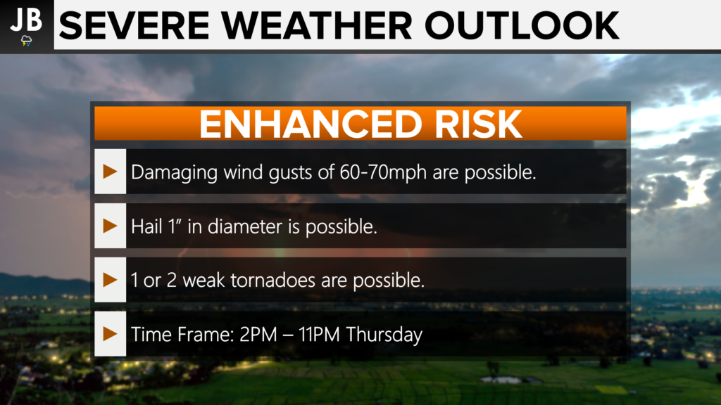
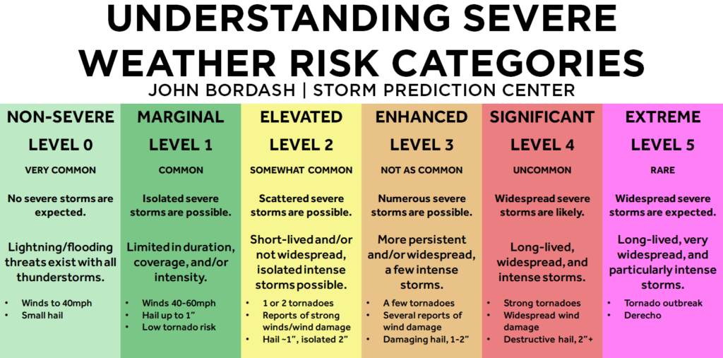
Widespread storms may be hard to come by today, but the storms we do see fire up could be powerful. These storms will have the potential to produce 60-70mph wind gusts, 1-2″ sized hail, and even 1 or 2 weak spin-up tornadoes. Localized flash flooding is certainly possible as well. The timing to watch is 2PM-11PM this evening.
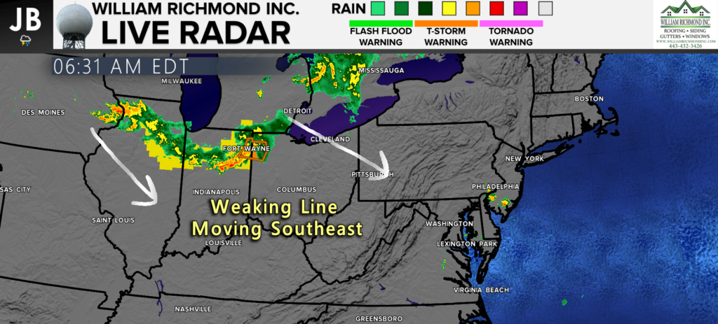
A line of strong storms moved through the Great Lakes overnight bringing 80-90mph wind gusts, a few tornadoes, and large hail. This morning, this line is moving through parts of Illinois, Indiana, and southern Michigan. This line is weakening as it moves southeast, and this may actually look to hinder severe weather chances locally.
Technical Discussion: This paragraph is more of a technical discussion to explain the science behind the forecast. I will try my best to break this down into layman’s terms! The thunderstorm complex talked about above, referred to as an MCS (Mesoscale Convective System), will greatly affect our severe weather threat today as atmospheric energy and the cold front move into the region. If the MCS impact on our region is minimal, with cloud cover relatively thin and minimal, if any showers, then our odds of a severe weather outbreak will be high thanks to ample thunderstorm energy combined with the high wind shear (quick wind speeds that change with direction through the different levels of the atmosphere) moving overhead. However, if the MCS holds together more, which would lead to extended cloud cover and more showers/weakening storms, the high thunderstorm energy component will be harder to come by which could potentially significantly damper the severe weather potential. We will need to watch the progress of the system closely. It is important to note that this weakening MCS itself will NOT be what brings the severe weather threat today. Additional storms will try to develop behind this, and those storms will be contingent on what happens with the MCS. Right now, areas least likely to be affected by the morning MCS appear to be the Baltimore area and points north and east, where that enhanced risk of severe weather is now in place. That region will be the area that is the most likely to see severe weather. Much of our region is at an elevated risk due to increased uncertainty.
Layman’s Term Summary: All of that is to say that there likely will not be a middle ground here for severe weather. It will likely either be boom or bust, and it will be dependent on potential rain showers and cloud cover during the midday hours. In my experience over the last decade, these types of setups tend to be more bust than boom about 60% of the time. Cloud cover can be a hard thing to get rid of in these types of setups. I would place my money today on this happening again. With that said though, that boom potential can really lead to big-time storms, and it is totally possible that we see that happen. My goal is not to downplay this threat– just to be realistic. That boom potential is what is leading today’s high severe weather forecast. This will be updated throughout the morning as we wait and see what happens.
Our Cheseapeake’s Bounty Futurecast is not too enthusiastic about today’s severe weather potential. It shows widespread showers this afternoon with only a couple of stronger storms firing up. Do notice though, those storms that are allowed to fire could get strong!
It will be important to stay weather aware this afternoon and evening. Clearing skies could lead to strong to severe storms as a cold front moves towards the region. Damaging winds, hail, and even a few tornadoes will be possible as storms look to move through between 2PM-11PM. Southern MD may be on the southern edge of storm development, so we will need to closely watch atmospheric trends throughout the day.
Stay with JB Weather for the latest information on Southern Maryland weather. You can always access my forecasts and updates here on the website, on Facebook, on Twitter, and on YouTube.
-JB
Shop G&H Jewelers Today for Loose Diamonds, Fine Diamond & Colored Gemstone Jewelry, On-site Custom Jewelry Design (CAD) & Manufacturing, Jewelry Repair and GIA Graduate Gemologist Appraisal Services. Third Generation Family Owned & Operated Since 1965.
John Bordash
View More PostsJB Weather forecaster John Bordash is working around the clock to provide Southern Maryland, and neighboring communities, with accurate and reliable weather information.

2 thoughts on “Enhanced Risk for Severe Storms for the Mid-Atlantic”
Comments are closed.
We have girls camp at the state park near Annapolis…. Should we be worried about these storms tonight?
I would certainly stay weather aware between 3PM-8PM! These storms may be hit-and-miss, which makes it difficult to forecast their exact location.