Hurricane Erin will sit offshore for most of today before finally getting pushed out to sea tonight, but even without a direct hit, Erin’s onshore winds will be felt across Southern Maryland.
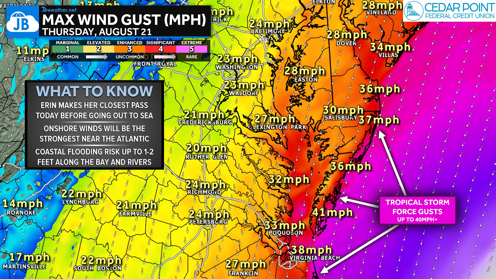
Expect breezy conditions area-wide, with gusts of 20–30 mph east of I-95 and higher, 40+ mph gusts along the immediate Atlantic coastline. These winds won’t be strong enough to cause widespread power outages locally, but loose outdoor items, small tree limbs, and high-profile vehicles may feel the impacts. Rainfall will be very limited, and most spots in our region may not see any measurable rain at all.
The bigger story is along the Bay, rivers, and Atlantic shoreline. Strong onshore flow will push water westward into the Bay, creating a risk for minor coastal flooding in low-lying communities. Water levels could rise 1–2 feet above normal, especially during high tide cycles, and some docks and shoreline roads may experience brief inundation. Boaters and anyone with waterfront property should plan for increased wave heights of 1–4 feet, choppy conditions, and rough boating weather throughout the day.
Overall, Erin’s impacts here will be indirect but noticeable. Outdoor plans away from the shoreline should be fine—just breezy—but those near the water should stay weather-aware today. Conditions begin improving later tonight as Erin finally lifts away from the coast.
John Bordash
View More PostsJB Weather forecaster John Bordash is working around the clock to provide Southern Maryland, and neighboring communities, with accurate and reliable weather information.