Brought to you by Chesapeake Orthodontics
After a 2-year snow drought, much of the Mid-Atlantic looks likely to finally receive a widespread, accumulating snowfall. While amounts will not be big, the cold air will help to ensure that whatever falls will stick. This snow event could lead to moderate impacts for your Tuesday!
We have seen an initial round of snow this morning, with more likely to move through this afternoon and evening. Our Cedar Point Federal Credit Union Futurecast model continues to point to widespread snowfall as we approach sunset. This snow is likely to linger through the overnight hours. The snow will likely come to an end first across southern zones and end by midday north of DC. It is important to note that this model shows more dry air than our other models.
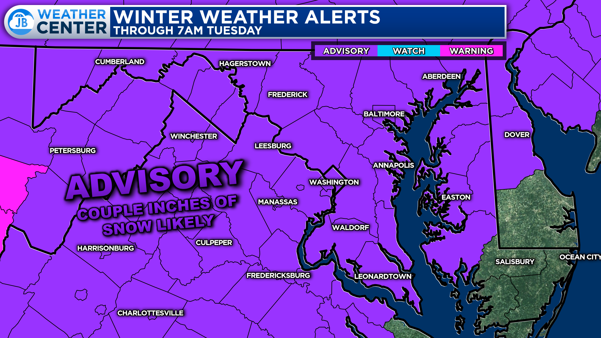
Winter Weather Advisories are in effect for much of the Mid-Atlantic through Tuesday morning. This denotes where at least a couple of inches of snow looks possible. Plan on slippery road conditions in this area. The hazardous conditions could impact the morning & evening commutes.
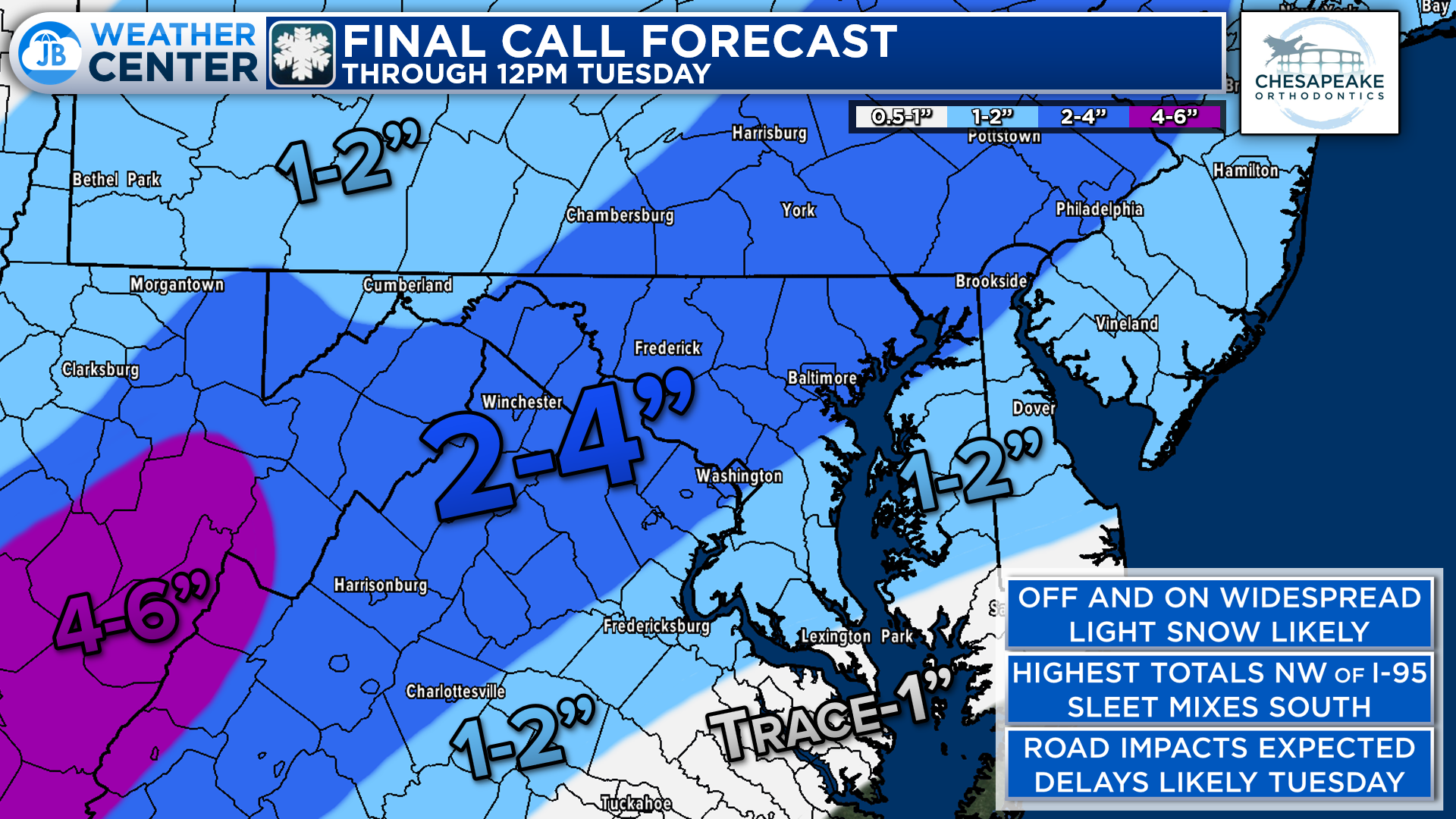
Regarding snow totals, I am still expecting a widespread, light snowfall. 1-2″ looks likely for areas southeast of I-95 where the snow will not last as long. 2-4″ of snow seems like a good bet along & northwest of I-95 where the snow will hold on longer into Tuesday morning. We may see some sleet mix in for far southern zones in lower St. Mary’s County and the Northern Neck.
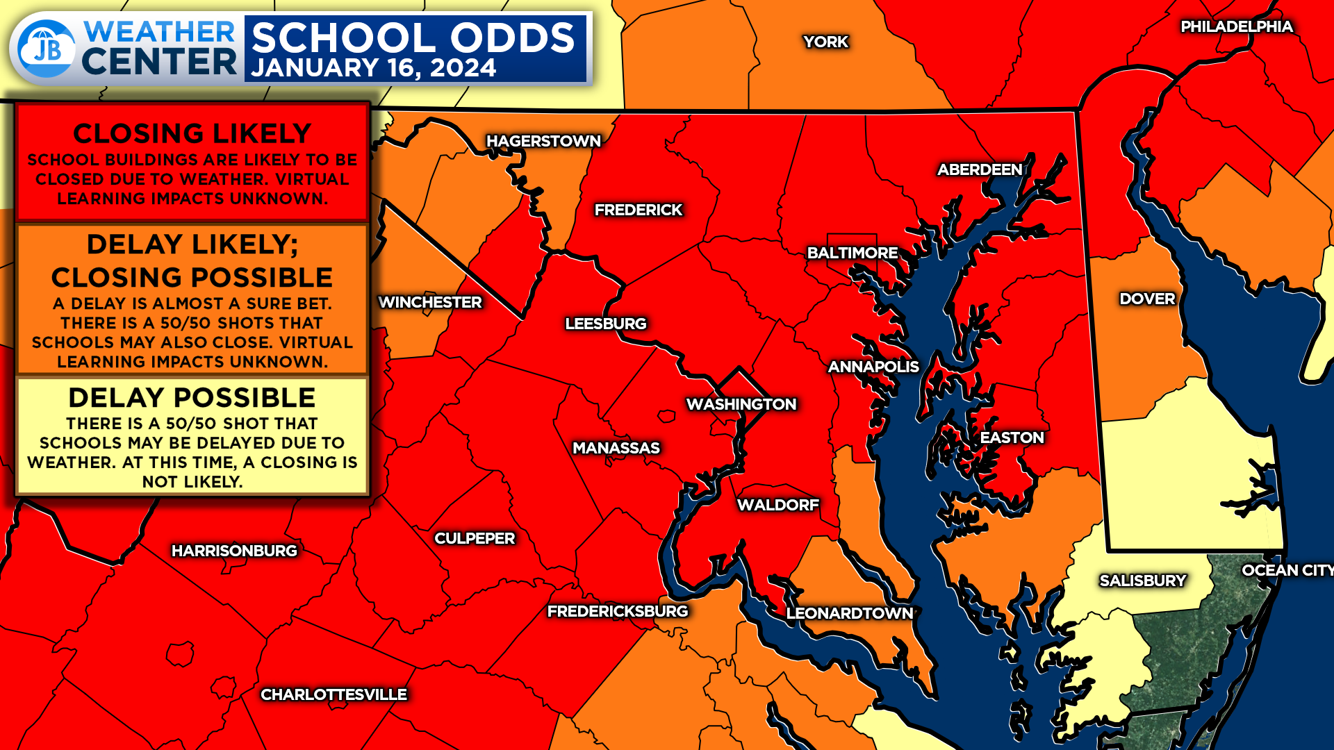
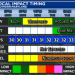
And yes, I am expecting widespread school delays and closures for Tuesday. While the amount of snow will not be the biggest impact, the timing and cold temps (allowing for immediate stickage) will. Areas in red have an 80%+ chance of a closure. Areas in orange have a 50/50 shot at a closure with an 80%+ chance at a delay.
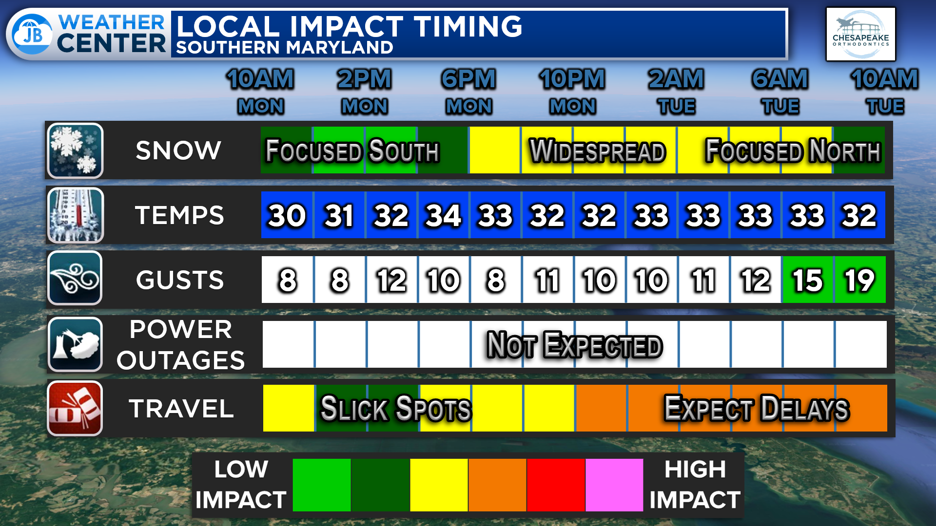
All in all, the impacts of this system will be minor to moderate. Snow already started this morning with the main event moving in this afternoon and evening. A general 1-3″/2-4″ of snow is expected in most locations. The cold temps mean that whatever falls will stick immediately, which will cause slick spots on area roadways. Expect traffic and school delays on Tuesday!
Stay with JB Weather for the latest information on impacts here in Southern Maryland. You can always access my forecasts and updates here on the website, on Facebook, on Twitter, and on YouTube. JB Weather is Southern Maryland’s Weather Leader, and I am working around the clock to keep you ahead of any storm!
-JB
Dr. Thomas Hao and Dr. Dylan Schneider offer comprehensive orthodontic services for all ages. Schedule your free consultation today. Visit www.SOMDBraces.com today for more information!
John Bordash
View More PostsJB Weather forecaster John Bordash is working around the clock to provide Southern Maryland, and neighboring communities, with accurate and reliable weather information.