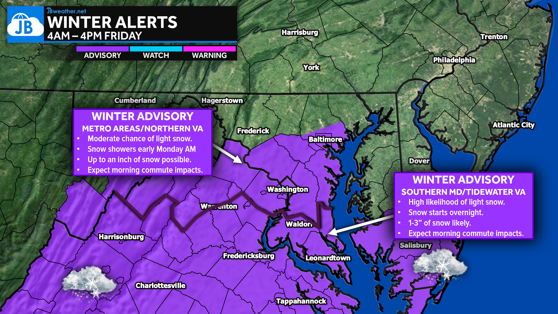
Our forecast has trended upward today as confidence increases in a light but widespread snowfall across the region Friday. A faster and slightly farther-north storm track now supports 1–3 inches of snow for most areas south of Route 50, with lighter amounts north. Winter Weather Advisories are already posted for much of the region, including Southern Maryland.
STORM SETUP
A weak southern storm will slide northeast overnight, running into a deep pocket of cold air settling across the Mid-Atlantic. Today’s model guidance shows a system that is both quicker and a bit farther north, which is why we’ve increased totals across Southern Maryland and central Virginia. While dry air north of D.C. will limit snowfall intensity for areas closer to Baltimore and the MD/PA line, the cold temperatures will ensure that whatever falls will stick immediately. The strongest lift and deepest moisture remain locked south of Route 50, lining up perfectly with where the steadiest snow is expected.
TIMING
Snow now appears likely to move into Southern Maryland and central Virginia between midnight and 4 AM, expanding northward toward the D.C. metro area by sunrise. The steadiest snowfall will occur Friday morning through midday, tapering off from west to east by early afternoon. Light snow showers may persist as far north as Baltimore and the MD/PA state line, but these areas will struggle to see true accumulating snow. Road conditions will deteriorate rapidly south of Route 50 due to cold pavement temperatures already in place.
FORECAST AMOUNTS
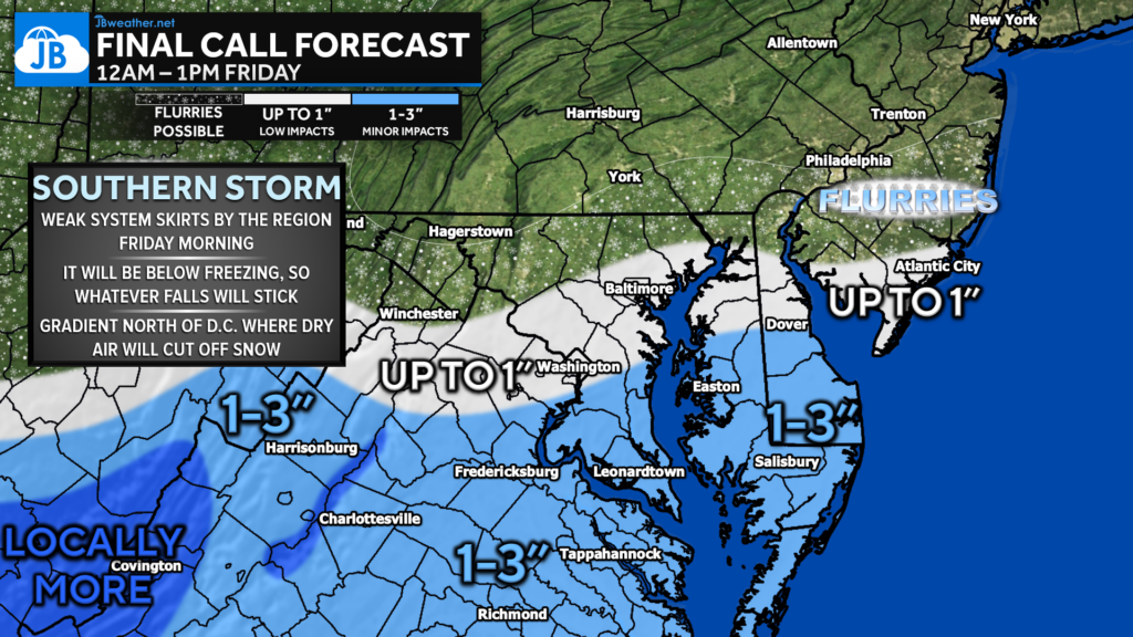
The latest data supports a widespread 1–3 inches of snow south of Route 50, from Southern Maryland through Fredericksburg, Tappahannock, Richmond, and the Northern Neck. Locally higher totals are possible in central Virginia where the snow band sets up most consistently. North of Route 50, areas like D.C., Annapolis, and Baltimore are more likely to see a coating to up to 1 inch, mainly on grassy surfaces but with slick spots possible. Farther north toward York, Harrisburg, and the MD/PA line, only flurries to a trace are expected.
IMPACTS
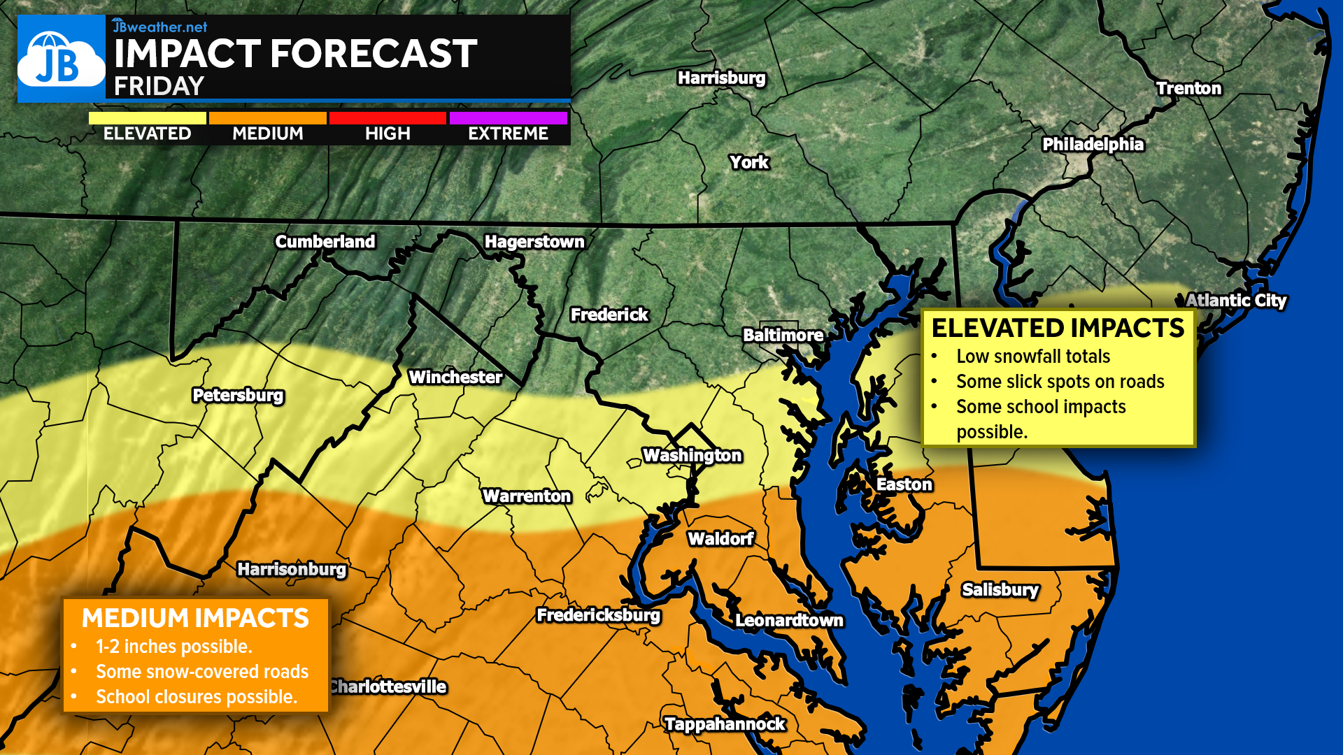
This is a low-to-moderate impact event, with the highest impacts concentrated south of Route 50. The cold air locked in overhead will allow snow to accumulate quickly on untreated surfaces, resulting in snow-covered roads by sunrise. Travel will be slow and slippery Friday morning across Southern Maryland and central Virginia.
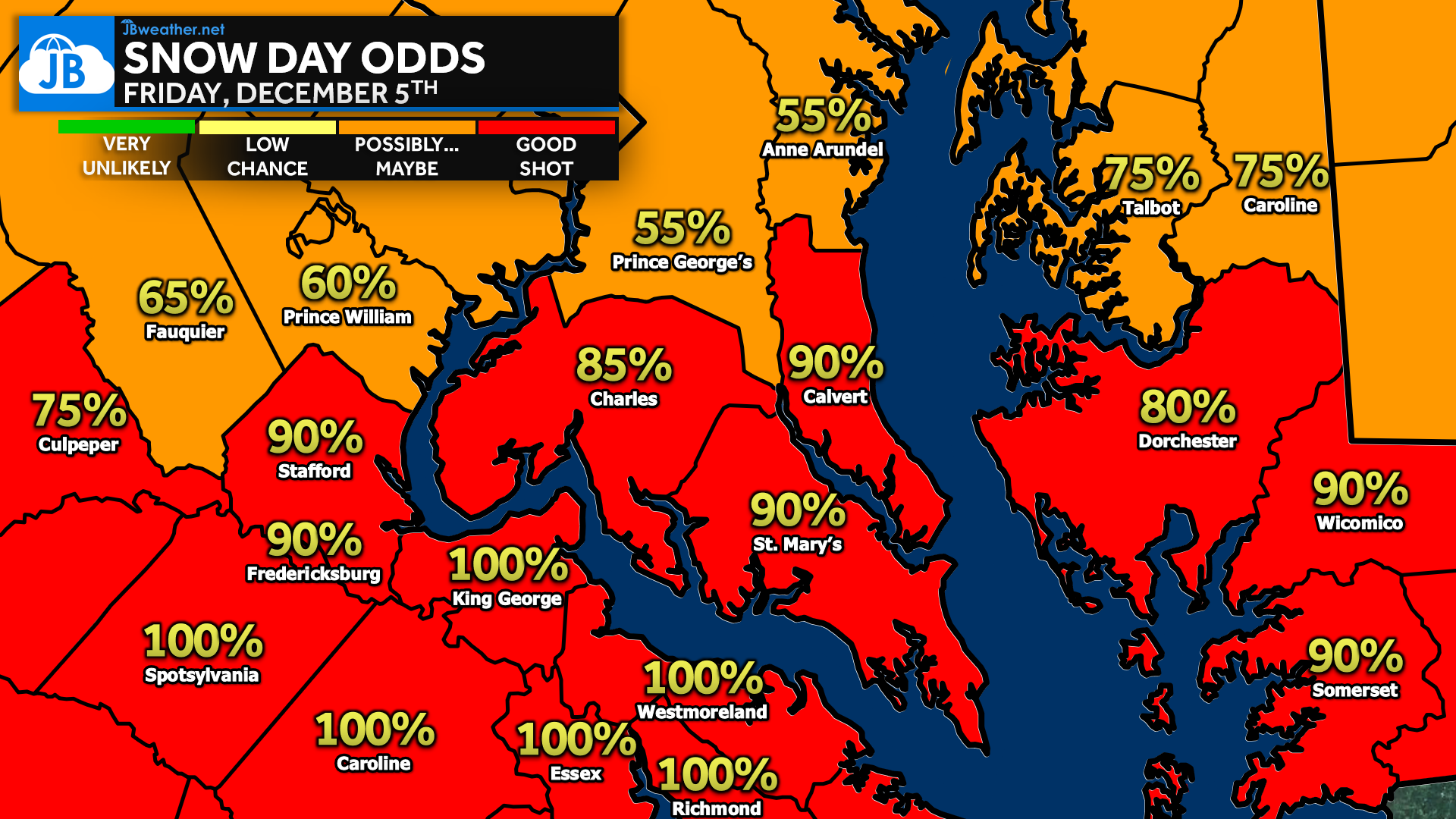
School closures are likely in these areas, with delays possible across the D.C. metro depending on how far north the steadier snow reaches. For Baltimore and points north, impacts remain minimal outside of isolated slick spots.
While this is not a major storm, it comes with the right ingredients—timing, cold temperatures, and light-to-moderate snow—to produce meaningful travel disruptions across our southern zones. The slightly farther-north trend supports accumulating snow for a much larger portion of the region than earlier in the week.
Stay with JB Weather for the latest information on impacts here in Southern Maryland and across the Mid-Atlantic. You can always access my forecasts and updates here on the website, on Facebook, on Twitter, on Instagram, and on YouTube. JB Weather is the Mid-Atlantic’s Weather Leader, and I am working around the clock to keep you ahead of any storm!
❄️ STORM FAQs
• Will it be cold enough for snow?
Yes. Temperatures will be in the 20s overnight and only reach the low 30s Friday.
• Who is most likely to see accumulating snow?
Areas south of Route 50, especially Southern Maryland and central Virginia.
• How much snow will fall?
Most areas south of Route 50 will see 1–3 inches, with lighter amounts north.
• Could school delays or closures happen?
Yes. Closures are likely south of Route 50, with delays possible in the D.C. metro.
• Will the forecast still change?
Small adjustments in the northern edge of the snow shield are still possible, but confidence is now high in a widespread light snowfall.
• Is this a major storm?
No, but timing and cold temperatures will make it impactful, especially for the morning commute.
John Bordash
View More PostsJB Weather forecaster John Bordash is working around the clock to provide Southern Maryland, and neighboring communities, with accurate and reliable weather information.