Brought to you by Chesapeake Orthodontics
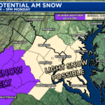
For the first time this season, snow looks likely across much of the Mid-Atlantic as a weak area of low-pressure slides to our south. Widespread, light snowfall accumulation is likely for many, which could pose impacts on Monday and Tuesday. While this will not e a big storm, it will be the first measurable snowfall for many.
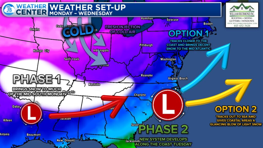
An area of low pressure will bring snowfall to much of the Mid-South today and Monday. As that low-pressure area tracks toward the Appalachian Mountains, it will transfer its energy to a new coastal low. Local impacts and snow amounts are dependent on how far north this tracks.
Our Cedar Point Federal Credit Union Futurecast shows light precip overspreading the region throughout Monday morning. Much of this is not likely to fall initially, thanks to dry air. We should begin to see snowfall as we approach lunchtime, though. Off-and-on periods of light snow are likely through Monday afternoon and evening. The focus of the snow should shift northward Monday evening and into Tuesday morning.
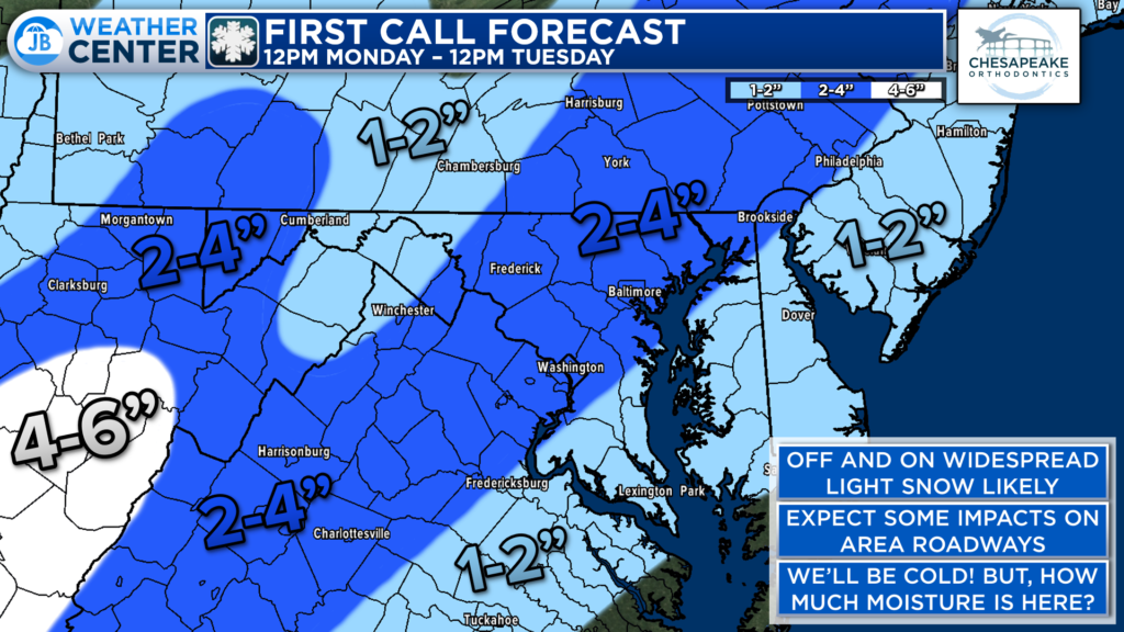
The snow will be light in nature throughout the event, which will limit totals. At least an inch of snow is likely for much of the region, including Southern MD. Slightly higher totals of a couple of inches will likely be north of DC, where the snow sticks around into Tuesday morning.
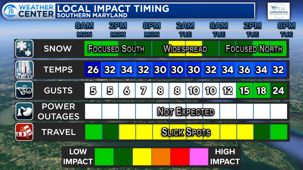
Generally speaking, this is a low-impact event. The snow should never be overly heavy. However, the cold temps will mean that whatever falls will stick. This could cause issues on area roadways Monday afternoon. Those problems could linger into Tuesday where the snow sticks around.
Storm FAQs
How confident are you in your forecast? I have moderate confidence with this forecast. The outstanding questions surround how far north the heaviest precip gets. Small shifts with either the track or the temperature profiles on Monday will lead to forecast changes.
Where will the heaviest snow fall? The highest snow totals will be northwest of the DC metro area, where the precip will be around the longest. However, even here, we are only talking a couple of inches.
When will the snow start? Current guidance shows that the snow may begin mid-to-late morning on Monday. Dry air will initially prohibit snow from reaching the ground. The sooner the snow is allowed to start falling, the more we’ll see.
When will the heaviest snow fall? For Southern MD–Monday afternoon and evening. While I am not forecasting “heavy” snow per se, widespread light snowfall is likely for most locations then. For Southern PA–Monday night into Tuesday morning.
When will the snow end? The snow should be winding down nu early Tuesday morning and clearing out of the region by Tuesday lunchtime.
How much snow will I get at my house? Check out the accumulation map. Generally, I’m expecting an inch or two for most spots with slightly higher totals northwest of DC.
Could more or less snow fall than currently forecast? Absolutely. For more snow to happen, we would need the storm to track further northwest, which would allow heavy precipitation to develop.
15% chance: Nothing
30% chance: Coating to an inch
50% chance: 1-3″
5% chance: 3-6″+
Will the snow stick? The recent string of cold temperatures leading into the event means that whatever falls is likely to stick, even to roadways. Expect some slick spots.
Stay with JB Weather for the latest information on impacts here in Southern Maryland. You can always access my forecasts and updates here on the website, on Facebook, on Twitter, and on YouTube. JB Weather is Southern Maryland’s Weather Leader, and I am working around the clock to keep you ahead of any storm!
-JB

Dr. Thomas Hao and Dr. Dylan Schneider offer comprehensive orthodontic services for all ages. Schedule your free consultation today. Visit www.SOMDBraces.com today for more information!
1 thought on “First Call: Light Snow Likely for Monday & Tuesday”
Comments are closed.
[…] First Call: Light Snow Likely for Monday & Tuesday […]