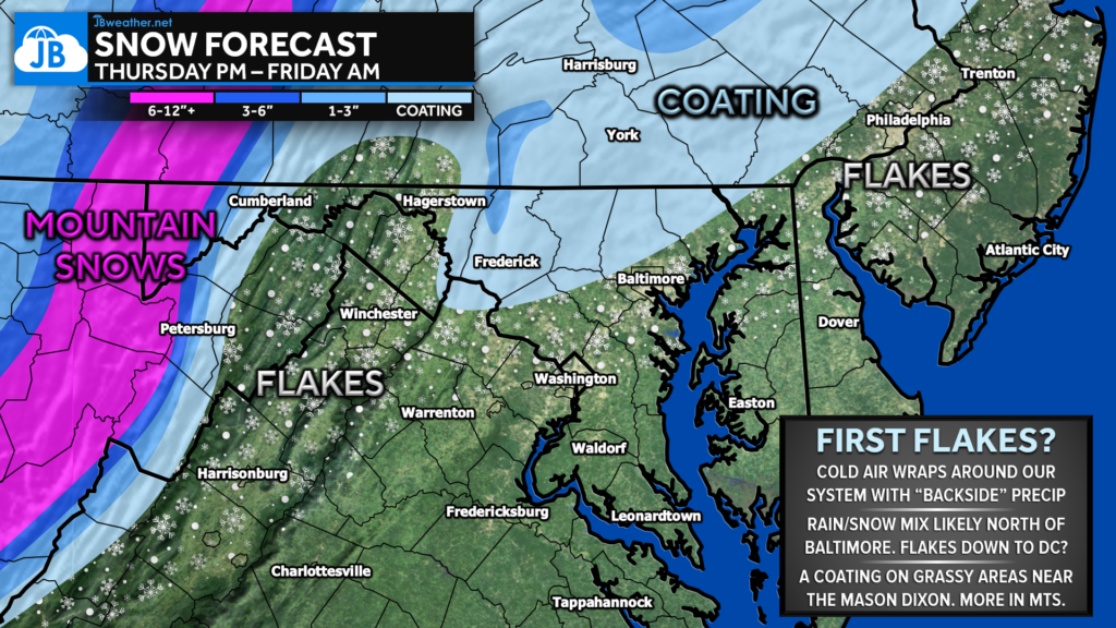
My first #SNOW map of the season! We have a system developing off the coast that will “retrograde” (move backward) over the Northeast. As that happens, wrap-around cold air may move in at the same time as “backside” precip to produce our first flakes Friday morning. The time to watch is 12am-10am.

I am quite skeptical about this setup as dry air and marginal temps in November don’t typically “help” with a forecast like this. But, I could see some flakes north of DC Friday morning, with a coating to spotty inch of snow on grassy areas north of Baltimore into PA.
TRAVEL: This should not impact overall travel on Friday morning as our roads are warm and, again, it’s November. But this could be conversational! We could see the snow come down heavy in a few squalls in the higher elevations.
NORTHERN FOLLOWERS: I would not expect school, business, or flight delays in Northern MD or Southern PA for right now. The key timing for potential snow in these northern areas would be between 12am-9am. Timing is subpar, but stickage may not really be an issue.
However, if temperatures are a smidge cooler with a more expansive precipit field, we could see flurries get down to Southern MD, and an inch of snow for some of the northern MD hills in the communities in Southern PA. That would be our boom scenario, with a 10% chance of happening.
This will be something to fun to watch play out and a sign that Winter is near! ❄️

