Brought to you by Berkshire Hathaway HomeServices PenFed Realty
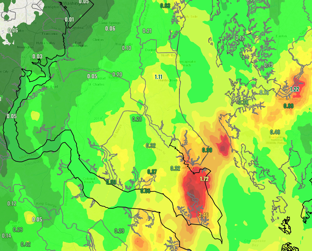
After a couple of days away in Philadelphia, it is nice to be back in the weather office! Some have seen a decent amount of rain push through the region over the last couple of days, as a coastal system moves onshore. Our southern zones were the ones to receive the most rain with upwards of 1-2″ of rain falling! This will help out the ongoing drought conditions in these areas.
After a foggy and cloudy start, we have been able to see some drying conditions to kick off our Sunday. With that said, these dry conditions are not likely to last long as a weak piece of atmospheric energy pushes through the region this evening. This, along with the warm and humid conditions outside, will work together to fire up some storms later on this evening.
Our Chesapeake’s Bounty Futurecast depicts this threat quite well. We will see thunderstorms begin to develop back out to our west, along I-81, later on, this afternoon. Initially, we may see a couple of these storms become strong to severe as some storm energy will be present in the atmosphere, thanks to the humidity.
These storms will head eastward throughout the afternoon and evening. This broken line of showers and storms will likely approach the I-95 corridor by dinner time, and cross into Southern MD near, or just after, sunset this evening. It will take some time to clear these out, likely not until after midnight.
Yes, this means that it may be quite difficult to see tonight’s lunar eclipse, which will be happening from 11:29pm-12:53am. Don’t come after the messenger!
As mentioned earlier, there is a chance that these storms may become strong or severe initially. This would only occur because of the humidity that is present, which leads to the development of storm energy. All other factors we look at for severe weather look subpar, at best. This means that once we lose the warm temps and humidity after sunset, these storms are likely to lose some of their punch.
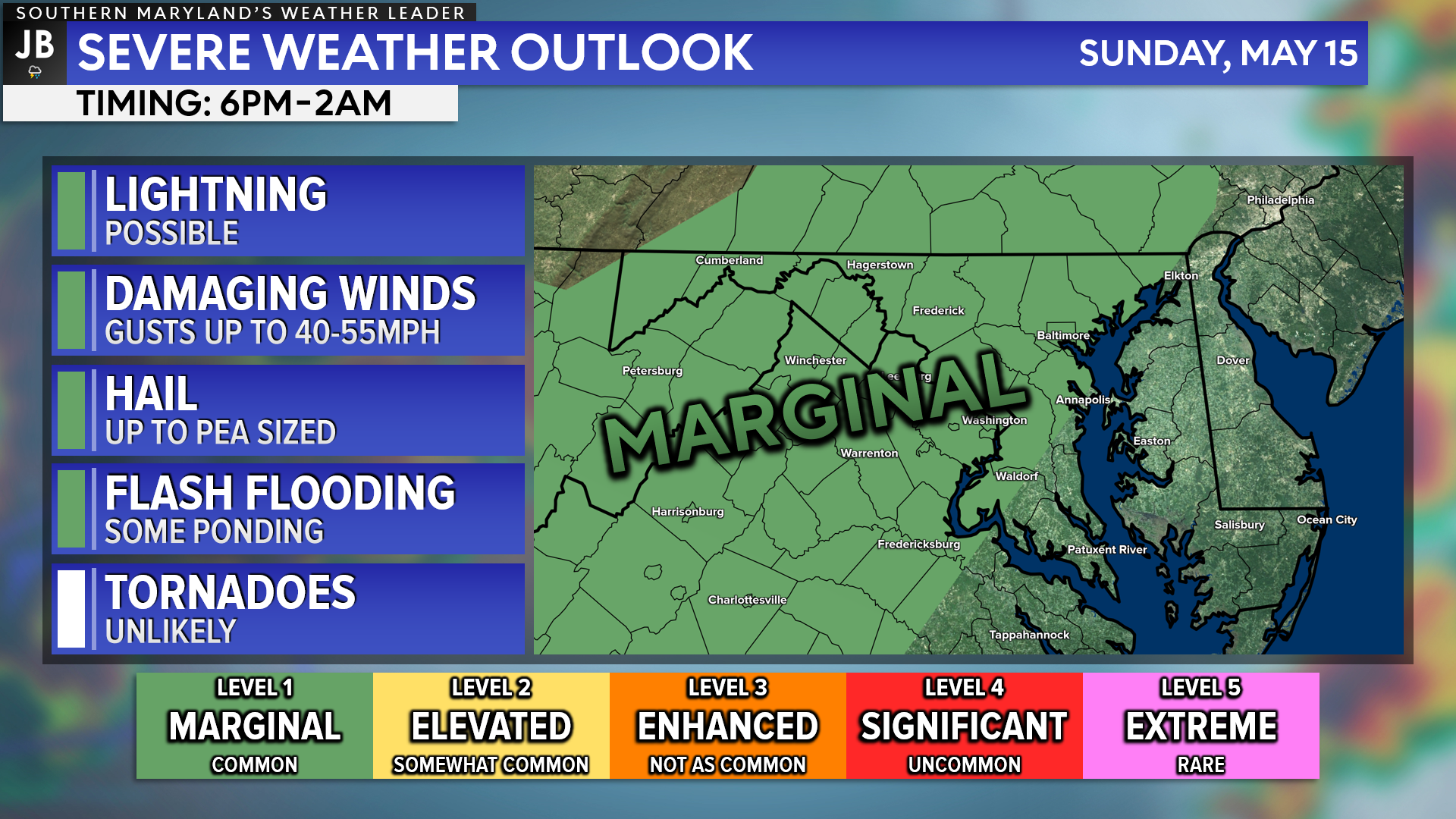
With that in mind, the Storm Prediction Center has placed areas west of I-95 under a Level 1 “Marginal Risk” of seeing severe storms this evening. Our region is not technically under any organized severe threat right now, as these storms should begin to weaken some as they move east.
With that said, though, we could still see some heavy rain, gusty winds, and some thunder/lightning late this evening as these swing through. Nothing too crazy is expected, but it is something to be aware of!
After this evening’s storm threat, all eyes will turn to tomorrow. Monday is likely to offer our first substantial and legitimate severe weather threat of the season. I will have more details on that later this afternoon. Stay tuned!
Stay with JB Weather for the latest information on Southern Maryland weather. You can always access my forecasts and updates here on the website, on Facebook, on Twitter, on Instagram, and on YouTube.
-JB

Real Estate now! Not sure where to start? View our Southern Maryland inventory of homes, land, farms and commercial properties on penfedrealty.com. Engage with our planning tools to determine your next real estate lifestyle decision, choose your realtor as a trusted advisor. Experience the difference with service and support from real estate’s forever brand!
John Bordash
View More PostsJB Weather forecaster John Bordash is working around the clock to provide Southern Maryland, and neighboring communities, with accurate and reliable weather information.

1 thought on “First Things First: Storms Possible Sunday Evening”
Comments are closed.
[…] [ May 15, 2022 ] First Things First: Storms Possible Sunday Evening Severe Weather […]