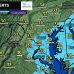
A strong cold front is sweeping through the region, delivering our first true blast of winterlike air for the season. Behind the front, a surge of northwesterly winds will send temperatures tumbling, with highs on Tuesday likely struggling to reach the 40s for many areas. Overnight lows Monday night and Tuesday night will drop well down into the 20s, marking the coldest stretch we’ve seen so far this fall. This will be a noticeable and abrupt shift from the milder pattern we’ve enjoyed recently.
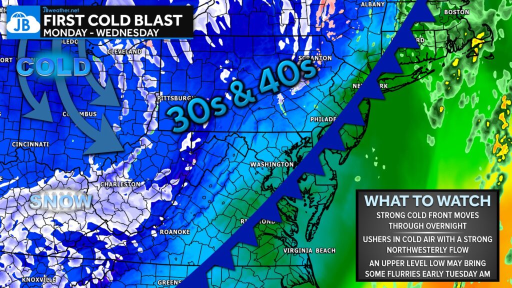
As this colder air pours in, an upper-level disturbance may squeeze out a few scattered flurries from late Monday night into early Tuesday morning. Thanks to the mountains blocking much of the northwesterly flow, these flurries are unlikely to be widespread or accumulating — more of a novelty than anything impactful. Still, consider this cold snap a preview of what’s ahead as we move deeper into November and begin transitioning into true winter setups.
John Bordash
View More PostsJB Weather forecaster John Bordash is working around the clock to provide Southern Maryland, and neighboring communities, with accurate and reliable weather information.