As we continue to keep a close eye on the potential winter storm threat for northwestern parts of the region on Tuesday, we’ll first deal with a smaller and much weaker system on Sunday. This one isn’t expected to bring significant impacts, but it will give us a quick taste of winter as a warm front lifts north during the morning hours. A brief mix of snow and sleet is possible northwest of I-95 before milder air takes over, with rain showers for everyone by lunchtime. It’s not a major event, but it’s enough to put winter weather on the map as we head into the first week of December.
A warm front lifting through the Mid-Atlantic on Sunday will bring our region its first small brush with winter. While this is not a high-impact event, areas northwest of I-95 may see a brief period of snow and sleet before the warm air wins out.
Timing
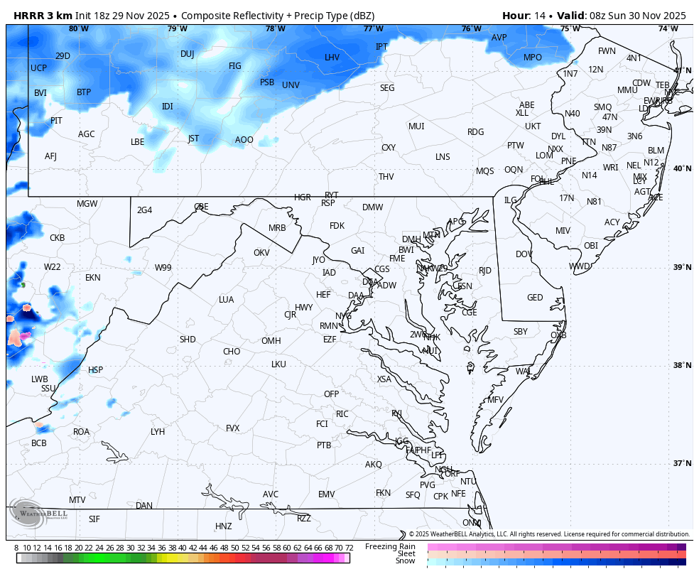
- 6–10 AM: Light precipitation spreads in from the southwest shortly after sunrise. Surface temperatures in the 30s northwest of I-95 may allow for a brief mix of snow and sleet.
- 10 AM – 1 PM: The warm front continues pushing north, changing any lingering wintry mix over to rain. Areas southeast of I-95 start and stay all rain.
- 1 PM – 5/6 PM: Scattered, mainly light rain showers continue across the region. A final line of showers arrives late afternoon with the cold front.
- After 5–6 PM: Precipitation exits the region. Conditions will dry out in time for the Washington Commanders’ Sunday night game, with cooler air filtering in behind the front.
Who Sees Wintry Weather?
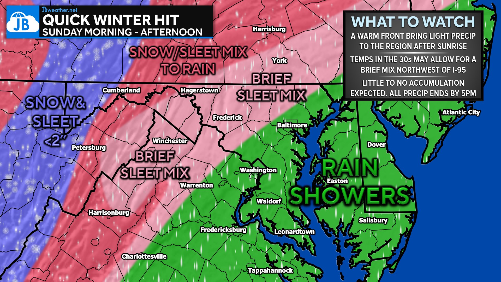
- Mountain Zones: A longer window of snow and a wintry mix that may linger into the afternoon hours.
- Accumulation: 1–2 inches of snow/sleet possible before the changeover.
- Northwest of I-95 (Northwestern suburbs and southern PA): A window of light snow/sleet is possible during the early morning hours.
- Accumulation: A dusting to <1” in the pink-shaded corridor.
- Along & southeast of I-95 (DC, Baltimore, southern MD, Annapolis, Eastern Shore): Temperatures remain warm enough for plain rain showers throughout the day.
Rainfall Amounts
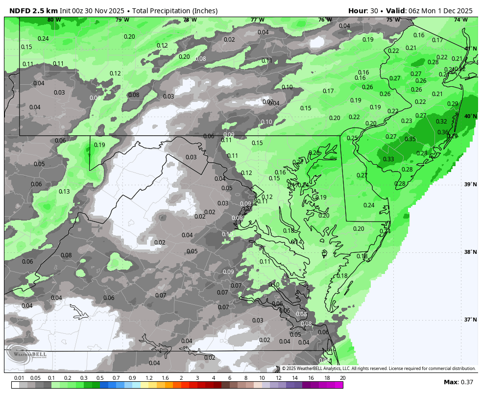
- Overall precipitation totals remain low.
- Most locations: 0.10”–0.25” of rain.
- Southeast of I-95: Generally lighter amounts—under 0.25”.
Big Picture
This is not a storm and not a significant winter weather event, but it is a reminder that the season is right around the corner. A quick burst of snow or sleet in the colder spots northwest of I-95 will give some communities their first small taste of winter before everyone transitions to spotty rain showers in the afternoon.
Cooler air settles in behind the system Sunday night and early next week.
John Bordash
View More PostsJB Weather forecaster John Bordash is working around the clock to provide Southern Maryland, and neighboring communities, with accurate and reliable weather information.