Brought to you by Dugan, McKissick, Longmore LLC
After a dry end to July across the region, we have seen the rain chances really increase over the last couple of weeks across Southern Maryland. Tonight will look to offer another rain chance as a frontal boundary set up over the region and looks to bring the threat of slow-moving storms across the region. A Flash Flood Watch has already been issued for tonight and tomorrow morning. This is because these slow-moving storms could cause isolated flooding.
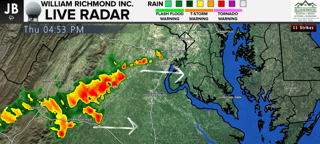
We can already see these storms beginning to fire up across Central VA on the radar this afternoon. These are the storms that will look to move eastward, and bring heavy rain, gusty winds, and thunder/lightning.

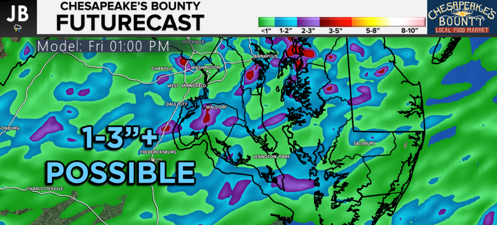
Our Chesapeake’s Bounty Futurecast shows how this line will develop and moves towards our region. Some areas overnight could see hours of heavy rain from these slow-moving storms. We are likely to see additional storms fire just before the morning commute and could bring additional flooding concerns to the area.
Futurecast shows the potential for a widespread 1-3″ of rain, with locally higher amounts. Adding this on top of what has already fallen over the last couple of weeks will cause issues. Low lying areas and areas with poor drainage will need to stay especially cautious tonight. Impacts on area roads do look likely tonight and tomorrow morning, potentially slowing down the AM Rush. Remember, if you encounter a flooded roadway, turn around don’t drown.

Stay with JB Weather for the latest information on Southern Maryland weather. You can always access my forecasts and updates here on the website, on Facebook, on Twitter, and on YouTube.
-JB

Dugan, McKissick & Longmore, LLC has served our Southern Maryland community for over 25 years. Our trusted attorneys are here to handle your unique case from beginning to end. To schedule an appointment, call us today at 301-862-3764 or visit our website at www.paxlawyers.com.

