Brought to you by Berkshire Hathaway HomeServices PenFed Realty
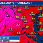
Today is the first day of astronomical summer, and right on cue the warmth and humidity have made a comeback. Tomorrow, we will add another summertime staple to the forecast: the threat of afternoon and evening storms that could bring flooding rains.
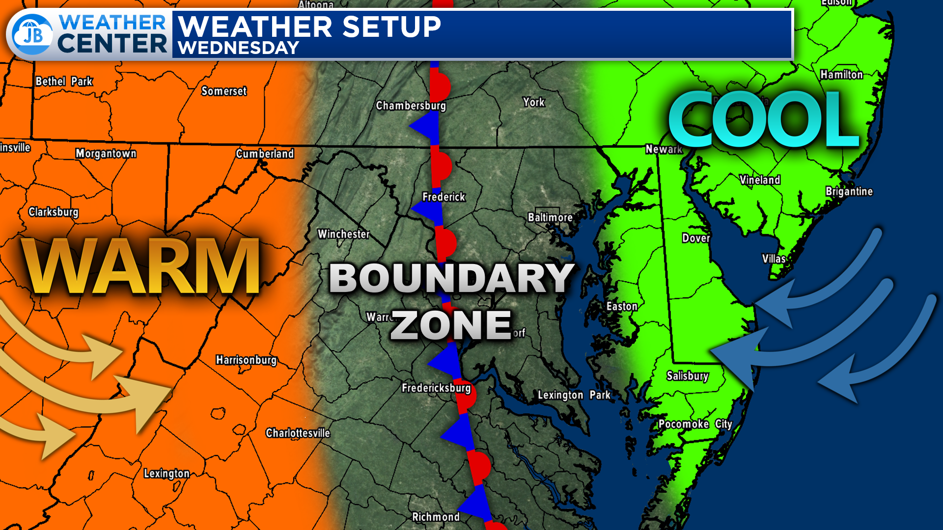
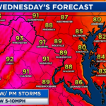
A boundary will set up across the region on Wednesday and will separate the warmer temperatures to the west and the cooler, seasonal temperatures to the east. The exact placement of this boundary will be important and will make tomorrow’s forecast rather difficult.
If this boundary sets up west of I-95, then we are likely to only see highs in the lower to middle 80s. However, if it sets up over our region or to the east, then we could see temps in the lower 90s. Additionally, this boundary will look to be the trigger for tomorrow’s showers and storms.
Our Chesapeake’s Bounty Futurecast depicts this threat well. We are likely to be dry on Wednesday through the midday hours. Then, during the mid-afternoon hours, scattered showers and storms are likely to develop. They will likely develop across northern areas first, and then move southward thanks to the boundary that will be draped across the region.
We are likely to see thunderstorms initially develop across the region during the afternoon and evening hours thanks to the heat and humidity that will be present. We will then see a cold front look to push through during the overnight hours, which will set off another round of showers and storms. This could lead to multiple waves of rain pushing through the region throughout Wednesday and Wednesday night.
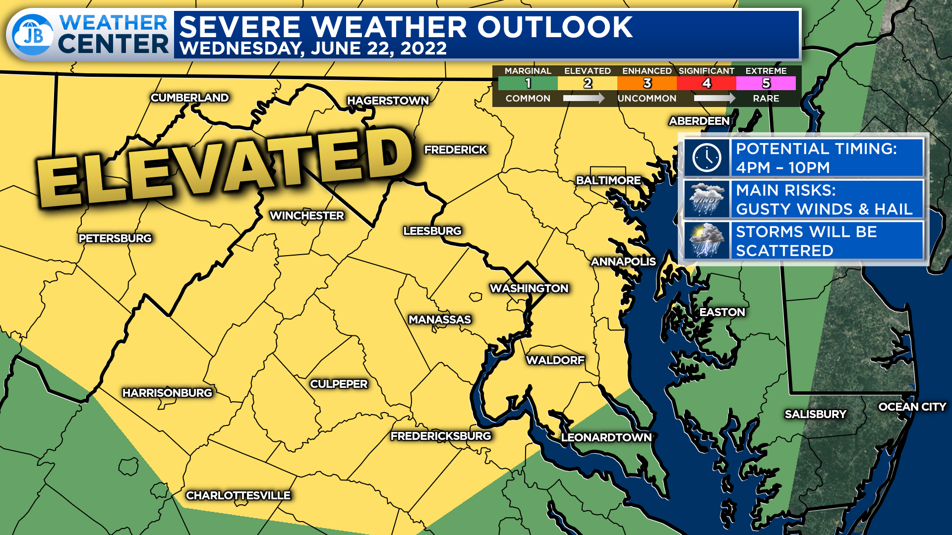
The Storm Prediction Center has placed much of our region under a Level 2 “Elevated Risk” of seeing severe weather with tomorrow afternoon’s round of rain and storms. The greatest risks will be mainly focused just to our northwest, but that Elevated Risk does extend down into our region as well. The timing for this severe threat is between 4-10pm. Granted, we will still have rain chances after 10pm.
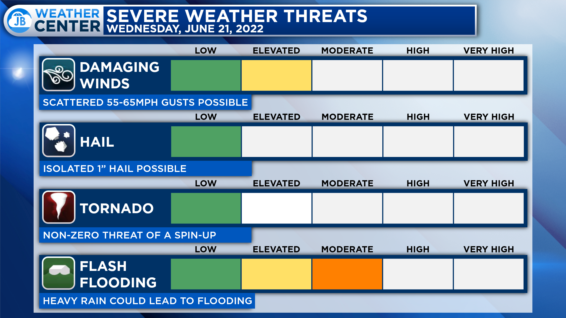
The main risks with any storms that fire up during the afternoon and evening hours will come from damaging wind gusts up to 65mph and isolated hail up to 1″ in diameter. There is also a non-zero tornado threat tomorrow afternoon, but that threat is rather low. Storms will be scattered tomorrow afternoon, so not everyone will get in on this severe threat. The bigger concern for most everyone will come from flash flooding.
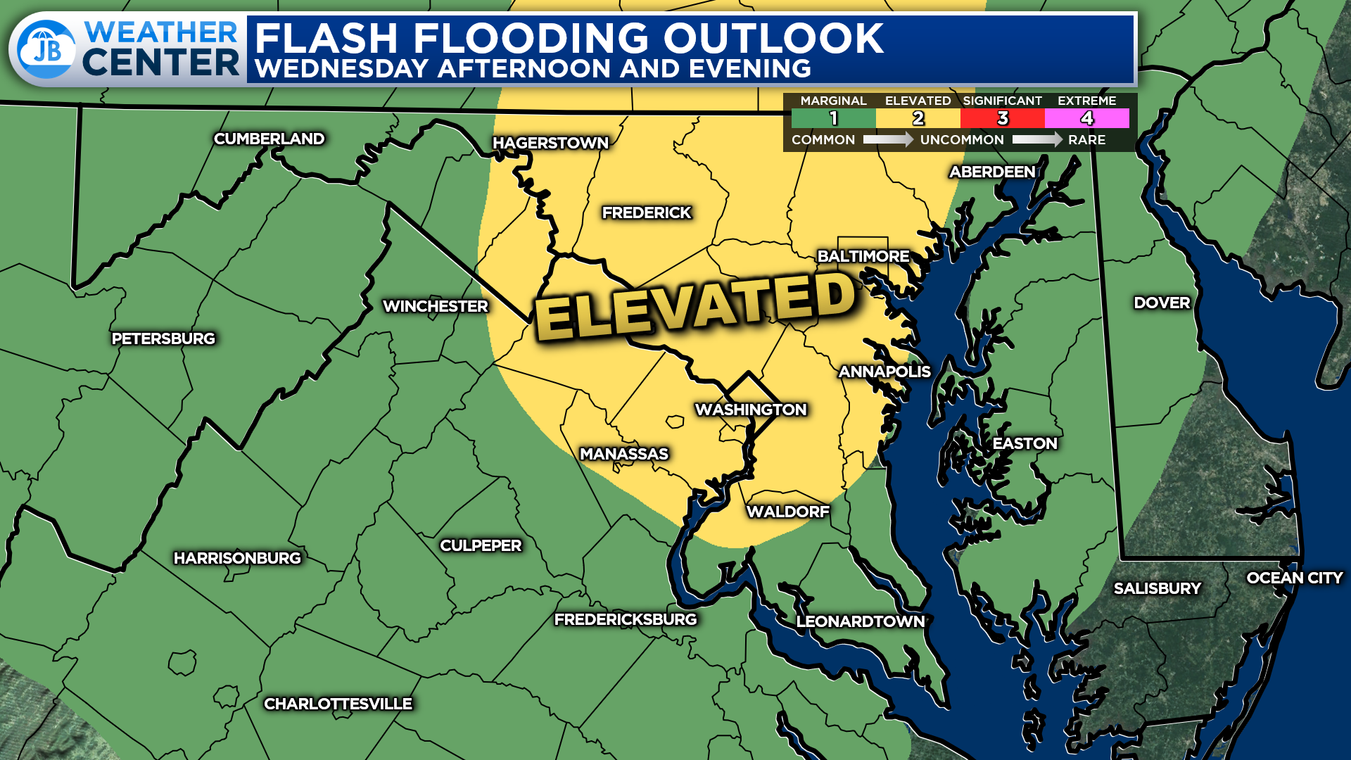
The Weather Prediction Center has already placed much of the region under a heightened threat of flash flooding for Wednesday and Wednesday night. This is because we are likely to see a couple of rounds of rain work through our region. Locally heavy rain will be possible with any one of these rounds, and seeing multiple rounds of locally heavy rain is likely to lead to issues for some communities.
Again, not everyone will see heavy rain tomorrow. However, those that do could see flash flooding take hold rather quickly. Therefore it will be important to stay aware of quickly changing weather conditions. Some spots could see up to 1-2″ of rain by sunrise on Thursday. With that said, others are likely to see limited amounts of rain. It will depend on where these localized pockets of heavy rain set up.
Stay with JB Weather for the latest information on Southern Maryland weather. You can always access my forecasts and updates here on the website, on Facebook, on Twitter, on Instagram, and on YouTube.
-JB

Real Estate now! Not sure where to start? View our Southern Maryland inventory of homes, land, farms and commercial properties on penfedrealty.com. Engage with our planning tools to determine your next real estate lifestyle decision, choose your realtor as a trusted advisor. Experience the difference with service and support from real estate’s forever brand!
John Bordash
View More PostsJB Weather forecaster John Bordash is working around the clock to provide Southern Maryland, and neighboring communities, with accurate and reliable weather information.