Brought to you by Berkshire Hathaway HomeServices PenFed Realty
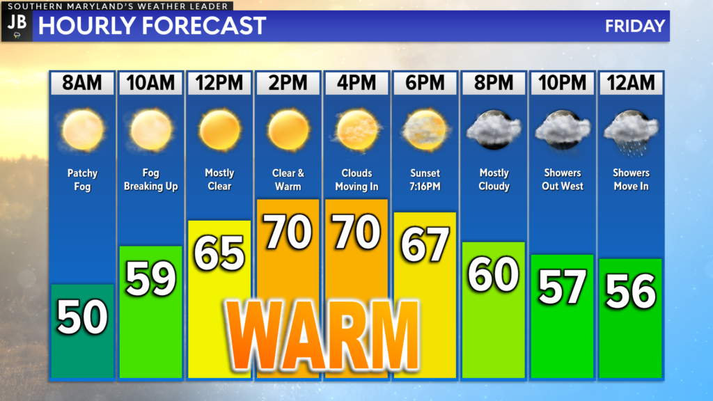
Weather conditions will rebound across the region today as temperatures look to max out in the 70s across the region! Highs this afternoon will likely be 10-15 degrees warmer than yesterday’s rain-cool highs. Today will definitely be a day that you want to get outside and enjoy while you can!

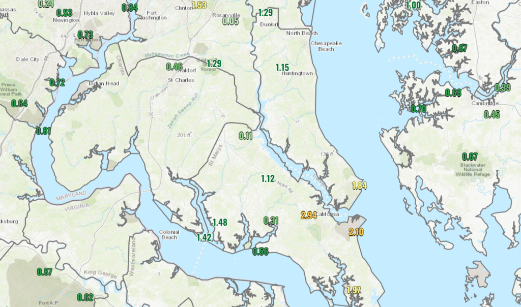
Today’s nice weather comes after a deluge of a day yesterday. Patuxent River NAS ended up officially recording 2.10″ of rain yesterday and Leonardtown, MD received 2.94″! The map above shows some of the official rain totals from across the region. Yesterday’s rain ended up being more intense than even I had expected as the low pressure passed by. Thankfully, that system is well offshore today.

In the wake of that system from yesterday, we are starting this morning off rather mild with excess moisture in the air. This has helped fog to develop across the region this morning, especially along the water. This fog should begin to burn off by mid-morning as the sun comes out in full force.
We should see clearing skies by lunchtime, which would allow many locations today to top off in the lower to middle 70s! The warm temperatures will also be thanks to a southerly wind that could gust upwards of 15-25mph at times today. Temperatures will be slow to cool off as we see an increase in cloud cover ahead of our next system.
Our Chesapeake’s Bounty Futurecast shows the increased cloud cover potentially giving way to rain showers as moisture works northward tonight. This Futurecast model becomes rather aggressive with the rain threat overnight, potentially pointing to some localized downpours moving through Southern Maryland by sunrise. I think this may be too aggressive.
I believe that what is more likely are off and on showers overnight as a warm front lifts northward. Sure, 1 or 2 showers could turn into downpours. As things stand right now, I do not anticipate anything similar to yesterday’s rain event. With that said, the Futurecast output is a possible outcome. I will continue to monitor trends throughout the day and provide updates to this part of the forecast as needed. Stay tuned.

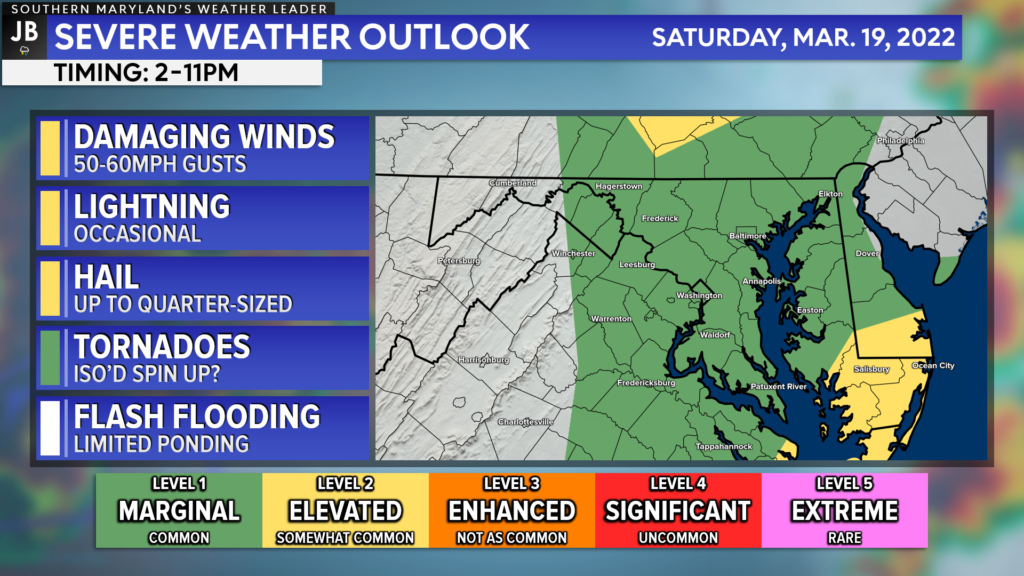
While the rain showers tonight should not be severe, a more credible storm threat exists tomorrow afternoon, between 2-11pm. This comes as a cold front will work through tomorrow afternoon. Much of our region is under a Level 1 “Marginial Risk” with a Level 2 “Elevated Risk” for far southeastern communities. Winds and hail appear to be the main threats right now with storms that do fire up. I will have more details on this threat in an update this afternoon.
Stay with JB Weather for the latest information on Southern Maryland weather. You can always access my forecasts and updates here on the website, on Facebook, on Twitter, on Instagram, and on YouTube.
-JB

Real Estate now! Not sure where to start? View our Southern Maryland inventory of homes, land, farms and commercial properties on penfedrealty.com. Engage with our planning tools to determine your next real estate lifestyle decision, choose your realtor as a trusted advisor. Experience the difference with service and support from real estate’s forever brand!

