Brought to you by Chesapeake Orthodontics
Yesterday was a warm and humid day across the region, and we will look to follow that up with even hotter conditions today. Highs across the region are likely to warm well into the 90s this afternoon with oppressive humidity levels. This dangerous heat has prompted a Heat Advisory for today.
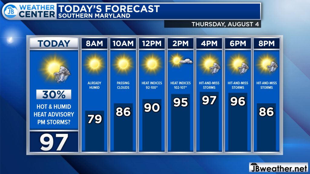
It is already warm and humid out there. This will lay the groundwork for today’s heat and humidity. We will likely see temperatures already get into the 90s by lunchtime, and the upper 90s by mid-afternoon. Humidity levels will be high as well, bringing high heat indices and prompting a storm chance.
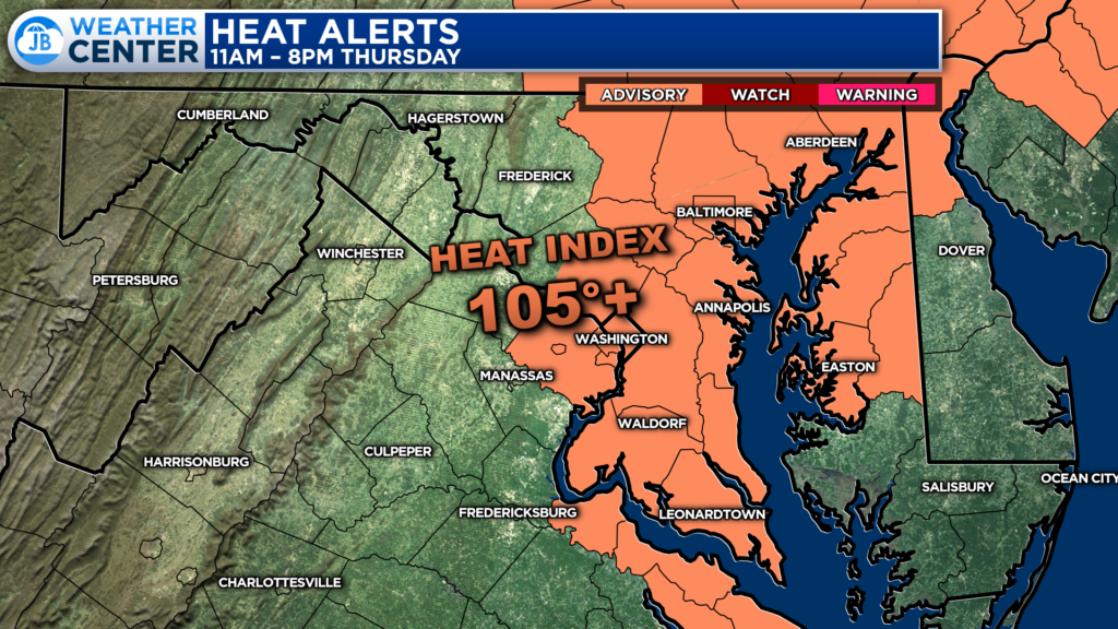
First, the combination of heat and humidity will lead to dangerous heat indices. The humidity is likely to be highest along the Bay, which is why areas from I-95 to the Bay have been placed under a Heat Advisory from 11am-8pm today.
Drink plenty of fluids, stay in an air-conditioned room, stay out of the sun, and check up on relatives and neighbors. Young children and pets should never be left unattended in vehicles under any circumstances. Take extra precautions if you work or spend time outside.
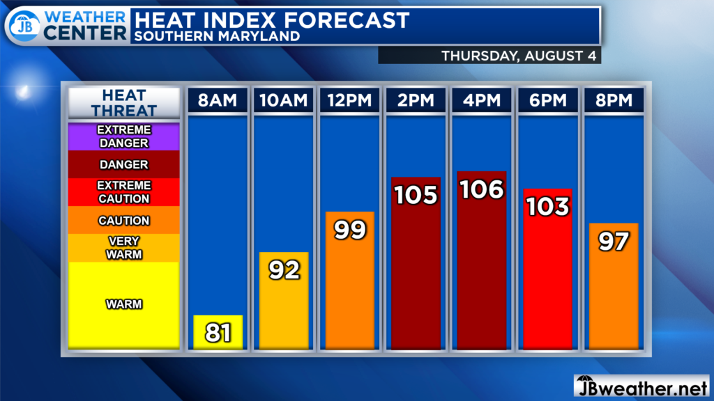
We will likely see the highest heat indices during the mid to late afternoon hours. That is when many spots in Southern MD are likely to see heat indices flirt with 105°. However, the heat will ramp up early, with those heat indices already getting close to 100° by lunchtime. This is heat that you want to take seriously!
The heat and humidity will also lead to potential storms as a weak wave of atmospheric energy moves overhead. Futurecast shows scattered, hit-and-miss storms firing to our west after lunchtime across parts may have locally heavy rain and gusty winds.
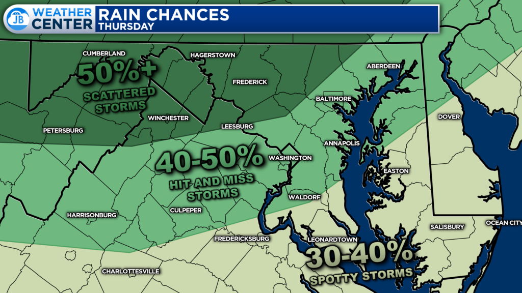
The highest rain chances today will be focused to our north and west, where there is a 40-50%+ chance of seeing these storms. Any storms in Southern MD are likely to be widely scattered, meaning that not everyone will see them. There is no organized severe threat today, but you will want to stay weather aware.
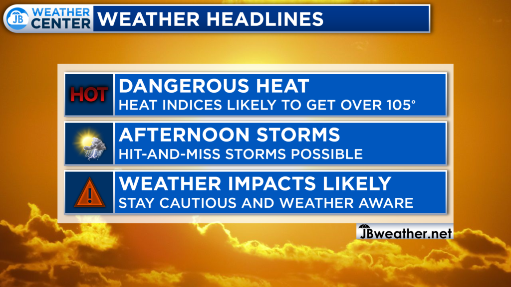
Today is turning out to be a moderate impact weather day. The highest impacts will come from the heat and humidity pushing heat indices over 105° at times. This could allow for hit-and-miss strong storms to fire up this afternoon. All-in-all, you will want to stay cautious of the heat and weather aware of any potential storms.
If you have outdoor plans this afternoon and evening, I would not cancel them. However, I would have water with you. And, I would recommend stay weather aware as hot and miss storms try to fire during the afternoon and evening hours. Have a Plan B ready to go, and be ready to act if quickly-changing weather conditions move overhead.
Stay with JB Weather for the latest information on Southern Maryland weather. You can always access my forecasts and updates here on the website, on Facebook, on Twitter, on Instagram, and on YouTube.
-JB

Dr. Thomas Hao and Dr. Dylan Schneider offer comprehensive orthodontic services for all ages. Schedule your free consultation today. Visit www.SOMDBraces.com today for more information!
