Brought to you by Calvert Title Company
Yesterday brought dangerous heat and humidity with storms that push through in the evening. Communities that saw the storms received plenty of rain and a lot of lightning. Today, unfortunately, will look to be a repeat performance on almost all fronts.
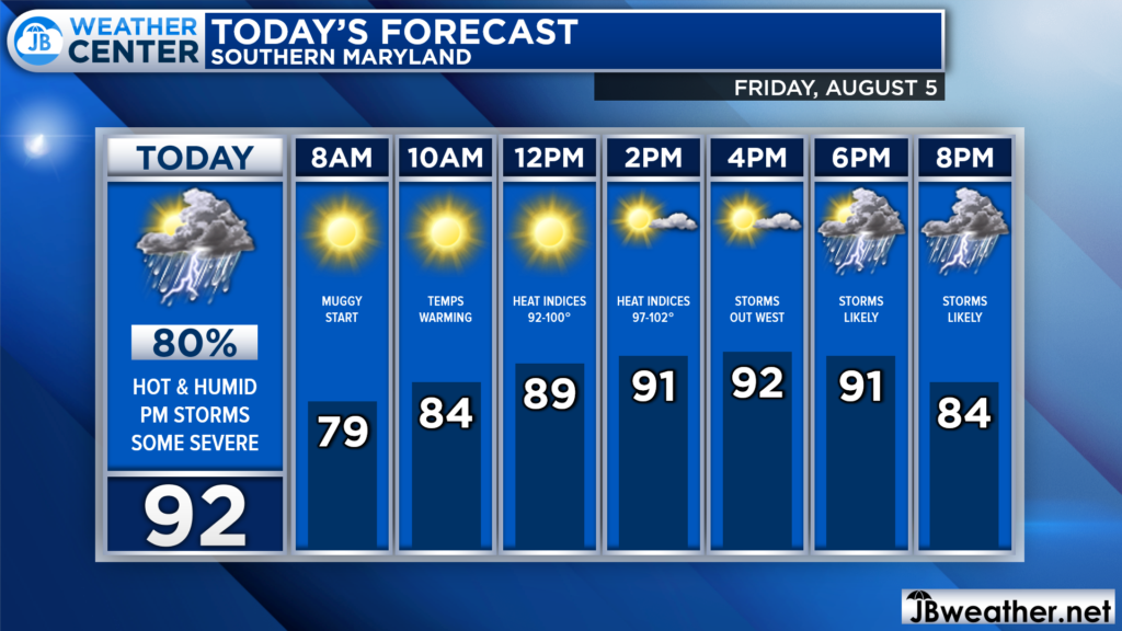
We are already off to a muggy start this morning, which will set the scene for today’s heat and humidity. We will likely see temperatures warm into the upper 80s by lunchtime and into the lower to middle 90s by this afternoon. Then, we are likely to see scattered storms develop this afternoon.
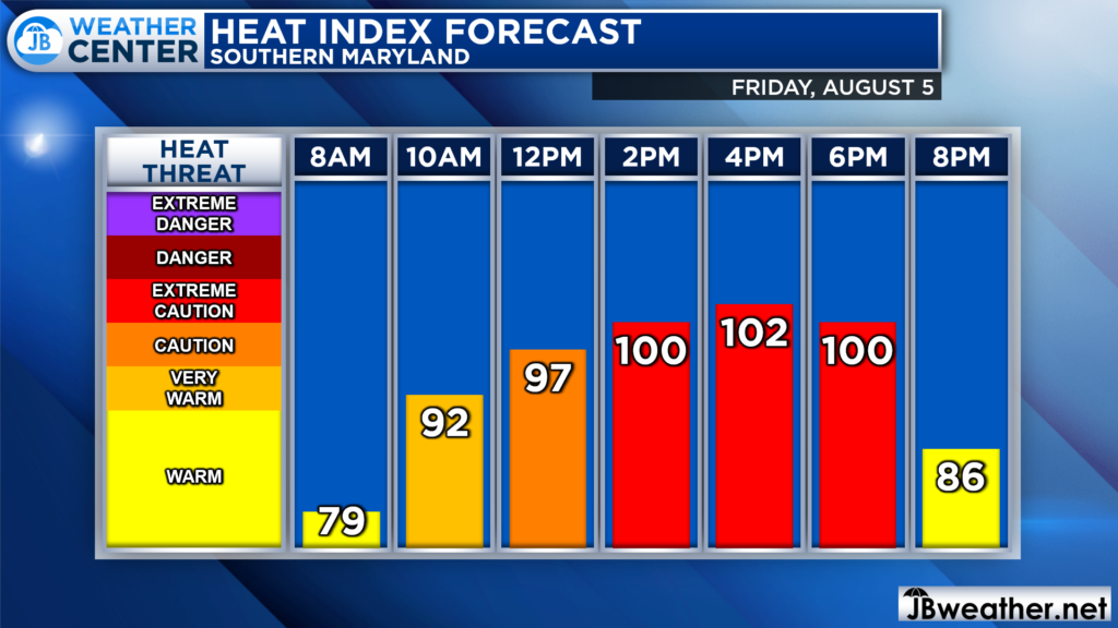
The heat and humidity combination will lead to high heat indices, yet again. We are likely to see those feels-like temperatures get back over 100° this afternoon. While we will likely fall just short of Heat Advisory criteria, you will want to take extreme caution when dealing with this heat.
Drink plenty of fluids, stay in an air-conditioned room, stay out of the sun, and check up on relatives and neighbors. Young children and pets should never be left unattended in vehicles under any circumstances. Take extra precautions if you work or spend time outside.
The heat and humidity will also help support strong storms this evening. Futurecast seems to have a good handle on the threat. We will likely see storms begin to fire up to our west during the late-afternoon hours. The storms will likely strengthen as they head eastward, into our local area, this evening.
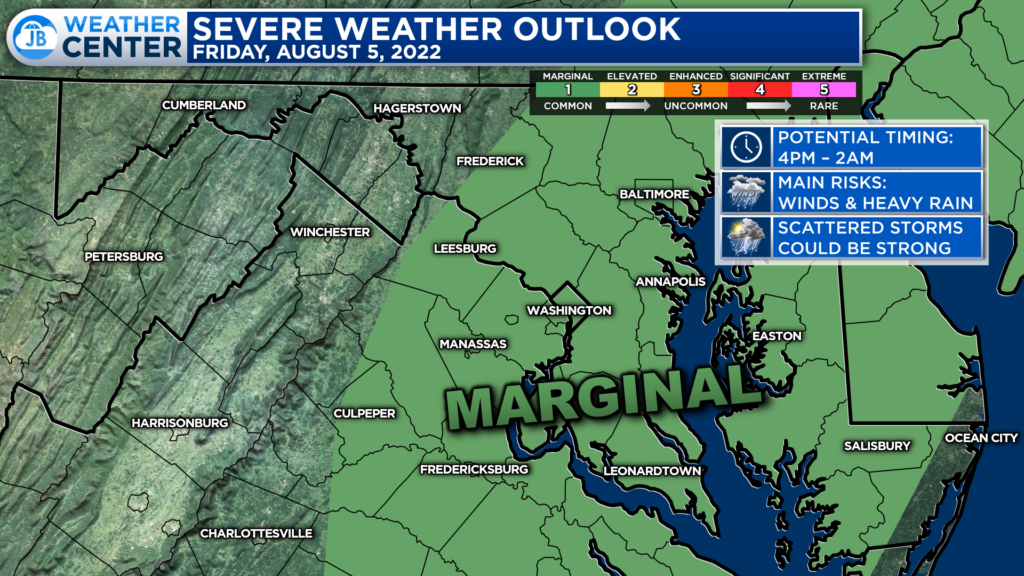
Much of the region has been placed under a Level 1 “Marginal Risk” of severe weather. This low severe risk today speaks more to the uncertainty of how many storms will become officially severe, not whether we will see storms or not. Scattered storms are likely anytime after 4pm, especially east of I-95.
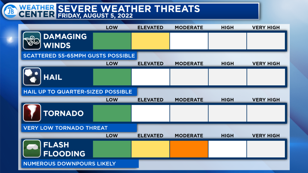
The main severe threats this evening from these storms will be the potential to produce 55-65mph winds and localized flash flooding. Some spots saw quite a bit of rain yesterday, and over the last couple of weeks. This will makes the ground prime for flooding to occur.
If you end up under a downpour, take it seriously. Also, like yesterday, any storms that develop will likely contain a lot of lightning. This is thanks to the high amount of humidity we will have.
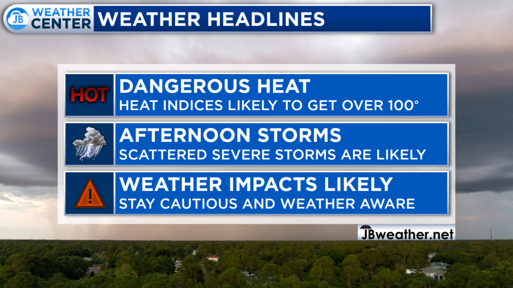
Today is turning out to be a high-impact weather day. The heat and humidity combo will push heat indices over 100° at times. This will likely allow for scattered strong storms to fire up this evening. All-in-all, you will want to stay cautious of the heat and weather aware of any potential storms.
If you have outdoor plans this afternoon and evening, I would plan on scattered storms moving through and bringing some impacts. You are more likely to see higher impacts the later in the evening we head. Have a Plan B ready to go and be ready to take action quickly if these storms do move overhead. These storms could bring a lot of lightning and lead to flooding. Take these storms seriously if they threaten!
Stay with JB Weather for the latest information on Southern Maryland weather. You can always access my forecasts and updates here on the website, on Facebook, on Twitter, on Instagram, and on YouTube.
-JB

Calvert Title Company is guiding you HOME one closing at a time! Check out https://calverttitle.com/ today!
