Brought to you by Cedar Point Federal Credit Union
Much of this week has featured quiet weather conditions with cool, Fall-like temperatures. This quiet stretch will come to an end today, though, as the outer bands of Ian will begin to move through and impact the region. Umbrellas and rain boots will be needed across the region for the next few days.
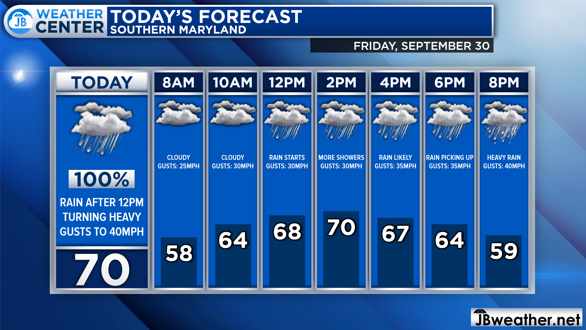
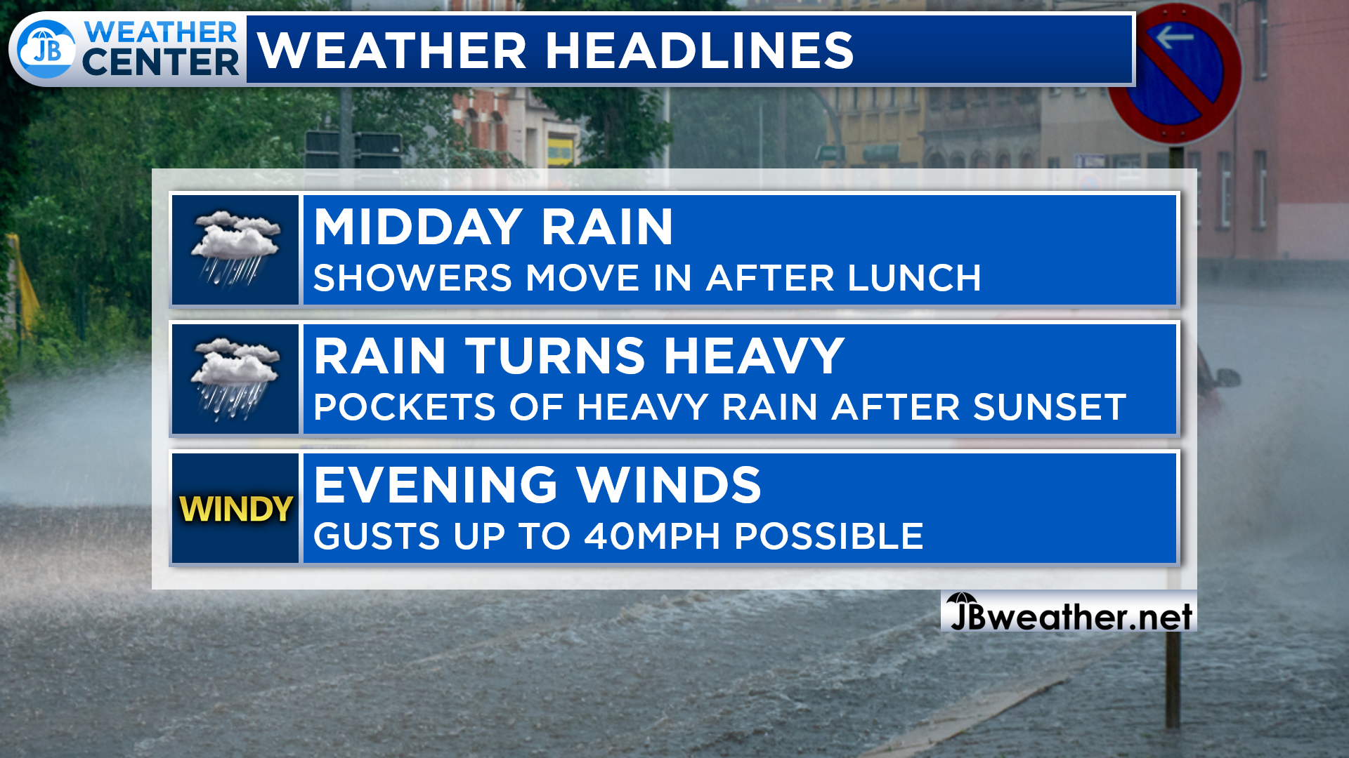
We are off to a quiet start this morning with cool temps, some easterly gusts, and mostly cloudy skies. We will see the rain showers start to move in around lunchtime, and that rain will likely start to turn heavy after sunset. Winds will also gradually pickup throughout the day.
Futurecast shows that Southern MD should expect rain showers around for the lunch hour as rain streams into the region from the southeast. The rain will become more widespread throughout the evening. There may be some breaks in the rain field, but most of us should get in on heavy rain after midnight.
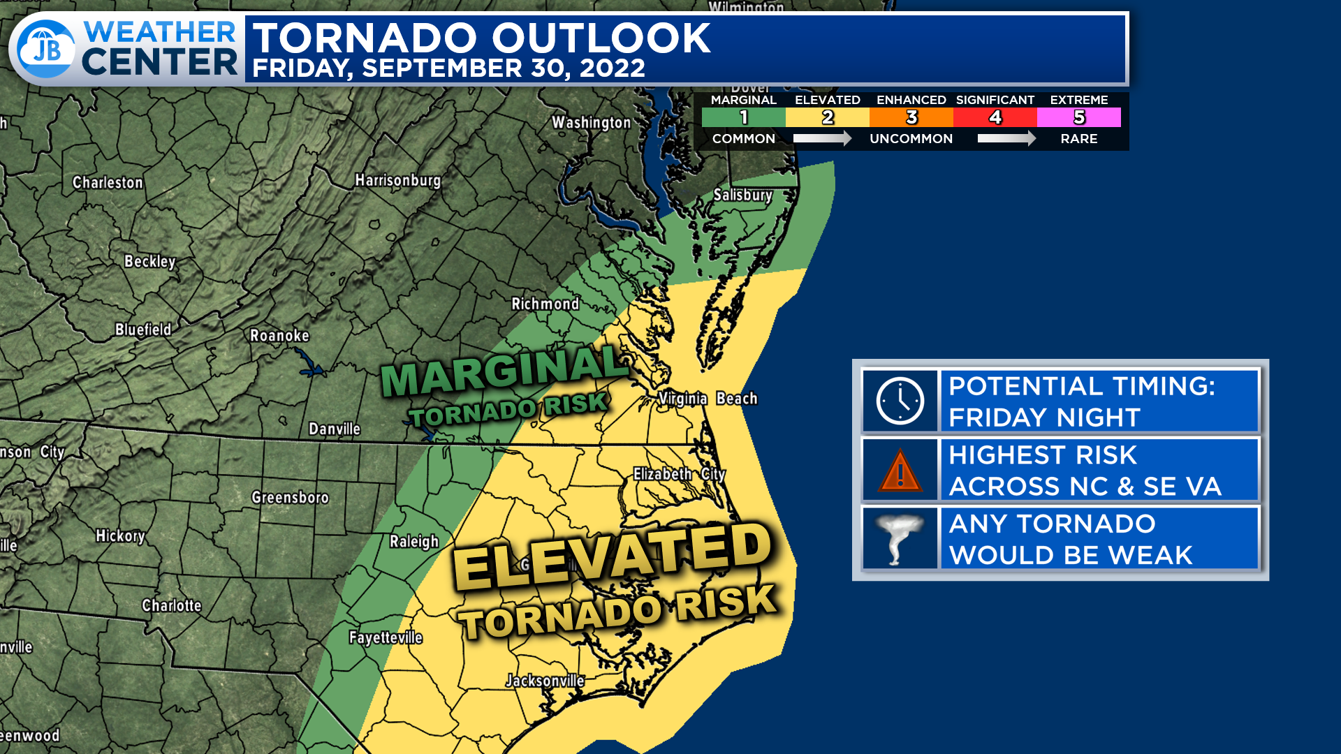
Late tonight and early tomorrow morning, we are likely going to see embedded areas of heavier rain move onshore, and into our region. Some of these heavier bursts of rain may be prone to rotate, and produce weak tornadoes. The most elevated tornado threat overnight will be focused southeast of our region, across the Carolinas and southeast Virginia.
Unlike with Ida or Isaias, I do not expect widespread tornado reports across our region tonight. With that said, we are on the edge of a marginally conducive environment for a weak spin-up or two. This will be something that we need to monitor overnight. However, as I stated earlier, the primary tornado risk is focused well to our south and east with this storm.
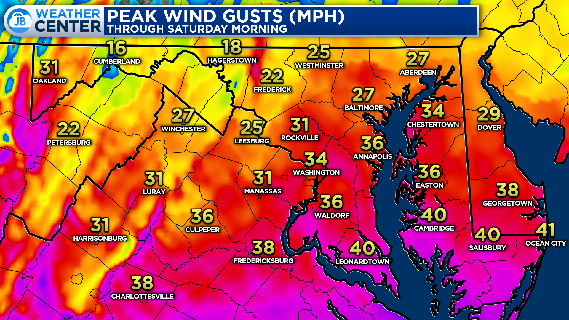
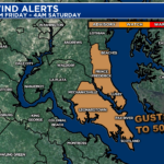
We will also see a noticeable increase in easterly winds. Winds gusts are likely to be highest along the ridge tops and along the southern coastal locations as Ian moves inland. Our immediate coastal locations could see max gusts of 40mph at times tonight. Communities further inland could see gusts up to 30-35mph. While these winds are not the most extreme that we have ever seen, they could cause some isolated outages.
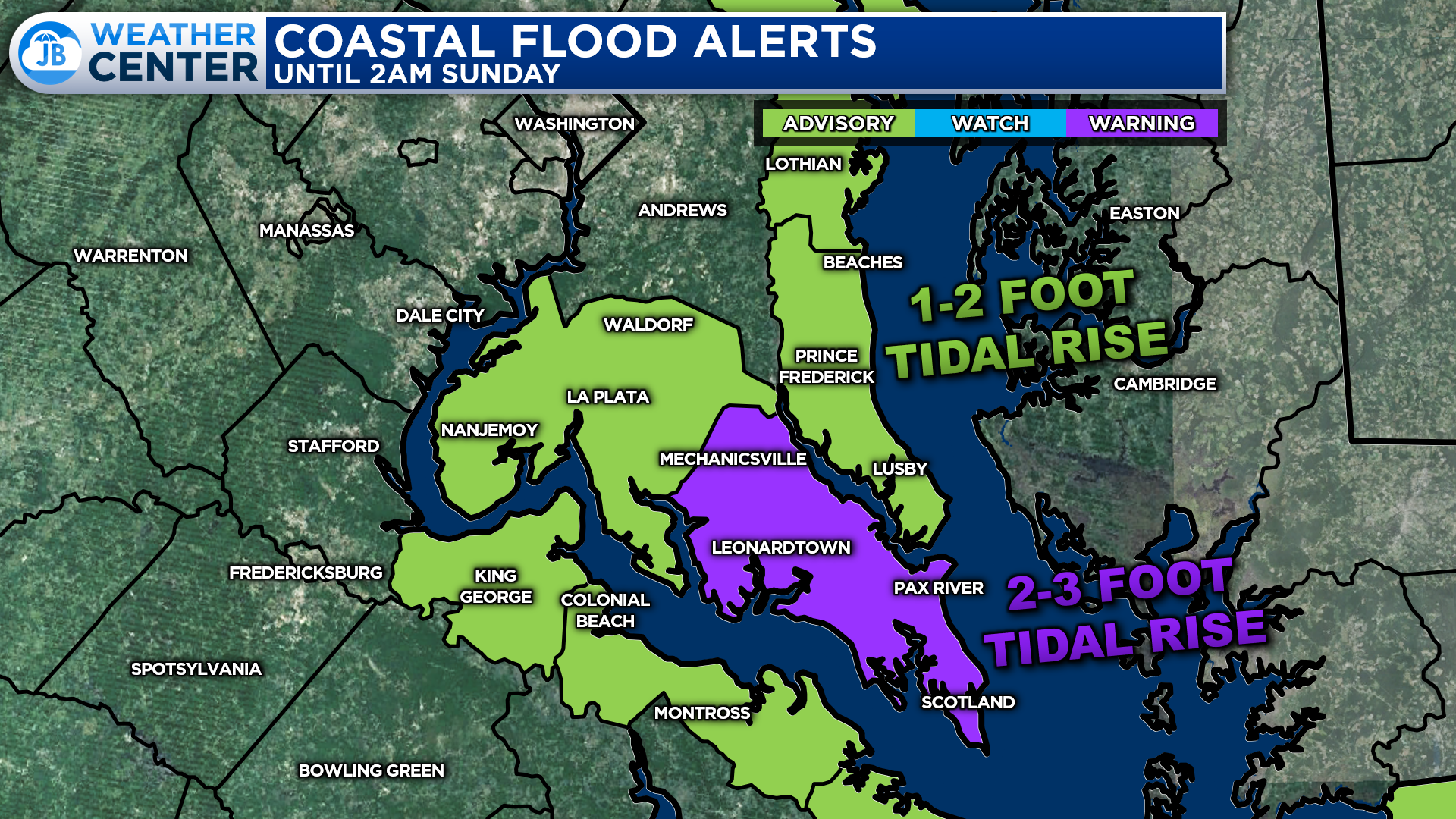
The onshore, easterly winds will allow for water to buildup somewhat along the coastline tonight and tomorrow. Coastal flood alerts are in effect for our coastal communities, as result. Up to 2-3 feet of tidal rise is possible in St. Mary’s County, especially at the southern tip of the county. This is why a Coastal Flooding Warning is in effect there. Coastal Flood Advisories are in effect elsewhere, where we’re likely looking at 1-2 feet of tidal rise.
The water height impacts will be mainly felt around times of high tides. Our coastal communities need to take the necessary actions to protect flood-prone property. If travel is required, do not drive around barricades or through water of unknown depths.
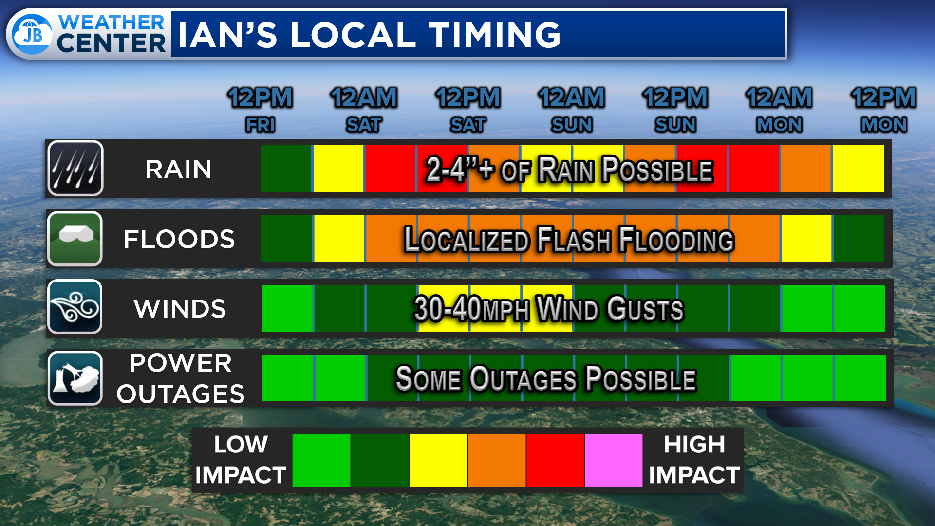
Ian’s impacts in Southern Maryland will be moderate. We are likely going to see a couple of inches of rainfall throughout the event. Our first push of rain is likely overnight tonight with another push of rain looking possible again on Sunday. This could cause some flooding in some areas. Wind impacts are possible as well with gusts up to 40mph. These two factors may make travel difficult at times. Use caution!
After a quiet start today, I would plan on a wet evening as bands of moderate to heavy rains push in with increasing wind gusts late tonight. I would not plan on attending any outdoor events tonight. While it will not rain all of the time everywhere, there will be an increasing number of heavy rain bursts throughout the night. Stay safe and stay weather aware today, and this weekend.
Stay with JB Weather for the latest information on Southern Maryland weather. You can always access my forecasts and updates here on the website, on Facebook, on Twitter, on Instagram, and on YouTube.
-JB
Cedar Point has been providing trusted banking, lending and personal finance solutions to the Southern Maryland Community since 1945. Visit the credit union at any of its 6 locations in St. Mary’s, Charles and Calvert counties or online at www.cpfcu.com.
John Bordash
View More PostsJB Weather forecaster John Bordash is working around the clock to provide Southern Maryland, and neighboring communities, with accurate and reliable weather information.