Brought to you by Calvert Title Company
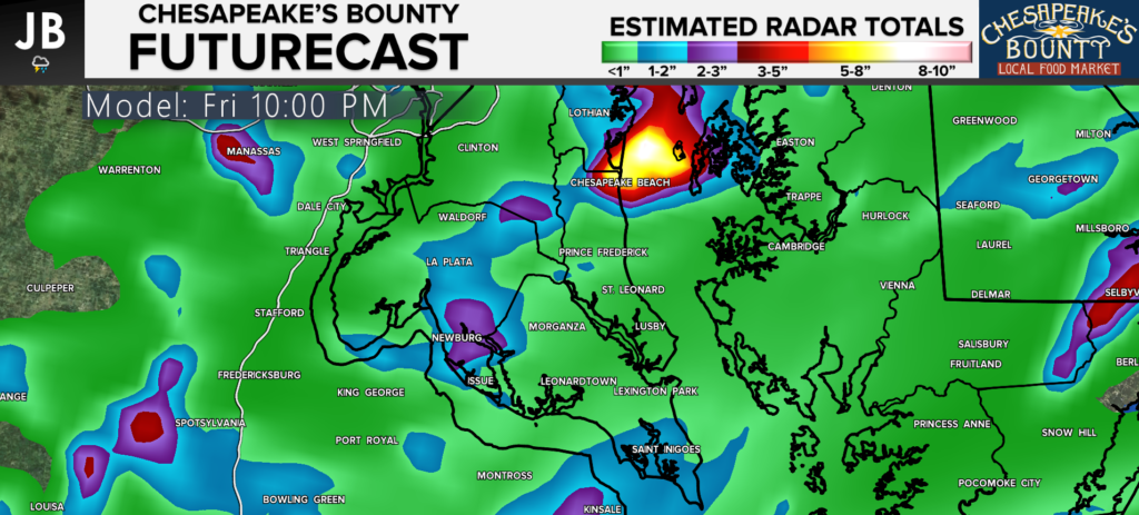
Rain began to move in last night, and we have seen waves of rain continue to move across the region overnight. This morning we are still dealing with the rain, and it will likely be with us throughout the day. You are the most likely to be dodging showers this morning with gradually drying as we head towards sunset. With that said, localized areas of heavy rain still look likely throughout the day. Our Chesapeake’s Bounty Futurecast shows this threat well.
Futurecast suggests that localized areas of 1-3″+ of additional rain could be possible today, with many communities seeing up to an inch. This added amount of rain could certainly cause flooding issues in some areas. The Flash Flood Watch remains in effect for the area through the morning, so you will want to stay weather aware as you head out!

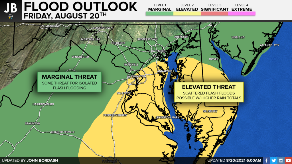
With this in mind, the National Weather Service continues to highlight our region with an Elevated Threat of seeing flash flooding throughout the day. A rapid rise of water is certainly possible if your community gets caught under a heavier storm. Remember, if you come across a flooded roadway to turn around, and not drown.

Stay with JB Weather for the latest information on Southern Maryland weather. You can always access my forecasts and updates here on the website, on Facebook, on Twitter, and on YouTube.
-JB

Brought to you by Calvert Title Company. Calvert Title Company is guiding you HOME one closing at a time! Check out https://www.facebook.com/calverttitle today!

