Brought to you by Berkshire Hathaway HomeServices PenFed Realty
Today will kick off our first potential heatwave across the Mid-Atlantic! Temperatures will look to surge into the upper 80s and lower 90s today as we also see humidity levels increase! For this 3-day stretch to be considered an official “heatwave,” we will need the highs over the next 3-day to all make it into the 90s.

There are some showers and storms out across western Maryland and southwestern Pennsylvania this morning. This area of rain is associated with a warm front that is pushing through early this morning. This will clear our region before lunchtime and may bring an isolated rain shower with it, locally.
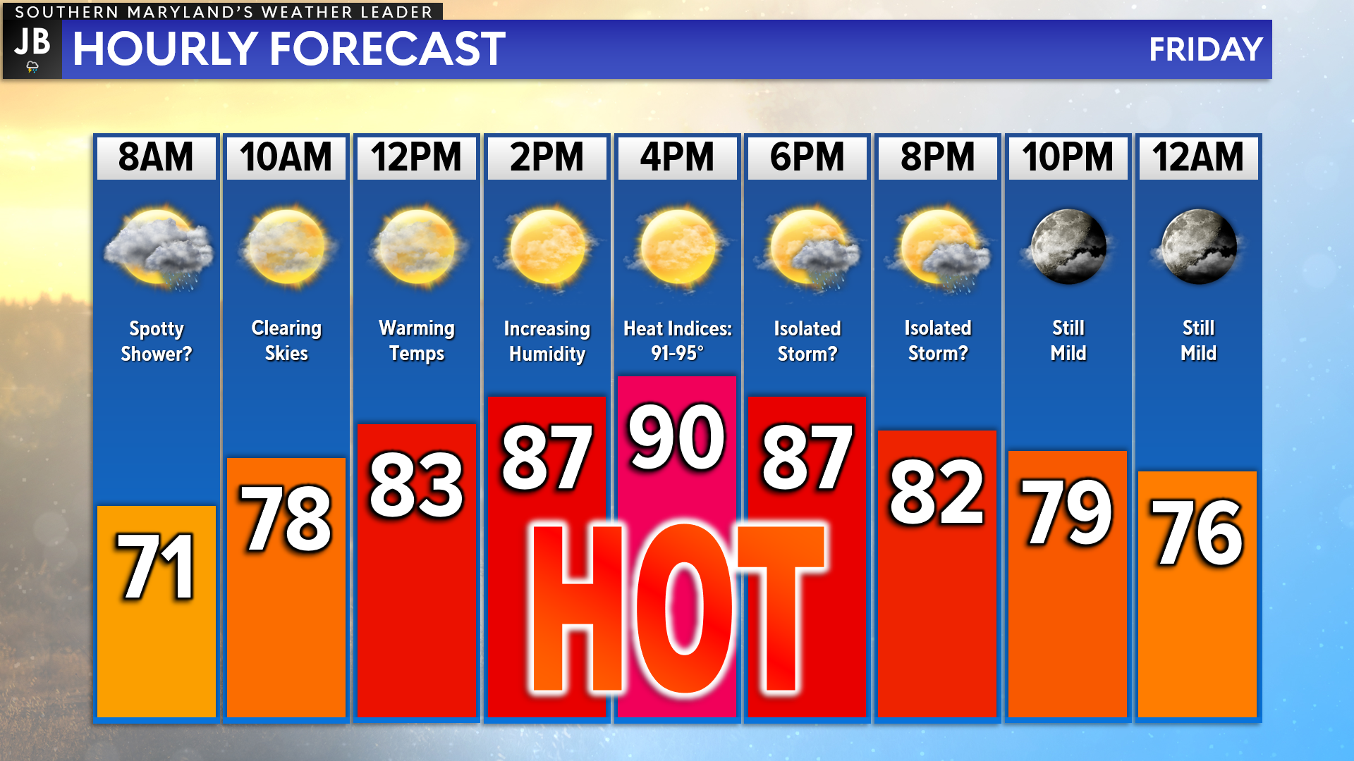
Once that warm front passes through the region later on this morning, we will see southerly winds take over and surge temps into the 90s! Humidity levels will also be on the rise, making it feel like the mid-90s. This afternoon will definitely feel like June! Temps won’t be quick to cool off this evening, either.
What may save us from reaching the 90s today is if we see a lot of cloud cover work through with the warm front. If we see that, that will act to keep us a tad cooler. However, if we see limited cloud cover that burns off fast, then temperatures will be more than able to make it into the 90s.
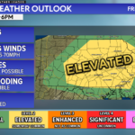
Behind the warm front this morning, we will likely see an additional organized area of storminess– which we refer to as a mesolow. This small low-pressure area will look to develop a line of storms as it moves eastward. Some of these storms could be severe as it does so! Our Chesapeake’s Bounty Futurecast depicts this well.
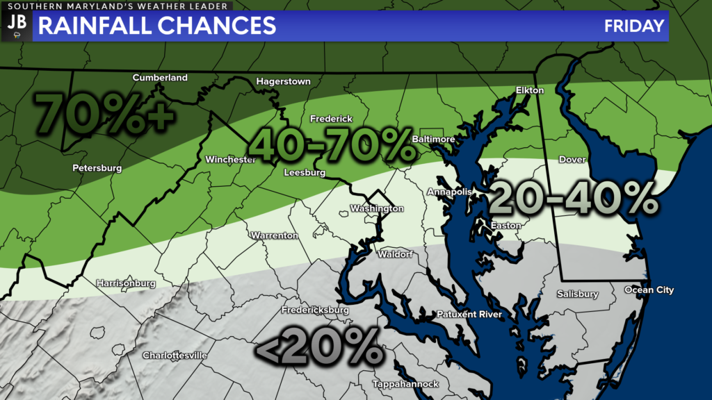
The areas that are the most likely to see showers and storms this afternoon will be closer to the Mason Dixon line and across Pennsylvania and New Jersey. Rain chances drop off quickly south of there. However, an isolated shower or storm cannot be totally ruled out this far south. Granted, the highest chances will be to our north!
Be aware of the heat over the next few days, and take extra precautions if you work or spend time outside. Reschedule strenuous activities to early morning or evening. Plan to wear lightweight and loose-fitting clothing and seek shade from the sun. Schedule frequent rest breaks in shaded or air-conditioned environments and stay hydrated with non-alcoholic beverages.
Stay with JB Weather for the latest information on Southern Maryland weather. You can always access my forecasts and updates here on the website, on Facebook, on Twitter, on Instagram, and on YouTube.
-JB

Real Estate now! Not sure where to start? View our Southern Maryland inventory of homes, land, farms and commercial properties on penfedrealty.com. Engage with our planning tools to determine your next real estate lifestyle decision, choose your realtor as a trusted advisor. Experience the difference with service and support from real estate’s forever brand!
John Bordash
View More PostsJB Weather forecaster John Bordash is working around the clock to provide Southern Maryland, and neighboring communities, with accurate and reliable weather information.