Brought to you by Sonder Studios
Today will be a very active weather day, featuring heavy rain, gusty winds, and a sharp temperature drop as a strong cold front moves through the region.
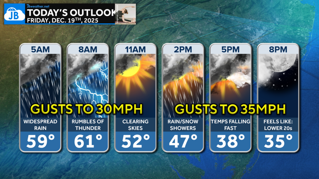
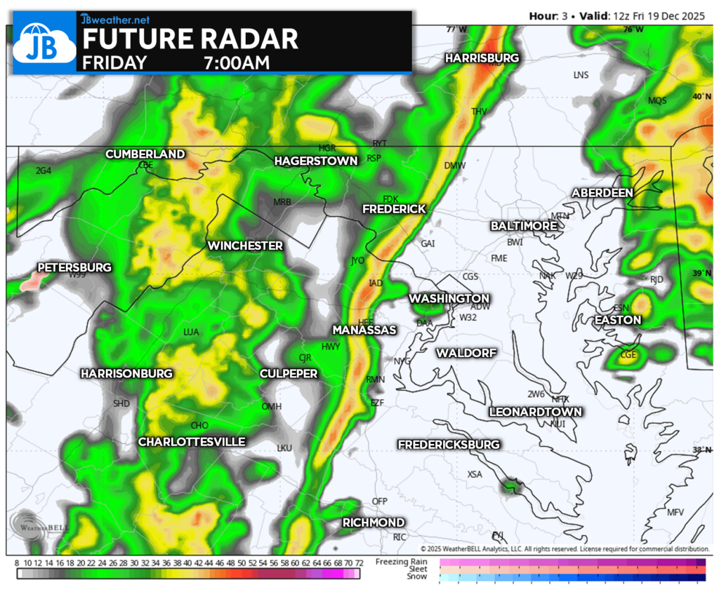
Rain is ongoing this morning, with some locations already picking up around an inch of rainfall overnight. As the cold front pushes through mid-morning, a thin but intense line of heavy rain will sweep east, bringing brief downpours and a few rumbles of thunder. Rain tapers from west to east late morning, but roads may remain wet and ponding is possible in spots.

Behind the front, northwest winds ramp up quickly, with gusts of 30–40 mph developing through the afternoon. Additional scattered rain showers are possible, and snow showers may mix in northwest of I-95 as colder air pours in. By tonight, temperatures fall sharply with wind chills dropping into the 20s, setting up a cold and blustery end to the day.

Stay with JB Weather for the latest information on impacts here in Southern Maryland and across the Mid-Atlantic. You can always access my forecasts and updates here on the website, on Facebook, on Twitter, on Instagram, and on YouTube. JB Weather is the Mid-Atlantic’s Weather Leader, and I am working around the clock to keep you ahead of any storm!

SONDER STUDIOS® is home to Yoga, Pilates, Barre, and Strength classes in Calvert County. Wellness is our business, and belonging is at the heart of our culture. We are grateful for your trust for 6+ years. Sign up for an intro week at www.sonderstudios.us
John Bordash
View More PostsJB Weather forecaster John Bordash is working around the clock to provide Southern Maryland, and neighboring communities, with accurate and reliable weather information.